حقائق رئيسية
- المواعيد
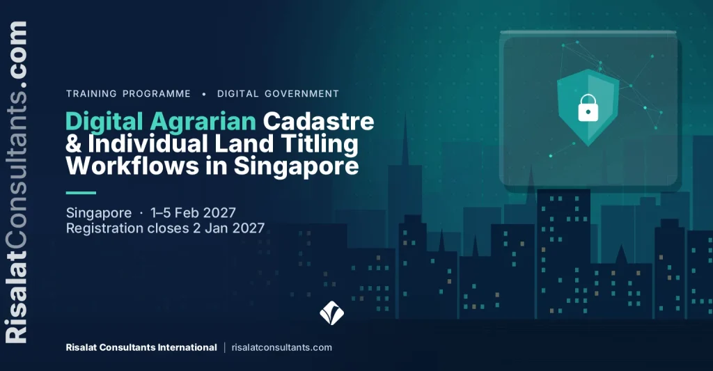
- 1–5 فبراير 2027 (5 أيام)
- المكان
- سنغافورة، سنغافورة
- الرسوم لكل مشارك
- £2,750 (جنيه إسترليني)
- الدفع
- بالفاتورة والتحويل المصرفي
- إغلاق التسجيل
- 2 يناير 2027
- الشهادة
- شهادة إتمام
- الخيار المؤسسي
- نفّذه لفريقك، في المواعيد التي تناسبك
في هذه الصفحة 14 قسماً
نظرة عامة على البرنامج
Digital transformation in agrarian reform requires robust spatial frameworks and reliable administrative titling systems. This five-day executive training programme delivered in Singapore equips public land administration officials with modern digital cadastre methodologies and systematised workflows. Participants explore modern approaches to parcel boundary mapping, digital land record management, and geographic information systems aligned with the ISO 19152 Land Administration Domain Model. Through technical exposure to Singapore modern land data infrastructure, delegates gain practical insights into transitioning from paper-based collective titles to secure, individual digital records.
The curriculum addresses the operational complexities faced by agrarian reform agencies, particularly in managing large-scale subdivision and registration pipelines. Delegates examine tenure verification protocols, spatial data harmonisation, and boundary adjudication processes that withstand legal scrutiny. Through detailed review of geospatial field data collection, validation pipelines, and registry data parcelisation, the course provides the tools needed to resolve overlapping tenure claims. The sessions emphasise maintainable data standards, inter-agency spatial coordination, and digital cadastre updating mechanisms necessary for long-term land administration sustainability.
Focusing on the practicalities of field demarcation and legal registration, the programme links technical survey accuracy with transparent administrative procedures. Participants practicalise boundary adjudication, alternative dispute mediation mechanisms, and land registry automation strategies. By assessing institutional workflows alongside geospatial technologies such as high-precision GNSS surveys and modern land information systems, public officials discover how to accelerate titling output while mitigating land governance risks. The course delivers immediately applicable competencies to standardise parcel demarcation and reinforce legal certainty for agrarian reform beneficiaries.
Agrarian reform programmes across developing economies, notably initiatives such as the Support to Parcelization of Lands for Individual Titling (SPLIT) Project funded by the World Bank, face urgent pressure to replace collective land ownership awards with secure individual titles. Protracted boundary ambiguities, missing cadastral records, and tenure overlaps continue to hinder agricultural investment and delay project completion. Mastering digital agrarian cadastre protocols, rapid parcelisation workflows, and automated registry linkages is essential now to enable field demarcation teams, adjudicators, and land registrars to validate records accurately and safeguard property rights.
يُقدّم هذا البرنامج Risalat Consultants International في سنغافورة، ويجمع بين جلسات يقودها خبراء ودراسة حالات واقعية والعمل الجماعي، ليتمكن المشاركون من تطبيق ما يتعلمونه في مؤسساتهم.
The Programme Strengthens Institutional Capability
- Principles of modern digital cadastre and Singapore land administration infrastructure
- Agrarian tenure regularisation: transitioning from collective awards to individual titles
- Applying the ISO 19152 Land Administration Domain Model to agrarian property subdivision
- Institutional roles: coordinating agrarian reform agencies, mapping bodies, and land registries
- Data governance, geodetic reference systems, and cadastral baseline validation
- High-precision GNSS surveying and mobile GIS applications for agrarian parcel demarcation
- Field adjudication procedures: securing stakeholder consent and public display protocols
- Processing cadastral survey returns and automated parcel topology cleaning
- الاستراتيجية الرقمية وتخطيط التحول
- حوكمة البيانات وجودتها
- تحليل البيانات وتصويرها مرئياً
- أساسيات الأمن السيبراني وإدارة المخاطر
It is designed for department of Agrarian Reform directors and programme managers, provincial and regional land registrars, government geodetic engineers and cadastral survey teams and others who want practical, current skills in digital government, data and technology.
The Growing Importance of Digital Agrarian Cadastre & Individual Land Titling Workflows in Singapore
تُغيّر الخدمات الرقمية والبيانات والتقنيات الجديدة طريقة عمل المؤسسات وطريقة خدمة المواطنين. فإذا أُحسن تطبيقها جعلت الخدمات أسرع وأقل تكلفة وأكثر شفافية، وإذا أُسيء تطبيقها أهدرت الأموال وعرّضت البيانات للخطر.
تحتاج المؤسسات إلى أشخاص قادرين على تخطيط التغيير الرقمي، وإدارة البيانات بمسؤولية، وحماية الأنظمة، واستخدام الأدلة المستمدة من البيانات في القرارات. وباتت هذه المهارات مطلوبة في جميع الوظائف، لا في تقنية المعلومات وحدها.
تحتاج المؤسسات بشكل متزايد إلى مهنيين قادرين على:
- تخطيط مبادرات رقمية تحل مشكلات حقيقية
- إدارة جودة البيانات وحمايتها ومشاركتها
- تحليل البيانات وعرضها بوضوح
- إدارة المخاطر السيبرانية والتقنية
- قيادة الأفراد خلال التغيير الرقمي
تساعد الأنظمة القوية في الحكومة الرقمية والبيانات والتكنولوجيا المؤسسات على:
- تقديم خدمات أسرع وأيسر وصولاً
- تحسين استخدام البيانات في القرارات
- حماية الأنظمة والبيانات الشخصية
- تحقيق القيمة من الاستثمارات التقنية
This Digital Agrarian Cadastre & Individual Land Titling Workflows in Singapore programme brings these elements together in a practical format, so that participants understand not only what good practice looks like but also how to introduce it in their own setting, with the people and resources they have.
Who Should Attend This Digital Agrarian Cadastre & Individual Land Titling Workflows in Singapore Training?
صُمم هذا البرنامج من أجل:
- Department of Agrarian Reform directors and programme managers
- Provincial and regional land registrars
- Government geodetic engineers and cadastral survey teams
- Agrarian legal officers and dispute adjudication specialists
- Land administration information technology and GIS managers
- Project management unit specialists implementing donor-funded land titling projects
- Spatial data infrastructure planners in public land agencies
- Deeds verification officers and tenure formalisation teams
- Land management bureau technical operations personnel
- مديرو وموظفو تقنية المعلومات والاتصالات
- قادة التحول الرقمي
- محللو البيانات والإحصائيون
يناسب البرنامج المهنيين ذوي الخبرة وكذلك من ينتقلون إلى مسؤوليات جديدة. ونشجع المجموعات التي تضم مؤسسات ودولاً مختلفة، لأن المشاركين يتعلمون الكثير من تجارب بعضهم بعضاً.
حدّد ما يحتاج فريقك إلى القدرة على إنجازه.
Digital Agrarian Cadastre & Individual Land Titling Workflows in Singapore Training Objectives
Upon successful completion of this Digital Agrarian Cadastre & Individual Land Titling Workflows in Singapore Training, participants will be able to:
- Master digital parcel boundary mapping using GNSS data integration and GIS platforms
- Formulate rigorous tenure verification workflows to validate historical agricultural land awards
- Execute registry data parcelisation protocols conforming to ISO 19152 Land Administration Domain Model standards
- Implement field parcel survey adjudication methodologies to resolve contested agrarian boundaries
- Apply alternative dispute mediation techniques within contested community titling operations
- Automate land registry workflows to streamline the issuance and recording of individual property titles
- Design quality assurance frameworks for cadastral datasets submitted by field surveying teams
- شرح الاتجاهات الرئيسية في الحكومة الرقمية واستخدام البيانات
- تخطيط مبادرة رقمية مرتبطة بأهداف الخدمات
- تطبيق مبادئ حوكمة البيانات وجودتها
يُطبَّق كل هدف خلال البرنامج من خلال التمارين أو دراسات الحالة أو العمل الجماعي، بحيث يغادر المشاركون وهم قادرون على تنفيذه، لا على وصفه فحسب.
محتوى البرنامج وهيكله
- Principles of modern digital cadastre and Singapore land administration infrastructure
- Agrarian tenure regularisation: transitioning from collective awards to individual titles
- Applying the ISO 19152 Land Administration Domain Model to agrarian property subdivision
- Institutional roles: coordinating agrarian reform agencies, mapping bodies, and land registries
- Data governance, geodetic reference systems, and cadastral baseline validation
- High-precision GNSS surveying and mobile GIS applications for agrarian parcel demarcation
- Field adjudication procedures: securing stakeholder consent and public display protocols
- Processing cadastral survey returns and automated parcel topology cleaning
- Integrating unmanned aerial systems and high-resolution orthophotography for boundary validation
- Standardising cadastral survey plans for statutory land registry submission
- Verifying agrarian beneficiary eligibility and collective title parcelisation rights
- Document fraud detection, deed historical reconstruction, and archive validation
- Protocols for managing overlapping claims, encumbrances, and boundary encroachments
- Administrative dispute mediation mechanisms during field demarcation campaigns
- Legal formalisation of mediated boundary settlements and technical recording
- Digital workflow design: automating the parcel subdivision life cycle
- Linking spatial cadastral parcels with textual land registry databases
- Enterprise land information systems: indexing, parcel identification numbering, and metadata
- Security, auditability, and access control in electronic land records management
- Standardising data exchange formats between surveying bodies and deeds registries
- Establishing cadastral quality assurance frameworks and compliance checkpoints
- Operational planning for large-scale field parcelisation and resource allocation
- Risk management and anti-corruption controls in digital titling workflows
- Developing institutional action plans for agrarian land administration reform
- Presentation and peer review of participants individual modernisation strategies
المحتوى الكامل يوماً بيوم
يمتد البرنامج على 5 أيام. ويجمع كل يوم بين مداخلات الخبراء والعمل التطبيقي وورشة عمل أو دراسة حالة ختامية:
- First Day: Cadastral Modernisation Frameworks and Agrarian Tenure Structures
- Second Day: Geospatial Data Acquisition, Field Adjudication, and Parcel Mapping
- Third Day: Tenure Verification, Legal Adjudication, and Dispute Resolution
- Fourth Day: Registry Data Parcelisation and Workflow Automation
- Fifth Day: Quality Assurance, Project Operations, and Strategic Modernisation Plans
المحتوى الكامل يوماً بيوم
First Day | Cadastral Modernisation Frameworks and Agrarian Tenure Structures
- Principles of modern digital cadastre and Singapore land administration infrastructure
- Agrarian tenure regularisation: transitioning from collective awards to individual titles
- Applying the ISO 19152 Land Administration Domain Model to agrarian property subdivision
- Institutional roles: coordinating agrarian reform agencies, mapping bodies, and land registries
- Data governance, geodetic reference systems, and cadastral baseline validation
Workshop: Cadastral Modernisation Frameworks and Agrarian Tenure Structures: Applying It to Your Institution
يعمل المشاركون في مجموعات صغيرة على تطبيق أساليب اليوم على أمثلة من مؤسساتهم، ويتفقون على خطوات عملية تالية.
Second Day | Geospatial Data Acquisition, Field Adjudication, and Parcel Mapping
- High-precision GNSS surveying and mobile GIS applications for agrarian parcel demarcation
- Field adjudication procedures: securing stakeholder consent and public display protocols
- Processing cadastral survey returns and automated parcel topology cleaning
- Integrating unmanned aerial systems and high-resolution orthophotography for boundary validation
- Standardising cadastral survey plans for statutory land registry submission
Workshop: Geospatial Data Acquisition, Field Adjudication, and Parcel Mapping: Applying It to Your Institution
يعمل المشاركون في مجموعات صغيرة على تطبيق أساليب اليوم على أمثلة من مؤسساتهم، ويتفقون على خطوات عملية تالية.
Third Day | Tenure Verification, Legal Adjudication, and Dispute Resolution
- Verifying agrarian beneficiary eligibility and collective title parcelisation rights
- Document fraud detection, deed historical reconstruction, and archive validation
- Protocols for managing overlapping claims, encumbrances, and boundary encroachments
- Administrative dispute mediation mechanisms during field demarcation campaigns
- Legal formalisation of mediated boundary settlements and technical recording
Case Study: Tenure Verification, Legal Adjudication, and Dispute Resolution in Practice
يحلل المشاركون حالة واقعية، ويقارنون الخيارات المتخذة بالممارسات الجيدة، ويستخلصون دروساً يمكنهم تطبيقها في بيئة عملهم.
Fourth Day | Registry Data Parcelisation and Workflow Automation
- Digital workflow design: automating the parcel subdivision life cycle
- Linking spatial cadastral parcels with textual land registry databases
- Enterprise land information systems: indexing, parcel identification numbering, and metadata
- Security, auditability, and access control in electronic land records management
- Standardising data exchange formats between surveying bodies and deeds registries
Workshop: Registry Data Parcelisation and Workflow Automation: Applying It to Your Institution
يعمل المشاركون في مجموعات صغيرة على تطبيق أساليب اليوم على أمثلة من مؤسساتهم، ويتفقون على خطوات عملية تالية.
Fifth Day | Quality Assurance, Project Operations, and Strategic Modernisation Plans
- Establishing cadastral quality assurance frameworks and compliance checkpoints
- Operational planning for large-scale field parcelisation and resource allocation
- Risk management and anti-corruption controls in digital titling workflows
- Developing institutional action plans for agrarian land administration reform
- Presentation and peer review of participants individual modernisation strategies
Capstone Exercise: Digital Agrarian Cadastre & Individual Land Titling Workflows in Singapore Action Plan for Your Institution
يجمع المشاركون حصيلة الأسبوع في خطة عمل لمؤسساتهم، تتضمن الأولويات والمسؤولين والخطوات الأولى، ثم يعرضونها لتلقي ملاحظات الزملاء والميسّرين.
Digital Agrarian Cadastre & Individual Land Titling Workflows in Singapore Training Methodology
The training employs a participatory, practitioner-led instructional approach combining thematic technical lectures with hands-on GIS parcelisation laboratory exercises. Delegates analyse real-world institutional case studies and review operational practices observed in Singapore digital land management ecosystem. Daily collaborative clinics enable participants to resolve operational bottlenecks encountered in large-scale titling projects, supported by practical workflow simulation exercises and peer-reviewed operational action planning.
يجمع البرنامج بين:
- جلسات يقودها خبراء حول الممارسات الحالية
- دراسات حالة إقليمية ودولية
- عمل جماعي وتمارين عملية
- محاكاة ولعب أدوار حسب الحاجة
- مناقشة التحديات الخاصة بالمشاركين
- التعلم من الأقران عبر المؤسسات والدول
- أدوات ونماذج عملية تعود بها إلى العمل
- تأمل يومي وتخطيط للعمل
قبل البرنامج، يساعد تقييم مسبق قصير الميسّرين على فهم دور كل مشارك وأولوياته، بحيث يمكن تكييف الأمثلة والتمارين مع المجموعة. ويُختتم كل يوم بتأمل قصير يدوّن فيه المشاركون ما سيطبقونه في العمل.
النتائج المتوقعة
Upon completion of this Digital Agrarian Cadastre & Individual Land Titling Workflows in Singapore Training, participants will be able to:
- Ability to execute digital parcel boundary mapping compliant with international cadastral standards
- Capacity to structure systematic tenure verification protocols for agrarian land records
- Proficiency in carrying out rapid registry data parcelisation and spatial database updates
- Practical competence in managing field adjudication and community-level boundary mediation
- Skills to configure automated workflows between surveying divisions and registration offices
- A customised operational action plan to enhance parcelisation efficiency in home agencies
- تخطيط مبادرات رقمية مرتبطة بأهداف الخدمات
- تطبيق مبادئ حوكمة البيانات وجودتها
يغادر المشاركون بخطة عمل شخصية وأدوات عملية يمكنهم استخدامها في مؤسساتهم منذ الأسبوع الأول من عودتهم. ويمكن للمؤسسات التي ترسل عدة مشاركين الاستفادة من البرنامج للاتفاق على أساليب ونماذج مشتركة بين الفرق، مما يسهّل استدامة التحسينات.
£2,750 لكل مشارك · فاتورة وتحويل مصرفي · خصم للمجموعات المكوّنة من 5 مشاركين أو أكثر
خمسة مشاركين أو أكثر من مؤسسة واحدة: اطلبوا سعر المجموعة عند طلب الفاتورة.
عشرة مشاركين أو أكثر: قد تكون تكلفة النسخة الداخلية لمؤسستك أقل للفرد الواحد. اطلب عرض سعر للتدريب الداخلي.
يُغلق التسجيل خلال 50 يوماً (2 يناير 2027)
Institutional Application of Digital Agrarian Cadastre & Individual Land Titling Workflows in Singapore Training
يدعم هذا البرنامج المؤسسات في تعزيز:
- الاستراتيجية الرقمية
- حوكمة البيانات
- القرارات القائمة على البيانات
- الأمن السيبراني
- إدارة التكنولوجيا
يعود المشاركون بأدوات عملية لتحسين:
- سجلات جرد البيانات
- لوحات المتابعة
- سجلات المخاطر
- شراء التقنيات
- خطط التغيير
صُمم البرنامج بحيث ينتقل التعلم من قاعة التدريب إلى المؤسسة. ويعمل المشاركون على عملياتهم ووثائقهم الخاصة كلما أمكن، ويغادرون بخطة عمل يمكن لمديريهم مراجعتها ودعمها.
الأهمية الإقليمية والتطبيق
أوروبا
تطبّق المؤسسات الأوروبية الحكومة الرقمية والبيانات والتكنولوجيا ضمن أطر تنظيمية مفصّلة وأجندات إصلاحية. ويمكن للمشاركين من أوروبا مقارنة ممارساتهم بممارسات زملائهم من مناطق أخرى، واختبار مدى نجاح الأساليب الراسخة في ظروف مختلفة.
أفريقيا
في أنحاء أفريقيا، تعمل الوزارات والهيئات وفرق المشاريع العاملة في الحكومة الرقمية والبيانات والتكنولوجيا بشكل متزايد إلى جانب برامج ممولة من الجهات المانحة تتطلب أنظمة وأدلة واضحة. ويساعد البرنامج المشاركين على تكييف الممارسات الجيدة مع المؤسسات والموارد التي يعملون بها.
الشرق الأوسط
في الشرق الأوسط، تفرض استراتيجيات التنمية الوطنية وخطط التنويع متطلبات متزايدة في مجالات الحكومة الرقمية والبيانات والتكنولوجيا. ويستكشف المشاركون كيفية بناء القدرات التي تحتاجها هذه الخطط داخل الجهات العامة والشركات.
آسيا
تجمع المؤسسات في أنحاء آسيا بين النمو السريع وبرامج التحديث الطموحة. ويمكن للمشاركين من آسيا تبادل خبراتهم في التوسع السريع في الأنظمة والتعلم من المناهج المتبعة في أماكن أخرى.
المحيط الهادئ
تواجه الدول الجزرية الصغيرة ودول المحيط الهادئ قيوداً خاصة تتعلق بالحجم والمسافة والقدرات. ويسلط البرنامج الضوء على مناهج عملية ومتناسبة في الحكومة الرقمية والبيانات والتكنولوجيا تلائم المؤسسات الأصغر حجماً.
يتيح عقد البرنامج في سنغافورة للمشاركين الالتقاء بعيداً عن ضغوط عملهم اليومي، ليقارنوا كيفية التعامل مع الحكومة الرقمية والبيانات والتكنولوجيا في بيئات مختلفة. ويمكن أيضاً تقديم البرنامج نفسه داخلياً لمؤسسة واحدة، في بلدها أو عبر الإنترنت، بحالات مأخوذة من عملها الحالي.
- الجمع
- التنقية
- التخزين
- التحليل
- القرار
لمحة عن البلد المضيف – سنغافورة
برامج وورش عمل وزيارات ميدانية ودورات تدريبية في سنغافورة من Risalat Consultants International
تمنح الدراسة خارج البلد الأصلي المشاركين وقتاً للتركيز، ونظرة جديدة إلى مؤسساتهم، وفرصة لبناء شبكة علاقات مع زملاء من دول أخرى.
Digital Agrarian Cadastre & Individual Land Titling Workflows in Singapore Training Deliverables
يحصل المشاركون على الدعم قبل البرنامج وأثناءه وبعده، بحيث يشكّل التحضير والتعلم والمتابعة تجربة واحدة متصلة.
قبل البرنامج
- التقييم المسبق للمشاركين
- Digital Agrarian Cadastre & Individual Land Titling Workflows in Singapore Readiness Assessment
- Digital Agrarian Cadastre & Individual Land Titling Workflows in Singapore Resource Pack
- مواد قراءة تحضيرية
- دعم واستشارات مجانية بشأن التأشيرة
أثناء البرنامج
- الاستقبال من المطار والمساعدة عند الوصول
- إقامة مع الإفطار
- عشاء ترحيبي للتعارف
- حقيبة Risalat التدريبية (حقيبة، وقارورة، وكوب، وقميص، وقبعة، وغلاف جواز سفر، وأقلام، ودفتر، ومغناطيس وميدالية مفاتيح)
- Comprehensive Digital Agrarian Cadastre & Individual Land Titling Workflows in Singapore Training Manual
- قائمة التحقق من النضج الرقمي
- نموذج جرد البيانات
- نموذج تخطيط لوحة المتابعة
- سجل المخاطر التقنية
- ورش عمل عملية ومحاكاة
- مناقشات جماعية وتعلم من الأقران
- غداء ومرطبات يومية
- الاستفادة الكاملة من مرافق مكان التدريب
- جهاز Mini Pad / جهاز لوحي مزود بمواد تعليمية رقمية
- زيارة ميدانية (حسب الاقتضاء)
- جولة ترفيهية في المدينة
بعد البرنامج
- شهادة الإتمام
- جائزة Risalat تقديراً للمشاركة في البرنامج
- مواد مرجعية بعد التدريب
- التقييم الذاتي لحوكمة البيانات
- قائمة التحقق لمراجعة المشاريع الرقمية
- الدعم بعد التدريب وإرشادات المتابعة
- تقرير البرنامج
يمكن للمؤسسات أيضاً طلب نسخة داخلية مصممة خصيصاً من هذا البرنامج، تُقدَّم في مقارها أو عبر الإنترنت. اطلب عرضاً.
Common Challenges in Digital Agrarian Cadastre & Individual Land Titling Workflows in Singapore, And How This Training Helps
كيف يمكن للمؤسسات تخطيط مبادرات رقمية تحل مشكلات حقيقية؟
The programme addresses this directly on the first day (Cadastral Modernisation Frameworks and Agrarian Tenure Structures), where participants practise the methods involved and adapt them to their own institution, then build it into their action plan.
كيف يمكن للمؤسسات إدارة جودة البيانات وحمايتها ومشاركتها؟
The programme addresses this directly on the second day (Geospatial Data Acquisition, Field Adjudication, and Parcel Mapping), where participants practise the methods involved and adapt them to their own institution, then build it into their action plan.
كيف يمكن للمؤسسات تحليل البيانات وعرضها بوضوح؟
The programme addresses this directly on the third day (Tenure Verification, Legal Adjudication, and Dispute Resolution), where participants practise the methods involved and adapt them to their own institution, then build it into their action plan.
كيف يمكن للمؤسسات إدارة المخاطر السيبرانية والتقنية؟
The programme addresses this directly on the fourth day (Registry Data Parcelisation and Workflow Automation), where participants practise the methods involved and adapt them to their own institution, then build it into their action plan.
كيف يمكن للمؤسسات قيادة الأفراد خلال التغيير الرقمي؟
The programme addresses this directly on the fifth day (Quality Assurance, Project Operations, and Strategic Modernisation Plans), where participants practise the methods involved and adapt them to their own institution, then build it into their action plan.
الأسئلة الشائعة
When and where does the Digital Agrarian Cadastre & Individual Land Titling Workflows in Singapore programme take place?
It runs from 1 Feb 2027 to 5 Feb 2027, in Singapore. The registration deadline is shown at the top of this page.
من ينبغي أن يحضر؟
The programme is designed for department of Agrarian Reform directors and programme managers, provincial and regional land registrars, government geodetic engineers and cadastral survey teams, agrarian legal officers and dispute adjudication specialists, and others who want practical skills in digital government, data and technology.
هل سأحصل على شهادة؟
نعم. يحصل المشاركون الذين يُتمّون البرنامج على شهادة إتمام من Risalat Consultants International.
هل يمكن تقديم هذا البرنامج لمؤسستنا حصرياً؟
نعم. يمكننا تقديم نسخة مؤسسية مصممة خصيصاً في مقر مؤسستكم أو في مدينة أخرى أو عبر الإنترنت، مبنية حول حالاتكم الخاصة. استخدموا نموذج طلب العرض في هذه الصفحة.
هل أحتاج إلى خبرة سابقة في الحكومة الرقمية والبيانات والتكنولوجيا؟
لا يُشترط أي تخصص سوى الخبرة في دور ذي صلة. ويساعد تقييم مسبق قصير الميسّرين على تكييف الجلسات مع المجموعة.
Who Will Deliver This Programme
Each date is delivered by a team assigned from Risalat's expert network for this subject. For this programme we assign:
How we choose them: Experience in the region of the participants or comparable settings; Command of the financier rules that apply (World Bank, ADB, AfDB, EU, UN) where relevant; Delivery in English; other languages on request for in-house groups; No conflict of interest with participants' institutions.
Names and short CVs of the assigned experts are shared with registered participants and sponsoring organisations before the programme, on request. Are you an expert in this subject? Join our expert network.
دورات تدريبية في سنغافورةTechnology training courses
لماذا سنغافورة لهذا البرنامج
تشتهر سنغافورة بكفاءة خدماتها العامة وحكومتها الإلكترونية وتخطيطها الحضري، وكلها مفيدة للزيارات الدراسية.
The Digital Agrarian Cadastre & Individual Land Titling Workflows in Singapore programme in February 2027 brings together officials and professionals from across the Asia region and beyond. Sessions combine short inputs, case studies and group work on participants' own files, and the city's institutions can be added as a study visit on request.
الوصول: مطار شانغي (SIN).
تحقق مما إذا كنت بحاجة إلى تأشيرة عبر أداة التحقق من التأشيرة المجانية، واطلب خطاب دعوة بعد إتمام تسجيلك.
الموضوع نفسه في مدن أخرى
- State Land Titling, Allocation and Community Livelihood Planning in Bali (Bali)
- Digital Land Administration and Cadastral Parcel Mapping in Seoul (Seoul)
برامج أخرى في سنغافورة
- Extractive Industries Governance and EITI Implementation in Singapore
- Hazardous and Bulky Waste Maritime Handling and Disposal in Singapore
- Inter-Island Aviation Logistics and Sustainable Air Cargo Operations in Singapore
- Air Navigation Services Modernisation and Instrument Flight Procedures in Singapore
- Digital Financial Infrastructure & Capital Market Modernisation in Singapore
For teams and institutions
Bring your team
Teams that learn together apply more at work. Tell us how many people and how you would like to take part: we reply with a group quote within two working days.
Other dates and cities for this subject: Digital Government and Data Governance training courses (95 upcoming dates).
المزيد من الدورات التدريبية في سنغافورة · جميع البرامج في آسيا · تقويم التدريب الكامل
Plan this programme in a roadmap: why it matters, why to approve it, the dates to plan and the career it builds.