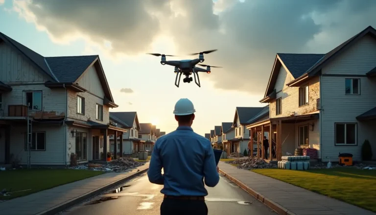

Time matters in disaster response. The old ways of handling emergencies just don’t cut it anymore. Studies prove that drones slash disaster management and assessment time by 90% compared to teams working on the ground.
Disaster management is changing fast as drones prove their worth. These unmanned aircraft bring game-changing capabilities to emergency teams. They excel at quick aerial surveys and can safely check dangerous areas. Drones do more than just speed things up – they deliver up-to-the-minute data analysis, give teams a better view of the situation, and help put resources exactly where they’re needed during critical moments.
This complete breakdown will show you how drone systems work in disasters. We’ll look at their technical abilities, how teams use them, and what challenges they face. The guide covers everything from planning ahead of disasters to checking the aftermath. You’ll see exactly how these flying machines are changing the way we handle emergencies.
Current State of Drone Technology in Disaster Management
Drone technology has transformed disaster management dramatically over the last several years. Modern unmanned aircraft systems (UAS) have become sophisticated tools that execute complex disaster response missions with unmatched precision.
Rise of drone capabilities
Ground needs in emergency response have shaped drone capabilities. Drones can now be positioned strategically across cities and deployed immediately during emergencies. These systems work best in post-disaster scenarios. They assess damage to facilities, houses, and infrastructure while providing instant, solid evidence to analyze.
Key technological components
Our review of current drone systems reveals several core elements that are the foundations of modern disaster response UAS:
- Flight Systems: Comprising three critical sub-systems:
- Software for secure pilot intervention
- Hardware meeting performance specifications
- Communication systems for reliable control
- Imaging Technology: Advanced cameras including thermal detection capabilities
- Control Systems: Dedicated C2 (Command and Control) links for managing flight operations
Industry standards and specifications
The International Civil Aviation Organization (ICAO) has created detailed standards for humanitarian aid and emergency response operations using drones. These standards focus on several key points:
Requirement Category Specification Details Operational Authorization Civil aviation authority approval required Safety Protocols Performance-based criteria for safety achievement Personnel Requirements Licensed remote pilot certification mandatory Equipment Standards Compliance with manufacturer specifications Modern drones come in configurations of all types to handle different disaster response needs. Multi-rotor drones excel in confined spaces and detailed imaging. Fixed-wing variants work best for extensive area coverage. Hybrid VTOL (Vertical Takeoff and Landing) systems combine these advantages to improve operational flexibility.
Current drone systems use sophisticated LiDAR technology for precise terrain mapping and thermal imaging to detect heat signatures in disaster zones. These capabilities, paired with live data transmission systems, help emergency service agencies respond immediately and effectively.
Operational Framework for Drone-Based Response
Our years of work in disaster response operations show that a resilient operational framework helps maximize drone benefits in emergencies. The framework has three vital phases that ensure drones deploy and work effectively.
Pre-disaster planning protocols
We created detailed protocols that blend drone capabilities into disaster management plans. The process starts with a systematic way to spot threats and assess risks. Studies show that adding drone capabilities to pre-disaster planning cuts response time by up to 93% compared to traditional emergency medical services.
Our pre-disaster planning has:
- Ways to spot potential hazards and vulnerable areas
- Strategies to deploy drones
- Protocols for communication
- Plans to allocate resources
Emergency deployment procedures
Disasters require quick action through our emergency deployment procedures. Rapid deployment system gets drones airborne in about 30 seconds.
Post-disaster assessment makes use of information from advanced imaging to evaluate damage fully. Drones with thermal detection can spot heat signatures from people and dangerous situations, like water-logged solar panels on rooftops.
Recent implementations achieved 89.3% validation accuracy in telling damaged structures from undamaged ones using UAV-captured images. This high accuracy helps us give reliable damage assessments to emergency response teams.
Three main aspects drive our assessment approach:
- Rapid Evaluation: Quick first look at affected areas
- Detailed Analysis: Full documentation of damage
- Resource Allocation: Smart distribution of emergency resources
Working together with public and private sectors helped us create effective coordination systems that improve emergency response capabilities. This partnership proves valuable especially when you have immediate disaster response and communications support needs.
Technical Capabilities and Applications
Drones excel at gathering vital information during disasters. Multiple imaging and sensing technologies work together to give a complete picture of the situation.
Imaging and sensing technologies
Advanced optical systems combine multiple imaging technologies in drones. Field operations have shown remarkable improvements in data gathering speed. Drones process thermal data through onboard computing units and combine it with navigation and sensor inputs to find victims quickly. The team creates detailed maps and 3D models of disaster zones that help emergency responders find safe routes.
Real-time monitoring systems
The monitoring setup has three core parts that ensure non-stop surveillance and quick response:
- Ground Station Integration: Communication networks enable precise drone control from long distances
- Data Processing Systems: Onboard computing units handle initial processing by mixing multiple data streams for quick analysis
- Communication Networks: Reliable data transmission systems work even in tough environments
These technologies help drones detect heat signatures, find survivors in remote areas, and spot people trapped in emergencies. The combined capabilities allow continuous monitoring while sending data quickly to emergency teams.
The drones have worked well in many scenarios. They showed great results in spotting people through body shape recognition and movement detection with computer vision. This setup works especially when you have low temperature or poor visibility, like in forests and flood zones.
Data Processing and Analysis Systems
Disaster management teams face unique challenges when they process massive amounts of drone-captured data. We’ve helped build sophisticated systems that handle this complexity and give useful insights to emergency responders.
Image processing workflows
Advanced photogrammetry workflows have produced remarkable results in processing efficiency. The processing time dropped from 908 to 104 minutes for 2,691 images. Distributed computing approach now processes over 11,500 images in just 7.8 hours, which shows a 70% improvement over leading commercial solutions.
A robust workflow has:
- Computing parallelism for faster processing
- GPU acceleration for complex calculations
- Hybrid bundle adjustment techniques
- Immediate data streaming capabilities
AI-powered analysis tools
State-of-the-art AI models designed for emergency situations can significantly enhance drones disaster response capabilities. The CLIP Zero-Shot Classifier works effectively and offers flexible image classification without task-specific training.
Dynamic decision support system analyzes incoming drone data continuously to help emergency responders. The system uses Multi-Criteria Decision Making (MCDM) methods within a dynamic genetic algorithm to provide immediate route rankings and situation assessment.
Work with Synthetaic’s RAIC (Rapid Automatic Image Categorization) showed we can find people in floodwaters within days. Traditional methods might need six weeks of manual data labeling. This faster processing time is vital in time-sensitive search and rescue operations.
Computer vision and remote sensing technologies have improved our disaster management capabilities substantially. AI-powered analysis tools merged with our decision support systems enable fast, large-scale image analysis. Emergency management teams now receive accurate and immediate information.
Implementation Challenges and Solutions
Drone technology has come a long way, but using these systems during disasters brings unique challenges that need groundbreaking solutions. Our work in the field shows several key areas that just need attention to deploy these systems successfully.
Technical limitations
Current drone systems face major constraints in how they operate. Battery life is our biggest problem, and most systems can’t fly very long. We’ve seen that limits on payload capacity affect knowing how to carry essential equipment and supplies. This becomes even more important during large-scale disasters that need wide coverage.
We’ve put these solutions in place to tackle these limits:
- Multi-drone deployment strategies
- Strategic charging station placement
- Lightweight sensor configurations
- Optimized flight path planning
Environmental constraints
Weather conditions create big challenges for our drone operations. Strong winds and heavy rain can affect flight capabilities by a lot. Our work in complex disaster areas brings its own set of unique problems:
Environmental Challenge Impact Our Solution Adverse Weather Limited visibility Advanced sensing systems Complex Terrain Navigation difficulties AI-assisted path planning Signal Interference Communication disruption Redundant systems Operational bottlenecks
Several operational challenges affect how well we can deploy drones. Our data reveals that all but one of these drone surveys cover areas smaller than one square kilometer, while 70% of operations last under 30 minutes. These limits affect our ability to respond effectively.
Urban areas bring extra complications. Our records show that 79% of drone operations happen in rural areas because urban flight approvals are harder to get. This creates a real problem since disasters hit urban areas harder due to their dense population and valuable assets.
Experience across multiple disasters shows that the first few hours are vital, especially when communication networks fail. Response teams overcome these challenges by building backup systems and setting clear protocols for emergency deployment.
Resource Requirements and Management
Proper planning of hardware, personnel, and support systems forms the foundation of drone deployment in disaster management. Hands-on experience with drone operations shows that resource allocation and management strategies need careful review.
Hardware and software needs
Analysis reveals that drone operations need substantial equipment and software investment. Small drones that work well in disaster response cost between AUD 1,528.99 and AUD 15,289.90
Personnel training requirements
Training protocols must line up with international standards. Every team member must complete these requirements:
- Original certification and licensing requirements
- Operational safety and emergency procedures training
- Data processing and analysis methodology courses
- Regular proficiency assessments and updates
Maintenance and support systems
Maintenance framework uses strict protocols to keep equipment reliable and operations safe. We have created a detailed system where staff must log all maintenance activities in the RPAS Technical Log.
Licensed remote pilots must conduct test flights after any changes that could affect flight safety. Our maintenance plan includes:
- Regular Equipment Inspections
- Scheduled Maintenance Protocols
- Emergency Repair Procedures
- Performance Monitoring Systems
Specialized organizations handle complex repairs, which gives us the best results. We use compliance audit system to review processes and procedures regularly, which helps maintain high operational standards.
Managing drone fleets has taught us that internal capacity building leads to long-term success. Many organizations now want to develop their own drone capabilities instead of relying on partner-operated drones. This approach gives them better control over operations, timing, and costs.
Performance Metrics and Quality Control
Drone-based disaster management needs precise performance standards that we test and monitor continuously. Our team developed detailed metrics to make operations reliable for all mission types.
Accuracy assessment methods
Three vital areas determine if our missions succeed. Our extensive testing shows that 3D photogrammetry performance plays a key role when time matters in disaster reconnaissance. We found the best overlapping ratios for aerial imagery that give us detailed and accurate 3D models. These models are vital for analyzing how disasters affect an area.
We use the Reliability, Availability, Maintainability, and Safety (RAMS) assessment framework to improve drone operations. Our reliability analysis spots critical elements that might cause failures. This helps us:
- Optimize maintenance intervals
- Support preventive maintenance criteria
- Reduce repair and maintenance costs
- Increase overall system availability
Our intrinsic reliability studies during the design phase have substantially improved how we predict and prevent system failures. This proactive approach lets us upgrade critical parts and subsystems early, which results in better overall reliability levels.
Quality assurance protocols
Our quality assurance framework delivers consistent performance in all disaster response operations. We have strong quality standards that improve our readiness for future emergencies.
Our experience with disaster response operations shows that combining accurate assessment methods, reliable systems, and strict quality controls makes emergency support more effective. These high standards ensure drone systems perform consistently when people need them most.
Safety and Regulatory Compliance
Safety and regulatory compliance are the foundations of drone operations in disaster management. Over the last several years, we’ve built complete protocols that work well and meet international standards.
Flight safety protocols
We’ve created strong safety protocols based on the Flight Safety Foundation’s workshop findings. Our methods address fourteen key safety risks that affect both airborne traffic and ground operations. These protocols focus on:
- Pre-flight Assessment
- Equipment verification
- Weather condition review
- Airspace clearance confirmation
- Communication system checks
Our emergency response procedures handle many different scenarios, from equipment failures to unexpected obstacles. Our records show that following these protocols substantially reduces accidents, injuries, and equipment damage.
Regulatory requirements
Regulatory compliance framework lines up with international aviation standards while keeping operations efficient. We use a structured approach that meets Civil Aviation Safety Authority (CASA) requirements.
Risk management strategies
Our risk management follows the Joint Authorities for Rulemaking of Unmanned Systems (JARUS) methodology, specifically using the Specific Operations Risk Assessment (SORA). We utilize a complete risk assessment model that reviews six vital criteria:
- Operational Environment Assessment
- Technical System Evaluation
- Human Factor Analysis
- Emergency Response Capability
- Security Protocol Implementation
- Data Protection Measures
Complete safety and regulatory measures create a strong framework for effective drone operations while maintaining high safety and compliance standards. Experience proves proper risk management and regulatory compliance help successful drone deployment in disaster management scenarios.
Partners in project success since 2011, diagnostics, advisory support and applied learning for ministries, public agencies and project teams.
Need help putting this into practice?
Start with a free 10-minute diagnostic or talk to our experts.