Ключевые факты
- Даты
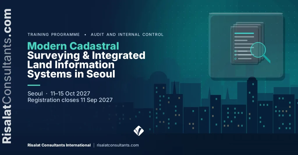
- 11–15 Oct 2027 (5 days)
- Где
- Сеул, Южная Корея
- Стоимость на одного участника
- £2 750 (GBP)
- Оплата
- По счету банковским переводом
- Регистрация закрывается
- 11 Sep 2027
- Сертификат
- Сертификат о прохождении
- Корпоративный формат
- Проведите ее для своей команды в удобные вам даты
На этой странице 14 разделов
Обзор программы
Modern cadastre systems require strong links between technical survey accuracy and institutional land administration processes. This five-day executive training course in Seoul provides land administration specialists with the tools needed to modernise digital cadastral mapping. Participants examine spatial data infrastructure interoperability, national spatial planning policies, and automated parcel registration frameworks. The curriculum demonstrates how modern digital surveying technologies streamline boundary verification, secure tenure rights, and reduce land record fragmentation across government tiers.
The programme analyses Fit-For-Purpose Land Administration approaches alongside rigorous geodetic standards, helping agencies balance mapping speed, cost, and spatial accuracy. Practitioners explore geospatial database architectures, coordinate reference systems, and open data exchange models. By drawing on leading practices in digital registry integration and e-government platforms, the course equips technical teams to upgrade paper-based cadastre systems into unified, queryable spatial repositories suitable for municipal land valuation and regional spatial development.
Participants engage directly with the practical complexities of institutional alignment, particularly between sub-national spatial plans and central land agencies. Structured exercises enable attendees to design spatial data harmonisation strategies that coordinate municipal zoning with national cadastral registries. The course provides actionable frameworks to resolve boundary overlaps, clean legacy land records, and implement interoperable cadastral services that support large-scale public infrastructure projects, sustainable development programmes, and transparent land governance.
Rapid urban expansion and major infrastructure programmes require reliable, reconciled digital spatial data to prevent land conflicts and planning gridlock. This programme directly targets project execution priorities under the Integrated Land Administration and Spatial Planning Project, where public agencies must reconcile municipal zoning layers with authoritative national land registries. Without institutional interoperability and modernised cadastral workflows, national spatial data initiatives risk costly duplication, legal disputes over tenure, and delays in donor-funded capital investments.
Программа, которую Risalat Consultants International проводит в Сеуле (Южная Корея), сочетает занятия под руководством экспертов, реальные кейсы и групповую работу, чтобы участники могли применять полученные знания в своей организации.
The Programme Strengthens Institutional Capability
- Core components of modern digital land administration and cadastre systems
- The Land Administration Domain Model (ISO 19152): core classes and implementation profiles
- Geodetic datums, reference frames, and national spatial coordinate transformations
- Reviewing digital parcel fabric management and topological consistency rules
- Comparative review of institutional cadastre structures and digital registry functions
- Principles of Fit-For-Purpose Land Administration: spatial, legal, and institutional dimensions
- Unmanned Aerial Vehicles (UAVs) and high-resolution satellite imagery for boundary capture
- Global Navigation Satellite System (GNSS) RTK surveying methodologies for cadastral updates
- Оценка рисков мошенничества и реестры рисков мошенничества
- Разработка и тестирование внутреннего контроля
- Модель трех линий и роль надзора
- Планирование аудита, доказательства и документация
It is designed for cadastral survey directors and field mapping officers, spatial planning leads in municipal and regional governments, national land agency digital registry managers and others who want practical, current skills in fraud, audit and internal control.
- Сбор
- Очистка
- Хранение
- Анализ
- Решение
The Growing Importance of Modern Cadastral Surveying & Integrated Land Information Systems in Seoul
От государственных органов и проектов, финансируемых донорами, ожидают подтверждения того, что средства используются по назначению. Аудиторы, надзорные органы и финансирующие организации все чаще смотрят не только на финансовую отчетность, но и на стоящие за ней механизмы контроля, документы и поведение.
Мошенничество и слабость контроля редко возникают из-за одного сбоя. Они разрастаются там, где роли нечетки, документы неполны, а тревожные сигналы остаются без внимания. Команды, понимающие, как происходит мошенничество и как механизмы контроля его останавливают, защищают и свою организацию, и людей, которым она служит.
Организациям все больше нужны специалисты, способные:
- Выявлять и оценивать риски мошенничества и контроля в своих процессах
- Разрабатывать соразмерные и проверяемые механизмы контроля
- Собирать и документировать надежные аудиторские доказательства
- Своевременно распознавать тревожные сигналы и правильно их эскалировать
- Превращать выводы в практические согласованные действия
Сильные системы противодействия мошенничеству, аудита и внутреннего контроля помогают организациям:
- Сокращать потери и неприемлемые расходы
- Проходить внешний аудит с меньшим числом замечаний
- Укреплять доверие финансирующих организаций и граждан
- Реагировать на обвинения справедливо и с документальным оформлением
This Modern Cadastral Surveying & Integrated Land Information Systems in Seoul programme brings these elements together in a practical format, so that participants understand not only what good practice looks like but also how to introduce it in their own setting, with the people and resources they have.
Who Should Attend This Modern Cadastral Surveying & Integrated Land Information Systems in Seoul Training?
Программа предназначена для:
- Cadastral survey directors and field mapping officers
- Spatial planning leads in municipal and regional governments
- National land agency digital registry managers
- Geographic Information System (GIS) database administrators in public registries
- Land administration project implementation unit (PIU) specialists
- Valuation and property taxation mapping coordinators
- Land tenure regularisation advisors and legal registrars
- Spatial Data Infrastructure (SDI) technical committee members
- Внутренние аудиторы и руководители аудита
- Финансовые менеджеры и бухгалтеры
- Специалисты по комплаенсу и рискам
- Специалисты и руководители по закупкам
Программа подходит как опытным специалистам, так и тем, кто переходит к новым обязанностям. Приветствуются группы из разных организаций и стран, поскольку участники многому учатся на опыте друг друга.
Отметьте, что должна уметь ваша команда.
Modern Cadastral Surveying & Integrated Land Information Systems in Seoul Training Objectives
Upon successful completion of this Modern Cadastral Surveying & Integrated Land Information Systems in Seoul Training, participants will be able to:
- Apply international cadastral standards including the Land Administration Domain Model (ISO 19152) to national digital registries
- Evaluate Fit-For-Purpose (FFP) spatial methods against conventional geodetic surveying to optimise parcel mapping workflows
- Develop interoperability protocols using Open Geospatial Consortium (OGC) specifications to link zoning plans with property registers
- Design spatial data harmonisation workflows to identify and rectify boundary overlaps between forestry, municipal, and private tenures
- Formulate digital transformation roadmaps for transitioning analogue parcel archives into secure, web-enabled cadastral databases
- Establish automated quality control metrics for multi-source spatial data ingestion and aerial survey validation
- Create institutional data-sharing governance models between municipal spatial planning authorities and central land administration agencies
- Объяснять, как и почему происходит мошенничество, с помощью признанных моделей рисков мошенничества
- Проводить оценку рисков мошенничества и контроля для реального процесса
- Сопоставлять механизмы контроля с рисками по модели трех линий
Каждая цель отрабатывается в ходе программы на упражнениях, кейсах или в групповой работе, чтобы участники умели это делать, а не только описывать.
Содержание и структура программы
- Core components of modern digital land administration and cadastre systems
- The Land Administration Domain Model (ISO 19152): core classes and implementation profiles
- Geodetic datums, reference frames, and national spatial coordinate transformations
- Reviewing digital parcel fabric management and topological consistency rules
- Comparative review of institutional cadastre structures and digital registry functions
- Principles of Fit-For-Purpose Land Administration: spatial, legal, and institutional dimensions
- Unmanned Aerial Vehicles (UAVs) and high-resolution satellite imagery for boundary capture
- Global Navigation Satellite System (GNSS) RTK surveying methodologies for cadastral updates
- Crowdsourced and participatory mapping integration within statutory frameworks
- Cost-accuracy trade-offs in nationwide systematic land regularisation programmes
- National Spatial Data Infrastructure (NSDI) architecture for land administration
- Implementing Open Geospatial Consortium (OGC) standards: WMS, WFS, and CSW for cadastre data
- Web-based land registration portals and interoperable API development
- Metadata management and spatial registry cataloguing using ISO 19115 standards
- Cloud-hosted spatial database management systems and automated backup protocols
- Analysing structural misalignments between municipal zoning and central land titles
- Automated edge-matching, conflation, and topological error detection in parcel fabrics
- Standardising spatial planning layers to align with national cadastral base maps
- Resolving overlapping rights: state land, municipal jurisdiction, and customary domains
- Practical laboratory: building a multi-agency spatial data reconciliation workflow
- Designing institutional data-sharing agreements and spatial governance policies
- Risk management and data security for digital property ownership records
- Monitoring and evaluation indicators for land administration modernisation projects
- Drafting execution plans for the Integrated Land Administration and Spatial Planning Project
- Participant action plan presentations and technical peer review
Полное содержание по дням
Программа длится 5 дней. Каждый день сочетает выступления экспертов, практическую работу и заключительный семинар или разбор кейса:
- First Day: Modern Cadastral Architectures and International Standards
- Second Day: Fit-For-Purpose Land Administration and Data Acquisition
- Third Day: Spatial Data Infrastructure and Cadastral Interoperability
- Fourth Day: Spatial Data Harmonisation: Cadastre and Spatial Planning
- Fifth Day: Digital Governance, Implementation, and Project Scaling
Полное содержание по дням
First Day | Modern Cadastral Architectures and International Standards
- Core components of modern digital land administration and cadastre systems
- The Land Administration Domain Model (ISO 19152): core classes and implementation profiles
- Geodetic datums, reference frames, and national spatial coordinate transformations
- Reviewing digital parcel fabric management and topological consistency rules
- Comparative review of institutional cadastre structures and digital registry functions
Workshop: Modern Cadastral Architectures and International Standards: Applying It to Your Institution
Работая в небольших группах, участники применяют методы дня к примерам из своих организаций и согласовывают практические дальнейшие шаги.
Second Day | Fit-For-Purpose Land Administration and Data Acquisition
- Principles of Fit-For-Purpose Land Administration: spatial, legal, and institutional dimensions
- Unmanned Aerial Vehicles (UAVs) and high-resolution satellite imagery for boundary capture
- Global Navigation Satellite System (GNSS) RTK surveying methodologies for cadastral updates
- Crowdsourced and participatory mapping integration within statutory frameworks
- Cost-accuracy trade-offs in nationwide systematic land regularisation programmes
Workshop: Fit-For-Purpose Land Administration and Data Acquisition: Applying It to Your Institution
Работая в небольших группах, участники применяют методы дня к примерам из своих организаций и согласовывают практические дальнейшие шаги.
Third Day | Spatial Data Infrastructure and Cadastral Interoperability
- National Spatial Data Infrastructure (NSDI) architecture for land administration
- Implementing Open Geospatial Consortium (OGC) standards: WMS, WFS, and CSW for cadastre data
- Web-based land registration portals and interoperable API development
- Metadata management and spatial registry cataloguing using ISO 19115 standards
- Cloud-hosted spatial database management systems and automated backup protocols
Case Study: Spatial Data Infrastructure and Cadastral Interoperability in Practice
Участники анализируют реалистичный кейс, сравнивают принятые решения с передовой практикой и извлекают уроки, применимые в своих условиях.
Fourth Day | Spatial Data Harmonisation: Cadastre and Spatial Planning
- Analysing structural misalignments between municipal zoning and central land titles
- Automated edge-matching, conflation, and topological error detection in parcel fabrics
- Standardising spatial planning layers to align with national cadastral base maps
- Resolving overlapping rights: state land, municipal jurisdiction, and customary domains
- Practical laboratory: building a multi-agency spatial data reconciliation workflow
Workshop: Spatial Data Harmonisation: Cadastre and Spatial Planning: Applying It to Your Institution
Работая в небольших группах, участники применяют методы дня к примерам из своих организаций и согласовывают практические дальнейшие шаги.
Fifth Day | Digital Governance, Implementation, and Project Scaling
- Designing institutional data-sharing agreements and spatial governance policies
- Risk management and data security for digital property ownership records
- Monitoring and evaluation indicators for land administration modernisation projects
- Drafting execution plans for the Integrated Land Administration and Spatial Planning Project
- Participant action plan presentations and technical peer review
Capstone Exercise: Modern Cadastral Surveying & Integrated Land Information Systems in Seoul Action Plan for Your Institution
Участники объединяют итоги недели в план действий для своей организации с приоритетами, ответственными и первыми шагами и представляют его коллегам и ведущим для обратной связи.
Modern Cadastral Surveying & Integrated Land Information Systems in Seoul Training Methodology
The training combines technical lectures with practical geospatial data laboratories, policy case studies, and structured syndicate working sessions. Participants work directly with open-source GIS software, standard schema models, and cadastral datasets to execute spatial reconciliation exercises. Daily sessions encourage peer exchange and institutional problem-solving, culminating in the development of individual action plans tailored to home-country policy mandates.
Программа сочетает:
- Занятия под руководством экспертов по актуальной практике
- Региональные и международные кейсы
- Групповая работа и практические упражнения
- Симуляции и ролевые игры, где это уместно
- Обсуждение собственных задач участников
- Обмен опытом между организациями и странами
- Практические инструменты и шаблоны для работы
- Ежедневная рефлексия и планирование действий
Перед программой короткая предварительная оценка помогает ведущим понять роль и приоритеты каждого участника, чтобы адаптировать примеры и упражнения к группе. Каждый день завершается короткой рефлексией, в ходе которой участники отмечают, что они применят в работе.
- Операция
- Учет
- Контроль
- Доказательства
- Заключение
Ожидаемые результаты
Upon completion of this Modern Cadastral Surveying & Integrated Land Information Systems in Seoul Training, participants will be able to:
- Ability to implement the ISO 19152 Land Administration Domain Model within national cadastral database architectures
- Proficiency in deploying Fit-For-Purpose field surveying methodologies to accelerate national parcel mapping programmes
- Capability to establish interoperable OGC-compliant spatial web services connecting municipal zoning and land registries
- Execution of technical workflows to detect, resolve, and standardise overlapping parcel and planning boundaries
- Structured institutional governance templates to manage cross-agency spatial data-sharing agreements
- A prioritised institutional action plan to guide project investments and technical execution under modernisation programmes
- Оценивать риски мошенничества и контроля в своих процессах
- Разрабатывать и тестировать соразмерные механизмы контроля
Участники уходят с личным планом действий и практическими инструментами, которые можно применять в своей организации с первой же недели после возвращения. Организации, направляющие нескольких участников, могут использовать программу, чтобы согласовать общие методы и шаблоны для разных команд: так улучшения легче закрепить.
£2 750 за участника · оплата по счету банковским переводом · для групп от 5 человек предусмотрена скидка
Пять и более участников от одной организации: укажите групповой тариф в запросе счета.
Десять и более человек: корпоративная версия для вашей организации может обойтись дешевле в расчете на одного участника. Запросите расчет корпоративной программы.
Registration closes in 303 days (11 Sep 2027)
Institutional Application of Modern Cadastral Surveying & Integrated Land Information Systems in Seoul Training
Программа помогает организациям укрепить:
- Управление рисками мошенничества и коррупции
- Системы внутреннего контроля
- Механизмы аудита и надзора
- Работа по замечаниям аудита
- Добросовестность и каналы сообщений о нарушениях
Участники возвращаются с практическими инструментами для улучшения:
- Реестры рисков и карты контролей
- Планирование аудита и тестирование
- Доказательства и документация
- Отчетность перед руководством и советами
- Предотвращение неприемлемых расходов
Программа построена так, чтобы знания переходили из учебной аудитории в организацию. По возможности участники работают с собственными процессами и документами и уходят с планом действий, который их руководители могут рассмотреть и поддержать.
Региональная актуальность и применение
Европа
Европейские организации работают в сферах противодействия мошенничеству, аудита и внутреннего контроля в рамках детально проработанного регулирования и программ реформ. Участники из Европы могут сравнить свою практику с опытом коллег из других регионов и проверить, как устоявшиеся методы работают в иных условиях.
Африка
По всей Африке министерства, ведомства и проектные команды в сферах противодействия мошенничеству, аудита и внутреннего контроля все чаще работают параллельно с программами, финансируемыми донорами, которые ожидают четких систем и фактических данных. Программа помогает участникам адаптировать лучшую практику к своим организациям и имеющимся ресурсам.
Ближний Восток
На Ближнем Востоке национальные стратегии развития и планы диверсификации предъявляют все более высокие требования к противодействию мошенничеству, аудиту и внутреннему контролю. Участники изучают, как сформировать потенциал, необходимый для этих планов, внутри государственных органов и компаний.
Азия
Организации в Азии сочетают быстрый рост с амбициозными программами модернизации. Участники из Азии могут поделиться опытом быстрого масштабирования систем и узнать о подходах, применяемых в других странах.
Тихоокеанский регион
Малые островные и тихоокеанские государства сталкиваются с особыми ограничениями, связанными с размером, удаленностью и потенциалом. Программа показывает практичные и соразмерные подходы к противодействию мошенничеству, аудиту и внутреннему контролю, подходящие для небольших организаций.
Holding the programme in Seoul, South Korea brings participants together away from their daily pressures, so they can compare how fraud, audit and internal control is handled in different settings. The same programme can also be delivered in-house for one institution, in its own country or online, with cases taken from its current work.
Профиль принимающей страны – Южная Корея
Программы, семинары, ознакомительные поездки и учебные курсы в Сеуле (Южная Корея) от Risalat Consultants International
Обучение за пределами своей страны дает участникам время сосредоточиться, по-новому взглянуть на свою организацию и выстроить сеть контактов с коллегами из других стран.
Modern Cadastral Surveying & Integrated Land Information Systems in Seoul Training Deliverables
Участники получают поддержку до, во время и после программы, поэтому подготовка, обучение и последующее сопровождение складываются в единый непрерывный процесс.
До программы
- Предварительная оценка участников
- Modern Cadastral Surveying & Integrated Land Information Systems in Seoul Readiness Assessment
- Modern Cadastral Surveying & Integrated Land Information Systems in Seoul Resource Pack
- Материалы для предварительного чтения
- Бесплатная визовая поддержка и консультации
Во время программы
- Встреча в аэропорту и приветственное сопровождение
- Проживание с завтраком
- Приветственный ужин для нетворкинга
- Комплект участника Risalat (сумка, бутылка, кружка, футболка, кепка, обложка для паспорта, ручки, блокнот, магнит и брелок)
- Comprehensive Modern Cadastral Surveying & Integrated Land Information Systems in Seoul Training Manual
- Шаблон реестра рисков мошенничества
- Матрица сопоставления контролей
- Чек-лист аудиторских доказательств
- Трекер выводов и последующих действий
- Практические семинары и симуляции
- Групповые дискуссии и обмен опытом
- Ежедневный обед и кофе-брейки
- Полный доступ к инфраструктуре места проведения
- Мини-планшет с цифровыми учебными материалами
- Выездной визит (при наличии)
- Развлекательная экскурсия по городу
После программы
- Сертификат о прохождении
- Награда Risalat за участие в программе
- Справочные материалы после обучения
- Руководство по самооценке рисков мошенничества
- Чек-лист тестирования контролей
- Поддержка и консультации после обучения
- Отчет по программе
Организации также могут заказать адаптированную корпоративную версию этой программы с проведением на своей территории или онлайн. Запросить предложение.
Common Challenges in Modern Cadastral Surveying & Integrated Land Information Systems in Seoul, And How This Training Helps
Как организациям выявлять и оценивать риски мошенничества и контроля в собственных процессах?
The programme addresses this directly on the first day (Modern Cadastral Architectures and International Standards), where participants practise the methods involved and adapt them to their own institution, then build it into their action plan.
Как организациям разрабатывать соразмерные и проверяемые меры контроля?
The programme addresses this directly on the second day (Fit-For-Purpose Land Administration and Data Acquisition), where participants practise the methods involved and adapt them to their own institution, then build it into their action plan.
Как организациям собирать и документировать надежные аудиторские доказательства?
The programme addresses this directly on the third day (Spatial Data Infrastructure and Cadastral Interoperability), where participants practise the methods involved and adapt them to their own institution, then build it into their action plan.
Как организациям своевременно распознавать тревожные сигналы и правильно их эскалировать?
The programme addresses this directly on the fourth day (Spatial Data Harmonisation: Cadastre and Spatial Planning), where participants practise the methods involved and adapt them to their own institution, then build it into their action plan.
Как организациям превращать выводы в практические согласованные действия?
The programme addresses this directly on the fifth day (Digital Governance, Implementation, and Project Scaling), where participants practise the methods involved and adapt them to their own institution, then build it into their action plan.
Часто задаваемые вопросы
When and where does the Modern Cadastral Surveying & Integrated Land Information Systems in Seoul programme take place?
It runs from 11 Oct 2027 to 15 Oct 2027, in Seoul, South Korea. The registration deadline is shown at the top of this page.
Кому стоит участвовать?
The programme is designed for cadastral survey directors and field mapping officers, spatial planning leads in municipal and regional governments, national land agency digital registry managers, geographic Information System (GIS) database administrators in public registries, and others who want practical skills in fraud, audit and internal control.
Получу ли я сертификат?
Да. Участники, завершившие программу, получают сертификат о прохождении от Risalat Consultants International.
Можно ли провести эту программу только для нашей организации?
Да. Мы можем провести адаптированную корпоративную версию в вашей организации, в другом городе или онлайн на основе ваших собственных кейсов. Воспользуйтесь формой запроса предложения на этой странице.
Нужен ли мне опыт в области противодействия мошенничеству, аудита и внутреннего контроля?
Специальная подготовка не требуется, достаточно опыта работы в смежной должности. Короткая предварительная оценка помогает ведущим адаптировать занятия к группе.
Who Will Deliver This Programme
Each date is delivered by a team assigned from Risalat's expert network for this subject. For this programme we assign:
How we choose them: Experience in the region of the participants or comparable settings; Command of the financier rules that apply (World Bank, ADB, AfDB, EU, UN) where relevant; Delivery in English; other languages on request for in-house groups; No conflict of interest with participants' institutions.
Names and short CVs of the assigned experts are shared with registered participants and sponsoring organisations before the programme, on request. Are you an expert in this subject? Join our expert network.
Training courses in SeoulTechnology training courses
Почему эта программа проходит в Сеуле
Сеул является лидером в области электронного правительства и электронных закупок, что делает его идеальным местом для учебных визитов по цифровой трансформации.
The Modern Cadastral Surveying & Integrated Land Information Systems in Seoul programme in October 2027 brings together officials and professionals from across the Asia region and beyond. Sessions combine short inputs, case studies and group work on participants' own files, and the city's institutions can be added as a study visit on request.
Как добраться: аэропорт Инчхон (ICN).
Узнайте, нужна ли вам виза, с помощью бесплатного сервиса «Проверка визы» и запросите приглашение после регистрации.
Та же тема в других городах
- Digital Land Registration, Cadastre Systems and Tenure Security in Kigali (Kigali)
- Modern Irrigation Schemes and Land Administration Systems in Vienna (Vienna)
- State Land Titling, Allocation and Community Livelihood Planning in Bali (Bali)
- Digital Land Administration and Cadastral Parcel Mapping in Seoul (Seoul)
Другие программы в Сеуле
- Government Cloud Adoption, Interoperability & Data Governance in Seoul
- Socioemotional Curriculum Design and Rural Youth Enterprise Incubation in Seoul
- Infection Prevention and Healthcare Facility Upgrading in Cold Climates in Seoul
- Inter-Urban Freight Corridor Logistics and Rural Road Asset Maintenance in Seoul
- Performance-Based Intergovernmental Fiscal Transfers Management in Seoul
For teams and institutions
Bring your team
Teams that learn together apply more at work. Tell us how many people and how you would like to take part: we reply with a group quote within two working days.
Other dates and cities for this subject: Impact Evaluation and Data Analysis training courses (16 upcoming dates).
Другие учебные курсы в Южной Корее · Все программы в Азии · Полный календарь обучения
Plan this programme in a roadmap: why it matters, why to approve it, the dates to plan and the career it builds.