关键信息
- 日期
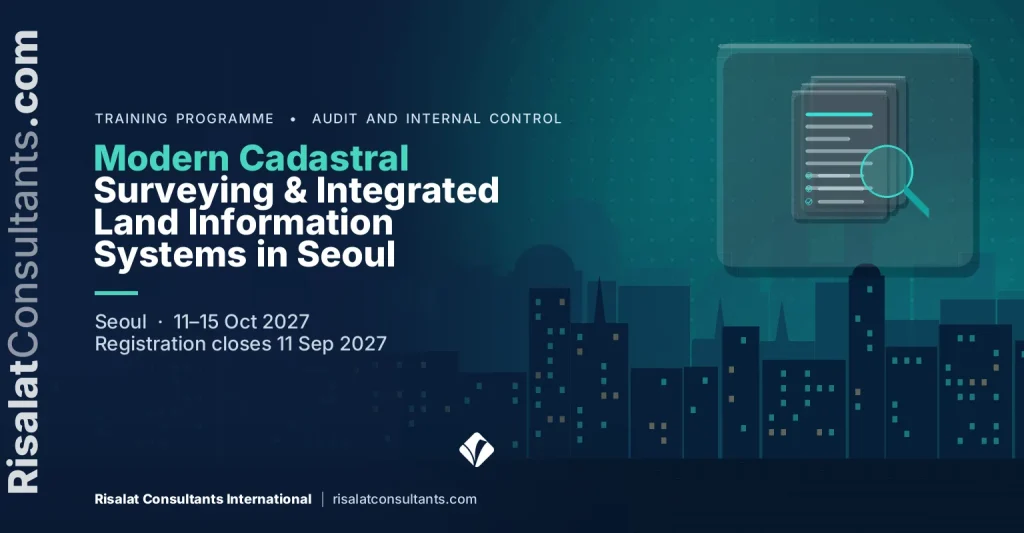
- 11–15 Oct 2027 (5 days)
- 地点
- 韩国首尔
- 每位学员费用
- £2,750(英镑)
- 付款
- 通过发票和银行转账付款
- 报名截止
- 11 Sep 2027
- 证书
- 结业证书
- 内训选项
- 按您的日期,为您的团队专场举办
本页内容14个部分
培训项目概述
Modern cadastre systems require strong links between technical survey accuracy and institutional land administration processes. This five-day executive training course in Seoul provides land administration specialists with the tools needed to modernise digital cadastral mapping. Participants examine spatial data infrastructure interoperability, national spatial planning policies, and automated parcel registration frameworks. The curriculum demonstrates how modern digital surveying technologies streamline boundary verification, secure tenure rights, and reduce land record fragmentation across government tiers.
The programme analyses Fit-For-Purpose Land Administration approaches alongside rigorous geodetic standards, helping agencies balance mapping speed, cost, and spatial accuracy. Practitioners explore geospatial database architectures, coordinate reference systems, and open data exchange models. By drawing on leading practices in digital registry integration and e-government platforms, the course equips technical teams to upgrade paper-based cadastre systems into unified, queryable spatial repositories suitable for municipal land valuation and regional spatial development.
Participants engage directly with the practical complexities of institutional alignment, particularly between sub-national spatial plans and central land agencies. Structured exercises enable attendees to design spatial data harmonisation strategies that coordinate municipal zoning with national cadastral registries. The course provides actionable frameworks to resolve boundary overlaps, clean legacy land records, and implement interoperable cadastral services that support large-scale public infrastructure projects, sustainable development programmes, and transparent land governance.
Rapid urban expansion and major infrastructure programmes require reliable, reconciled digital spatial data to prevent land conflicts and planning gridlock. This programme directly targets project execution priorities under the Integrated Land Administration and Spatial Planning Project, where public agencies must reconcile municipal zoning layers with authoritative national land registries. Without institutional interoperability and modernised cadastral workflows, national spatial data initiatives risk costly duplication, legal disputes over tenure, and delays in donor-funded capital investments.
本培训项目由Risalat Consultants International在韩国首尔举办,结合专家主讲、真实案例与小组练习,帮助学员将所学应用于本单位工作。
The Programme Strengthens Institutional Capability
- Core components of modern digital land administration and cadastre systems
- The Land Administration Domain Model (ISO 19152): core classes and implementation profiles
- Geodetic datums, reference frames, and national spatial coordinate transformations
- Reviewing digital parcel fabric management and topological consistency rules
- Comparative review of institutional cadastre structures and digital registry functions
- Principles of Fit-For-Purpose Land Administration: spatial, legal, and institutional dimensions
- Unmanned Aerial Vehicles (UAVs) and high-resolution satellite imagery for boundary capture
- Global Navigation Satellite System (GNSS) RTK surveying methodologies for cadastral updates
- 舞弊风险评估与舞弊风险登记册
- 内部控制的设计与测试
- 三道防线模型与监督的作用
- 审计规划、证据与文档记录
It is designed for cadastral survey directors and field mapping officers, spatial planning leads in municipal and regional governments, national land agency digital registry managers and others who want practical, current skills in fraud, audit and internal control.
- 收集
- 清洗
- 存储
- 分析
- 决策
The Growing Importance of Modern Cadastral Surveying & Integrated Land Information Systems in Seoul
公共机构和捐助方资助项目须证明资金按预定用途使用。审计师、监督机构和出资方越来越多地透过财务报表,审视其背后的控制、记录和行为。
舞弊和控制缺陷很少源于单一失误。它们往往滋生于职责不清、记录不全以及预警信号未被跟进的地方。了解舞弊如何发生以及控制如何加以阻止的团队,既能保护本机构,也能保护其所服务的民众。
各机构日益需要具备以下能力的专业人员:
- 识别并评估本机构流程中的舞弊与控制风险
- 设计适度且可测试的控制措施
- 收集并记录可靠的审计证据
- 及早识别危险信号并正确上报
- 将审计发现转化为切实可行、各方认可的行动
健全的反欺诈、审计和内部控制体系可帮助组织:
- 减少损失和不合规支出
- 以更少的审计发现通过外部审计
- 增强出资方和公民的信任
- 以公平且有据可查的方式回应指控
This Modern Cadastral Surveying & Integrated Land Information Systems in Seoul programme brings these elements together in a practical format, so that participants understand not only what good practice looks like but also how to introduce it in their own setting, with the people and resources they have.
Who Should Attend This Modern Cadastral Surveying & Integrated Land Information Systems in Seoul Training?
本培训项目适合:
- Cadastral survey directors and field mapping officers
- Spatial planning leads in municipal and regional governments
- National land agency digital registry managers
- Geographic Information System (GIS) database administrators in public registries
- Land administration project implementation unit (PIU) specialists
- Valuation and property taxation mapping coordinators
- Land tenure regularisation advisors and legal registrars
- Spatial Data Infrastructure (SDI) technical committee members
- 内部审计人员与审计经理
- 财务经理与会计人员
- 合规与风险官员
- 采购官员与采购经理
本培训项目既适合经验丰富的专业人员,也适合刚承担新职责的人员。我们鼓励来自不同机构和国家的学员组成混合小组,因为学员能从彼此的经验中获益良多。
勾选您的团队需要具备的能力。
Modern Cadastral Surveying & Integrated Land Information Systems in Seoul Training Objectives
Upon successful completion of this Modern Cadastral Surveying & Integrated Land Information Systems in Seoul Training, participants will be able to:
- Apply international cadastral standards including the Land Administration Domain Model (ISO 19152) to national digital registries
- Evaluate Fit-For-Purpose (FFP) spatial methods against conventional geodetic surveying to optimise parcel mapping workflows
- Develop interoperability protocols using Open Geospatial Consortium (OGC) specifications to link zoning plans with property registers
- Design spatial data harmonisation workflows to identify and rectify boundary overlaps between forestry, municipal, and private tenures
- Formulate digital transformation roadmaps for transitioning analogue parcel archives into secure, web-enabled cadastral databases
- Establish automated quality control metrics for multi-source spatial data ingestion and aerial survey validation
- Create institutional data-sharing governance models between municipal spatial planning authorities and central land administration agencies
- 运用公认的舞弊风险模型,阐述舞弊如何发生以及为何发生
- 针对一个真实流程开展舞弊与控制风险评估
- 运用三道防线模型将控制与风险相对应
每项目标都会在培训期间通过练习、案例或小组作业加以实践,使学员结业时不仅能够描述,更能够实际运用。
培训项目内容与结构
- Core components of modern digital land administration and cadastre systems
- The Land Administration Domain Model (ISO 19152): core classes and implementation profiles
- Geodetic datums, reference frames, and national spatial coordinate transformations
- Reviewing digital parcel fabric management and topological consistency rules
- Comparative review of institutional cadastre structures and digital registry functions
- Principles of Fit-For-Purpose Land Administration: spatial, legal, and institutional dimensions
- Unmanned Aerial Vehicles (UAVs) and high-resolution satellite imagery for boundary capture
- Global Navigation Satellite System (GNSS) RTK surveying methodologies for cadastral updates
- Crowdsourced and participatory mapping integration within statutory frameworks
- Cost-accuracy trade-offs in nationwide systematic land regularisation programmes
- National Spatial Data Infrastructure (NSDI) architecture for land administration
- Implementing Open Geospatial Consortium (OGC) standards: WMS, WFS, and CSW for cadastre data
- Web-based land registration portals and interoperable API development
- Metadata management and spatial registry cataloguing using ISO 19115 standards
- Cloud-hosted spatial database management systems and automated backup protocols
- Analysing structural misalignments between municipal zoning and central land titles
- Automated edge-matching, conflation, and topological error detection in parcel fabrics
- Standardising spatial planning layers to align with national cadastral base maps
- Resolving overlapping rights: state land, municipal jurisdiction, and customary domains
- Practical laboratory: building a multi-agency spatial data reconciliation workflow
- Designing institutional data-sharing agreements and spatial governance policies
- Risk management and data security for digital property ownership records
- Monitoring and evaluation indicators for land administration modernisation projects
- Drafting execution plans for the Integrated Land Administration and Spatial Planning Project
- Participant action plan presentations and technical peer review
完整的每日课程内容
本培训项目为期5天。每天均包含专家讲授、实践练习,并以研讨会或案例研究收尾:
- First Day: Modern Cadastral Architectures and International Standards
- Second Day: Fit-For-Purpose Land Administration and Data Acquisition
- Third Day: Spatial Data Infrastructure and Cadastral Interoperability
- Fourth Day: Spatial Data Harmonisation: Cadastre and Spatial Planning
- Fifth Day: Digital Governance, Implementation, and Project Scaling
完整的每日课程内容
First Day | Modern Cadastral Architectures and International Standards
- Core components of modern digital land administration and cadastre systems
- The Land Administration Domain Model (ISO 19152): core classes and implementation profiles
- Geodetic datums, reference frames, and national spatial coordinate transformations
- Reviewing digital parcel fabric management and topological consistency rules
- Comparative review of institutional cadastre structures and digital registry functions
Workshop: Modern Cadastral Architectures and International Standards: Applying It to Your Institution
学员分成小组,将当天所学方法应用于本机构的实例,并商定切实可行的后续步骤。
Second Day | Fit-For-Purpose Land Administration and Data Acquisition
- Principles of Fit-For-Purpose Land Administration: spatial, legal, and institutional dimensions
- Unmanned Aerial Vehicles (UAVs) and high-resolution satellite imagery for boundary capture
- Global Navigation Satellite System (GNSS) RTK surveying methodologies for cadastral updates
- Crowdsourced and participatory mapping integration within statutory frameworks
- Cost-accuracy trade-offs in nationwide systematic land regularisation programmes
Workshop: Fit-For-Purpose Land Administration and Data Acquisition: Applying It to Your Institution
学员分成小组,将当天所学方法应用于本机构的实例,并商定切实可行的后续步骤。
Third Day | Spatial Data Infrastructure and Cadastral Interoperability
- National Spatial Data Infrastructure (NSDI) architecture for land administration
- Implementing Open Geospatial Consortium (OGC) standards: WMS, WFS, and CSW for cadastre data
- Web-based land registration portals and interoperable API development
- Metadata management and spatial registry cataloguing using ISO 19115 standards
- Cloud-hosted spatial database management systems and automated backup protocols
Case Study: Spatial Data Infrastructure and Cadastral Interoperability in Practice
学员分析真实案例,将案例中的决策与良好实践进行比较,并总结出可在自身环境中运用的经验。
Fourth Day | Spatial Data Harmonisation: Cadastre and Spatial Planning
- Analysing structural misalignments between municipal zoning and central land titles
- Automated edge-matching, conflation, and topological error detection in parcel fabrics
- Standardising spatial planning layers to align with national cadastral base maps
- Resolving overlapping rights: state land, municipal jurisdiction, and customary domains
- Practical laboratory: building a multi-agency spatial data reconciliation workflow
Workshop: Spatial Data Harmonisation: Cadastre and Spatial Planning: Applying It to Your Institution
学员分成小组,将当天所学方法应用于本机构的实例,并商定切实可行的后续步骤。
Fifth Day | Digital Governance, Implementation, and Project Scaling
- Designing institutional data-sharing agreements and spatial governance policies
- Risk management and data security for digital property ownership records
- Monitoring and evaluation indicators for land administration modernisation projects
- Drafting execution plans for the Integrated Land Administration and Spatial Planning Project
- Participant action plan presentations and technical peer review
Capstone Exercise: Modern Cadastral Surveying & Integrated Land Information Systems in Seoul Action Plan for Your Institution
学员将一周所学整合为本机构的行动计划,明确优先事项、负责人和初步行动,并进行展示,听取同伴和讲师的反馈。
Modern Cadastral Surveying & Integrated Land Information Systems in Seoul Training Methodology
The training combines technical lectures with practical geospatial data laboratories, policy case studies, and structured syndicate working sessions. Participants work directly with open-source GIS software, standard schema models, and cadastral datasets to execute spatial reconciliation exercises. Daily sessions encourage peer exchange and institutional problem-solving, culminating in the development of individual action plans tailored to home-country policy mandates.
本培训项目融合了:
- 专家主讲当前实践
- 区域及国际案例研究
- 小组作业与实践练习
- 视情况安排模拟演练与角色扮演
- 探讨学员自身面临的挑战
- 跨机构、跨国家的同伴学习
- 可带回工作岗位的实用工具与模板
- 每日反思与行动规划
培训开始前,简短的课前评估可帮助讲师了解每位学员的岗位职责和重点关注事项,以便根据学员群体调整案例和练习。每天结束时安排简短的反思环节,学员记录下将在工作中应用的内容。
- 交易
- 记录
- 控制
- 证据
- 意见
预期成果
Upon completion of this Modern Cadastral Surveying & Integrated Land Information Systems in Seoul Training, participants will be able to:
- Ability to implement the ISO 19152 Land Administration Domain Model within national cadastral database architectures
- Proficiency in deploying Fit-For-Purpose field surveying methodologies to accelerate national parcel mapping programmes
- Capability to establish interoperable OGC-compliant spatial web services connecting municipal zoning and land registries
- Execution of technical workflows to detect, resolve, and standardise overlapping parcel and planning boundaries
- Structured institutional governance templates to manage cross-agency spatial data-sharing agreements
- A prioritised institutional action plan to guide project investments and technical execution under modernisation programmes
- 评估本机构流程中的舞弊与控制风险
- 设计并测试适度的控制措施
学员结业时将获得个人行动计划和实用工具,回到工作岗位的第一周即可在机构中应用。派出多名学员的机构可借助本培训项目,在各团队之间统一方法和模板,使改进成果更易持续。
每位学员£2,750 · 通过发票和银行转账付款 · 5人及以上团体报名可享优惠
同一机构五人及以上:请在申请发票时索取团体价。
10人或以上:为贵机构举办内训的人均费用可能更低。索取内训报价。
Registration closes in 303 days (11 Sep 2027)
Institutional Application of Modern Cadastral Surveying & Integrated Land Information Systems in Seoul Training
本培训项目帮助机构加强:
- 舞弊与腐败风险管理
- 内部控制框架
- 审计与监督安排
- 审计发现的跟进
- 廉洁与举报渠道
学员将带着实用工具回到工作岗位,以提升:
- 风险登记册与控制图
- 审计规划与测试
- 证据与文档记录
- 向管理层和董事会报告
- 预防不合规支出
本培训项目的设计旨在让学习成果从课堂延伸至机构。学员尽可能围绕自身的流程和文件开展练习,并在结业时带走一份可供其主管审阅和支持的行动计划。
区域相关性与应用
欧洲
欧洲机构在详尽的监管框架和改革议程下开展反欺诈、审计和内部控制工作。来自欧洲的学员可以与其他地区的同行比较实践,并检验成熟方法在不同条件下的效果。
非洲
在非洲各地,反欺诈、审计和内部控制领域的部委、机构和项目团队日益与捐助方资助的项目并行运作,而这些项目要求有清晰的体系和证据。本培训项目帮助学员根据所在机构及其资源条件,灵活运用良好做法。
中东
在中东地区,国家发展战略和经济多元化计划对反欺诈、审计和内部控制提出了日益增长的要求。学员将探讨如何在公共机构和企业内部培养这些计划所需的能力。
亚洲
亚洲各国的机构在快速发展的同时,推进着雄心勃勃的现代化计划。来自亚洲的学员可以分享快速扩展系统的经验,并借鉴其他地区的做法。
太平洋地区
小岛屿国家和太平洋国家在规模、距离和能力方面面临特殊制约。本培训项目重点介绍适合小型机构、务实且相称的反欺诈、审计和内部控制方法。
Holding the programme in Seoul, South Korea brings participants together away from their daily pressures, so they can compare how fraud, audit and internal control is handled in different settings. The same programme can also be delivered in-house for one institution, in its own country or online, with cases taken from its current work.
东道国概况:韩国
Risalat Consultants International在韩国首尔举办的培训项目、研讨会、实地见习与培训课程
在本国以外学习,可让学员专心投入,以全新视角审视本机构,并有机会与其他国家的同行建立人脉网络。
Modern Cadastral Surveying & Integrated Land Information Systems in Seoul Training Deliverables
学员在培训前、培训中及培训后均可获得支持,使准备、学习与跟进形成连贯完整的体验。
培训开始前
- 学员课前评估
- Modern Cadastral Surveying & Integrated Land Information Systems in Seoul Readiness Assessment
- Modern Cadastral Surveying & Integrated Land Information Systems in Seoul Resource Pack
- 课前阅读资料
- 免费签证支持与咨询
培训期间
- 机场接机与欢迎协助
- 住宿(含早餐)
- 欢迎交流晚宴
- Risalat培训礼包(背包、水瓶、马克杯、T恤、帽子、护照套、笔、笔记本、冰箱贴及钥匙扣)
- Comprehensive Modern Cadastral Surveying & Integrated Land Information Systems in Seoul Training Manual
- 舞弊风险登记册模板
- 控制映射矩阵
- 审计证据检查清单
- 审计发现与跟进追踪表
- 实践研讨与模拟演练
- 小组讨论与同伴学习
- 每日午餐与茶歇
- 全面使用培训场地设施
- 装有数字学习资料的迷你平板电脑
- 实地考察(如适用)
- 城市休闲观光
培训结束后
- 结业证书
- Risalat培训项目参与表彰奖
- 培训后参考资料
- 舞弊风险自我评估指南
- 控制测试检查清单
- 培训后支持与跟进指导
- 培训项目报告
各机构也可申请本培训项目的定制内训版本,在其办公场所或在线举办。索取方案建议书。
Common Challenges in Modern Cadastral Surveying & Integrated Land Information Systems in Seoul, And How This Training Helps
机构如何识别和评定自身流程中的欺诈与控制风险?
The programme addresses this directly on the first day (Modern Cadastral Architectures and International Standards), where participants practise the methods involved and adapt them to their own institution, then build it into their action plan.
机构如何设计相称且可检验的控制措施?
The programme addresses this directly on the second day (Fit-For-Purpose Land Administration and Data Acquisition), where participants practise the methods involved and adapt them to their own institution, then build it into their action plan.
机构如何收集并记录可靠的审计证据?
The programme addresses this directly on the third day (Spatial Data Infrastructure and Cadastral Interoperability), where participants practise the methods involved and adapt them to their own institution, then build it into their action plan.
机构如何及早识别危险信号并正确上报?
The programme addresses this directly on the fourth day (Spatial Data Harmonisation: Cadastre and Spatial Planning), where participants practise the methods involved and adapt them to their own institution, then build it into their action plan.
机构如何将发现转化为切实可行、各方认同的行动?
The programme addresses this directly on the fifth day (Digital Governance, Implementation, and Project Scaling), where participants practise the methods involved and adapt them to their own institution, then build it into their action plan.
常见问题
When and where does the Modern Cadastral Surveying & Integrated Land Information Systems in Seoul programme take place?
It runs from 11 Oct 2027 to 15 Oct 2027, in Seoul, South Korea. The registration deadline is shown at the top of this page.
谁应参加?
The programme is designed for cadastral survey directors and field mapping officers, spatial planning leads in municipal and regional governments, national land agency digital registry managers, geographic Information System (GIS) database administrators in public registries, and others who want practical skills in fraud, audit and internal control.
我能获得证书吗?
能。完成本培训项目的学员将获得Risalat Consultants International颁发的结业证书。
本培训项目能否仅为我们机构单独举办?
可以。我们可以在贵机构所在地、其他城市或在线提供量身定制的内训版本,并围绕贵机构自身的案例设计内容。请使用本页面的方案建议书申请表。
我是否需要具备舞弊、审计和内部控制方面的经验?
除具备相关岗位经验外,无需其他专业背景。简短的课前评估可帮助讲师根据学员群体调整课程。
Who Will Deliver This Programme
Each date is delivered by a team assigned from Risalat's expert network for this subject. For this programme we assign:
How we choose them: Experience in the region of the participants or comparable settings; Command of the financier rules that apply (World Bank, ADB, AfDB, EU, UN) where relevant; Delivery in English; other languages on request for in-house groups; No conflict of interest with participants' institutions.
Names and short CVs of the assigned experts are shared with registered participants and sponsoring organisations before the programme, on request. Are you an expert in this subject? Join our expert network.
Training courses in SeoulTechnology training courses
为何选择在首尔举办本培训项目
首尔在电子政务和电子采购领域处于领先地位,是开展数字化转型考察学习的理想之地。
The Modern Cadastral Surveying & Integrated Land Information Systems in Seoul programme in October 2027 brings together officials and professionals from across the Asia region and beyond. Sessions combine short inputs, case studies and group work on participants' own files, and the city's institutions can be added as a study visit on request.
交通: 仁川国际机场(ICN)。
使用免费的签证查询工具确认您是否需要签证,完成报名后即可申请邀请函。
其他城市的同主题培训
- Digital Land Registration, Cadastre Systems and Tenure Security in Kigali (Kigali)
- Modern Irrigation Schemes and Land Administration Systems in Vienna (Vienna)
- State Land Titling, Allocation and Community Livelihood Planning in Bali (Bali)
- Digital Land Administration and Cadastral Parcel Mapping in Seoul (Seoul)
首尔的其他培训项目
- Government Cloud Adoption, Interoperability & Data Governance in Seoul
- Socioemotional Curriculum Design and Rural Youth Enterprise Incubation in Seoul
- Infection Prevention and Healthcare Facility Upgrading in Cold Climates in Seoul
- Inter-Urban Freight Corridor Logistics and Rural Road Asset Maintenance in Seoul
- Performance-Based Intergovernmental Fiscal Transfers Management in Seoul
- 联合国开发计划署(UNDP) 联合国开发计划署
- 国际内部审计师协会(IIA) IIA
- 最高审计机关国际组织(INTOSAI) INTOSAI
For teams and institutions
Bring your team
Teams that learn together apply more at work. Tell us how many people and how you would like to take part: we reply with a group quote within two working days.
Other dates and cities for this subject: Impact Evaluation and Data Analysis training courses (16 upcoming dates).
Plan this programme in a roadmap: why it matters, why to approve it, the dates to plan and the career it builds.