حقائق رئيسية
- المواعيد
- 18–22 يناير 2027 (5 أيام)
- المكان
- New Otani Inn، يوكوهاما، اليابان
- الرسوم لكل مشارك
- £4,865 (GBP)
- الدفع
- بالفاتورة والتحويل المصرفي
- إغلاق التسجيل
- 29 نوفمبر 2026
- الصيغة
- 5-day short course: a practical capacity-building programme for government, NGO and project teams in Yokohama
- الخيار المؤسسي
- نفّذه لفريقك، في المواعيد التي تناسبك
On this page 10 sections
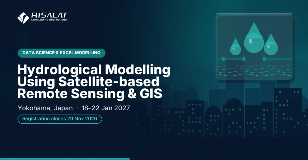
النمذجة الهيدرولوجية باستخدام الاستشعار عن بُعد بالأقمار الصناعية ونظم المعلومات الجغرافية
نظرة عامة على البرنامج
Scrupulous hydrological modelling requires reliable estimation of spatial and temporal distribution of water resource parameters. Throughout recent decades many engineers and planners have exhibited heightened interest in applying Geographic Information Systems (GIS) and Satellite-based Remote Sensing (RS) technologies to extract land surface specifications. The study of land surface hydrology using remote sensing techniques has become greatly sophisticated within the last ten years, especially after the launch of NASA’s Earth Observing System (EOS) and other research satellite platforms, and with the development of more sophisticated retrieval algorithms.
Free self-check: the digital readiness assessment gives how ready your institution is for digital services, data and AI, in about 10 minutes.
Remote sensing allows for the observation of the majority of constituent variables in the land surface water balance at varying spatial and temporal resolutions and accuracy. Therefore, technological applications have turned hydrological modelling into a powerful tool for water resource assessment, prediction, management and water demand or movement scenario analysis. This workshop provides detailed exposure to remote sensing, satellite image analysis, GIS and GNSS technologies as well as their applications in hydrological modelling, with particular emphasis on practical applicability of hydrological models including the soil and water assessment tool, variable infiltration capacity model, hydrological modelling system, river analysis system, and dimensional hydrodynamic model.
Delivered by Risalat Consultants International in Yokohama, Japan, it combines expert-led sessions, real cases and group work, so that participants can apply what they learn in their own institution. It addresses the application of remote sensing to hydrological parameters, thematic layer generation, geospatial technologies and hydrological modelling, and geospatial technology for 1/2 D hydrodynamic modelling.
يعزز البرنامج القدرات المؤسسية في:
- الاستشعار عن بُعد
- GIS and GNSS technologies
- نماذج بيانات GIS ومساقط الخرائط
- Datum and GPS survey requirements
- Advanced EO and hydrological data collection sensors including SAR, LIDAR, TLS, UAV, echo boat and GNSS/IRNSS receivers
- تقييم المخاطر المناخية والبيئية
- التخطيط للتكيف والتخفيف
- الاستراتيجيات القطاعية للطاقة والمياه والأراضي
- تصميم المشاريع لتحقيق الأهداف المناخية والبيئية
- التمويل المناخي والبيئي
- القياس والإبلاغ والتحقق
- إشراك المجتمع المحلي وأصحاب المصلحة
Why this matters now
تحتاج المؤسسات بشكل متزايد إلى مهنيين قادرين على:
- تقييم المخاطر المناخية والبيئية على خدماتهم وأصولهم
- تصميم مشاريع تحقق الأهداف المناخية والبيئية
- إعداد مقترحات يمكن للجهات الممولة اعتمادها
- قياس النتائج والإبلاغ عنها بمصداقية
- العمل مع المجتمعات والشركاء عبر القطاعات
تساعد الأنظمة القوية في مجالات المناخ والبيئة والموارد الطبيعية المؤسسات على:
- حماية الخدمات والبنية التحتية من المخاطر المناخية
- الوصول إلى التمويل المناخي والبيئي
- الوفاء بالالتزامات الوطنية والدولية
- استخدام الموارد الطبيعية على نحو مستدام
من ينبغي له الحضور
صُمم هذا البرنامج من أجل:
- المهنيون العاملون في مجال الموارد المائية
- العاملون في القطاع العام المكلفون بإدارة الموارد المائية
- المسؤولون والممثلون الحكوميون المشاركون في تخطيط الموارد المائية
- العلماء والباحثون
- المتخصصون العاملون في التقنيات الجغرافية المكانية
- المهنيون من المجالات الأخرى ذات الصلة
- موظفو شؤون تغير المناخ والبيئة
- موظفو قطاعات الطاقة والمياه والزراعة
- موظفو التخطيط والسياسات
- مديرو المشاريع والبرامج
- موظفو إدارة مخاطر الكوارث
- مسؤولو الحكومات المحلية
حدّد ما يحتاج فريقك إلى القدرة على إنجازه.
أهداف البرنامج
بنهاية هذا البرنامج سيتمكن المشاركون من:
- Demonstrate comprehensive understanding of RS and GIS applications for hydrological modelling
- Apply remote sensing to hydrological parameters and thematic layer generation
- Comprehend hydrological model types and their applications to real-world hydrological investigations
- Utilize geospatial technology for 1/2 D hydrodynamic modeling
- شرح التحديات المناخية والبيئية الرئيسية في قطاعهم
- تقييم المخاطر المناخية والبيئية على الخدمات والأصول
- التخطيط لتدابير التكيف والتخفيف
- تصميم مشاريع ذات نتائج مناخية وبيئية واضحة
- فهم المصادر الرئيسية للتمويل المناخي والبيئي
- إعداد الأجزاء الأساسية لمقترح التمويل
Training Structure & Contents
- الاتجاهات المناخية والبيئية في القطاع
- الخطط والالتزامات الوطنية
- تقييم المخاطر ونقاط الضعف
- أدوار الحكومة والمجتمعات المحلية والشركاء
- مناقشة حالة: مشروع تأثر بالمخاطر المناخية
- Workshop: applying context and risk methods to participant institutions
- خيارات التكيف والتخفيف
- الحلول القائمة على الطبيعة والحلول الهندسية
- التخطيط القطاعي للطاقة والمياه والأراضي
- التكاليف والمنافع والمفاضلات
- تمرين: تقييم الخيارات
- Workshop: applying planning solutions to participant institutions
- من المشكلة إلى مفهوم المشروع
- أطر النتائج في مجالي المناخ والبيئة
- الضمانات ومشاركة أصحاب المصلحة
- ترتيبات التنفيذ
- تمرين: مخطط المذكرة المفاهيمية
- Case study: project design in practice analysis
- مصادر التمويل المناخي والبيئي
- ما الذي تبحث عنه الجهات الممولة
- بناء المبرر المناخي
- الموازنات والتمويل المشترك
- دراسة حالة: مقترح ناجح
- Workshop: applying finance and proposal methods to participant institutions
- أساسيات القياس والإبلاغ والتحقق
- متابعة النتائج والتعلم
- التواصل بشأن النتائج
- الشراكات من أجل التنفيذ
- خطة عمل شخصية لمؤسستك
- Capstone exercise: presenting action plans for peer and facilitator feedback
- Corresponding field work to reinforce understanding of material covered
المحتوى الكامل يوماً بيوم
اليوم الأول | السياق والمخاطر
- الاتجاهات المناخية والبيئية في القطاع
- الخطط والالتزامات الوطنية
- تقييم المخاطر ونقاط الضعف
- أدوار الحكومة والمجتمعات المحلية والشركاء
- مناقشة حالة: مشروع تأثر بالمخاطر المناخية
- Workshop: applying context and risk methods to participant institutions
اليوم الثاني | تخطيط الحلول
- خيارات التكيف والتخفيف
- الحلول القائمة على الطبيعة والحلول الهندسية
- التخطيط القطاعي للطاقة والمياه والأراضي
- التكاليف والمنافع والمفاضلات
- تمرين: تقييم الخيارات
- Workshop: applying planning solutions to participant institutions
اليوم الثالث | تصميم المشاريع
- من المشكلة إلى مفهوم المشروع
- أطر النتائج في مجالي المناخ والبيئة
- الضمانات ومشاركة أصحاب المصلحة
- ترتيبات التنفيذ
- تمرين: مخطط المذكرة المفاهيمية
- Case study: project design in practice analysis
اليوم الرابع | التمويل والمقترحات
- مصادر التمويل المناخي والبيئي
- ما الذي تبحث عنه الجهات الممولة
- بناء المبرر المناخي
- الموازنات والتمويل المشترك
- دراسة حالة: مقترح ناجح
- Workshop: applying finance and proposal methods to participant institutions
اليوم الخامس | القياس والإبلاغ والتخطيط للعمل
- أساسيات القياس والإبلاغ والتحقق
- متابعة النتائج والتعلم
- التواصل بشأن النتائج
- الشراكات من أجل التنفيذ
- خطة عمل شخصية لمؤسستك
- Capstone exercise: presenting action plans for peer and facilitator feedback
- Corresponding field work to reinforce understanding of material covered
منهجية التدريب
The workshop is highly practical and employs contemporary adult-learning methodologies. The consultant combines detailed lectures with practical demos to help participants integrate geospatial data with various hydrological models, with a particular focus on transferring theoretical concepts into workplace practice. On the final day, field work is arranged to reinforce learning. A pre-assessment helps facilitators adjust examples and exercises, and each day concludes with a reflection on workplace application.
- جلسات يقودها خبراء حول الممارسات الحالية
- دراسات حالة إقليمية ودولية
- عمل جماعي وتمارين عملية
- محاكاة ولعب أدوار حسب الحاجة
- مناقشة التحديات الخاصة بالمشاركين
- التعلم من الأقران عبر المؤسسات والدول
- أدوات ونماذج عملية تعود بها إلى العمل
- تأمل يومي وتخطيط للعمل
- الصناديق
- الجهة
- المشروع
- النتائج
- القياس والإبلاغ والتحقق
النتائج المتوقعة
- تقييم المخاطر المناخية والبيئية
- التخطيط لتدابير التكيف والتخفيف
- تصميم مشاريع ذات نتائج واضحة
- إعداد مقترحات تمويل أقوى
- قياس النتائج والإبلاغ عنها بمصداقية
- العمل بفعالية مع المجتمعات والشركاء
- Implement a personal action plan and practical tools from the first week back
£4,865 لكل مشارك · فاتورة وتحويل مصرفي · خصم للمجموعات المكوّنة من 5 مشاركين أو أكثر
خمسة مشاركين أو أكثر من مؤسسة واحدة: اطلبوا سعر المجموعة عند طلب الفاتورة.
Ten or more: an in-house version for your institution may cost less per person. Ask for an in-house quote.
Registration closes in 7 days (29 Nov 2026)
الأهمية الإقليمية والتطبيق
Europe: European institutions apply climate, environment and natural resources within detailed regulatory frameworks and reform agendas. Participants from Europe can compare their practice with colleagues from other regions and test how established methods work under different conditions.
Africa: Across Africa, ministries, agencies and project teams working in climate, environment and natural resources increasingly operate alongside donor-financed programmes that expect clear systems and evidence. The programme helps participants adapt good practice to the institutions and resources they work with.
Middle East: In the Middle East, national development strategies and diversification plans place growing demands on climate, environment and natural resources. Participants explore how to build the capability these plans need inside public bodies.
Who Will Deliver This Programme
Each date is delivered by a team assigned from Risalat's expert network for this subject. For this programme we assign:
How we choose them: Experience in the region of the participants or comparable settings; Command of the financier rules that apply (World Bank, ADB, AfDB, EU, UN) where relevant; Delivery in English; other languages on request for in-house groups; No conflict of interest with participants' institutions.
Training courses in YokohamaEnergy and Water training courses
لماذا يوكوهاما لهذا البرنامج
Yokohama is a major maritime and industrial hub that accommodates the Port of Yokohama and the Minato Mirai 21 central business district. Visiting officials can examine advanced urban planning, waterfront regeneration, and port logistics facilities. The city is easily accessible via Tokyo's international airports and integrated rail networks.
The Hydrological Modelling Using Satellite-based Remote Sensing & GIS programme in January 2027 brings together officials and professionals from across the Asia region and beyond. Sessions combine short inputs, case studies and group work on participants' own files, and the city's institutions can be added as a study visit on request.
Getting there: Tokyo Haneda Airport (HND).
تحقق مما إذا كنت بحاجة إلى تأشيرة عبر أداة التحقق من التأشيرة المجانية، واطلب خطاب دعوة بعد إتمام تسجيلك.
برامج أخرى في يوكوهاما
Is there climate change and environment training for government officials in Yokohama in January 2027?
Can "Hydrological Modelling Using Satellite-based Remote Sensing & GIS" be delivered in-house for one organisation?
ما البرامج الأخرى التي تقدّمها Risalat في مجال تغير المناخ والبيئة؟
كيف تسجّل المؤسسات وتسدّد الرسوم؟
للفرق والمؤسسات
Bring your team
Teams that learn together apply more at work. Tell us how many people and how you would like to take part: we reply with a group quote within two working days.
Watch: this programme in short
تواريخ ومدن أخرى لهذا الموضوع: الدورات التدريبية لإدارة الطاقة والكهرباء والمرافق (118 تاريخاً قادماً).
المزيد من الدورات التدريبية في اليابان · جميع البرامج في آسيا · تقويم التدريب الكامل
تخطيط هذا البرنامج في خارطة طريق: لماذا هو مهم، ولماذا يجب الموافقة عليه، والتواريخ المراد التخطيط لها، والمسار المهني الذي يبنيه.