关键信息
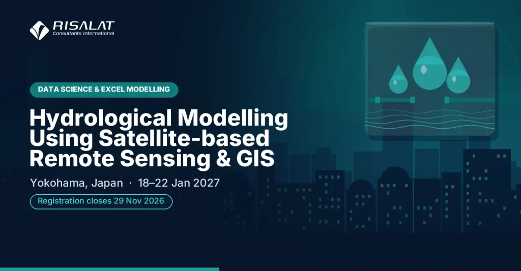
- 日期
- 2027年1月18–22日(5天)
- 地点
- 日本横滨新大谷酒店(New Otani Inn)
- 每位学员费用
- £4,865 (GBP)
- 付款
- 通过发票和银行转账付款
- 报名截止
- 2026年11月29日
- 证书
- 结业证书
- 内训选项
- 按您的日期,为您的团队专场举办
培训项目概述
Scrupulous Hydrological modelling requires reliable estimation of spatial and temporal distribution of water resource parameters. Throughout recent decades many engineers and planners have exhibited heightened interest in applying Geographic Information Systems (GIS) and Satellite-based Remote Sensing (RS) technologies to extract land surface specifications. The study of land surface hydrology using remote sensing techniques has become greatly sophisticated within last ten years, especially after the launch of NASA’s Earth Observing System (EOS) and other research satellite platforms, and with the development of more sophisticated retrieval algorithms. Remote sensing allows for the observation of the majority of constituent variables in the land surface water balance at varying spatial and temporal resolutions and accuracy. Therefore, technological applications have turned hydrological modelling into a powerful tool for water resource assessment, prediction, management and water demand/movement scenario analysis. This workshop has unique design and provides detailed exposure to remote sensing, satellite image analysis, GIS and GNSS technologies as well as their applications in hydrological modelling. Particular emphasis is made on practical applicability of the most vigorous and popular hydrological models including soil and water assessment tool, variable infiltration capacity model, hydrological modelling system, river analysis system, and dimensional hydrodynamic model.
Applying Remote sensing to Hydrological Parameters and Thematic Layer Generation Geospatial technologies and Hydrological Modelling Geospatial technology for 1/2 D Hydrodynamic modeling
Delivered by Risalat Consultants International in Yokohama, Japan, it combines expert-led sessions, real cases and group work, so that participants can apply what they learn in their own institution.
本培训项目可在以下方面加强机构能力
- Remote Sensing
- GIS an GNSS technologies
- GIS data models and map projections
- Datum and GPS survey Requirements
- Advanced EO and Hydrological Data Collection Sensors (SAR, LIDAR, TLS, UAV, echo boat and GNSS/IRNSS receivers)
- 气候与环境风险评估
- 适应与减缓规划
- 能源、水和土地领域的行业战略
- 面向气候与环境目标的项目设计
- Climate and environmental finance
- Measurement, reporting and verification
- Community and stakeholder involvement
It is designed for water Resource Professionals, public Sector Workers tasked with Water Resource Management, government Officials and Representatives involved in Water Resource Planning and others who want practical, current skills in climate, environment and natural resources.
- 收集
- 清洗
- 存储
- 分析
- 决策
The Growing Importance of Hydrological Modelling Using Satellite-based Remote Sensing & GIS
气候变化、环境压力和资源管理如今正影响着国家计划、预算和投资决策。出资方越来越期望项目从一开始就纳入气候与环境因素。
能够针对气候风险进行规划、妥善管理自然资源并编制合理提案的机构,更有能力保护公共服务,并获取这一领域的可用资金。
各机构日益需要具备以下能力的专业人员:
- 评估其服务和资产面临的气候与环境风险
- 设计符合气候与环境目标的项目
- 编制出资方能够批准的提案
- 可信地衡量和报告成果
- 与社区及跨部门合作伙伴协同工作
健全的气候、环境与自然资源体系有助于机构:
- 保护服务和基础设施免受气候风险影响
- 获取气候与环境资金
- 履行国家及国际承诺
- 可持续地利用自然资源
This Hydrological Modelling Using Satellite-based Remote Sensing & GIS programme brings these elements together in a practical format, so that participants understand not only what good practice looks like but also how to introduce it in their own setting, with the people and resources they have.
Who Should Attend This Hydrological Modelling Using Satellite-based Remote Sensing & GIS Training?
本培训项目适合:
- Water Resource Professionals
- Public Sector Workers tasked with Water Resource Management
- Government Officials and Representatives involved in Water Resource Planning
- Scientists and Researchers
- Specialists working with geospatial technologies
- Professionals from other related fields
- 气候变化与环境官员
- 能源、水和农业部门工作人员
- 规划与政策官员
- 项目与规划管理人员
- 灾害风险管理人员
- 地方政府官员
本培训项目既适合经验丰富的专业人员,也适合刚承担新职责的人员。我们鼓励来自不同机构和国家的学员组成混合小组,因为学员能从彼此的经验中获益良多。
勾选您的团队需要具备的能力。
Hydrological Modelling Using Satellite-based Remote Sensing & GIS Training Objectives
Upon successful completion of this Hydrological Modelling Using Satellite-based Remote Sensing & GIS Training, participants will be able to:
- Demonstrate Comprehensive understanding of RS and GIS applications for Hydrological Modelling
- Apply Remote Sensing to Hydrological Parameters and Thematic Layer Generation
- Comprehend Hydrological Model Types and their applications to real-world hydrological investigations
- Utilize Geospatial technology for 1/2 D Hydrodynamic modeling
- 阐述本行业面临的主要气候与环境挑战
- 评估服务和资产面临的气候与环境风险
- 规划适应与减缓措施
- 设计具有清晰气候与环境成果的项目
- 了解气候与环境资金的主要来源
- 编写资金申请提案的核心部分
每项目标都会在培训期间通过练习、案例或小组作业加以实践,使学员结业时不仅能够描述,更能够实际运用。
培训项目内容与结构
- 本行业的气候与环境趋势
- 国家计划与承诺
- 风险与脆弱性评估
- 政府、社区和合作伙伴的角色
- Case discussion: a project affected by climate risk
- 适应与减缓方案
- 基于自然的解决方案与工程解决方案
- 能源、水和土地的行业规划
- 成本、收益与权衡
- 练习:方案比选
- 从问题到项目构想
- 气候与环境成果框架
- 保障政策与利益相关方参与
- 实施安排
- 练习:概念说明提纲
- 气候与环境资金来源
- 出资方关注什么
- 构建气候逻辑依据
- 预算与联合融资
- 案例研究:一份成功的提案
- 监测、报告与核查基础
- 成果监测与学习
- 成果沟通
- 促进实施的伙伴关系
- 为本机构制定的个人行动计划
完整的每日课程内容
本培训项目为期5天。每天均包含专家讲授、实践练习,并以研讨会或案例研究收尾:
- 第一天:背景与风险
- 第二天:规划解决方案
- 第三天:项目设计
- 第四天:资金与提案
- 第五天:衡量、报告与行动规划
完整的每日课程内容
第一天 | 背景与风险
- 本行业的气候与环境趋势
- 国家计划与承诺
- 风险与脆弱性评估
- 政府、社区和合作伙伴的角色
- Case discussion: a project affected by climate risk
研讨:背景与风险在本机构的应用
学员分成小组,将当天所学方法应用于本机构的实例,并商定切实可行的后续步骤。
第二天 | 规划解决方案
- 适应与减缓方案
- 基于自然的解决方案与工程解决方案
- 能源、水和土地的行业规划
- 成本、收益与权衡
- 练习:方案比选
研讨:规划解决方案在本机构的应用
学员分成小组,将当天所学方法应用于本机构的实例,并商定切实可行的后续步骤。
第三天 | 项目设计
- 从问题到项目构想
- 气候与环境成果框架
- 保障政策与利益相关方参与
- 实施安排
- 练习:概念说明提纲
案例研究:项目设计实践
学员分析真实案例,将案例中的决策与良好实践进行比较,并总结出可在自身环境中运用的经验。
第四天 | 资金与提案
- 气候与环境资金来源
- 出资方关注什么
- 构建气候逻辑依据
- 预算与联合融资
- 案例研究:一份成功的提案
研讨:资金与提案在本机构的应用
学员分成小组,将当天所学方法应用于本机构的实例,并商定切实可行的后续步骤。
第五天 | 衡量、报告与行动规划
- 监测、报告与核查基础
- 成果监测与学习
- 成果沟通
- 促进实施的伙伴关系
- 为本机构制定的个人行动计划
Capstone Exercise: Hydrological Modelling Using Satellite-based Remote Sensing & GIS Action Plan for Your Institution
学员将一周所学整合为本机构的行动计划,明确优先事项、负责人和初步行动,并进行展示,听取同伴和讲师的反馈。
Hydrological Modelling Using Satellite-based Remote Sensing & GIS Training Methodology
The workshop on Hydrological Modelling Using Satellite-based Remote Sensing and GIS is highly practical and employs various contemporary adult-learning methodologies. The consultant will combine detailed lectures with practical demos in order to help participants integrate geo-spatial data with various hydrological models. The programme has particular focus on transferring theoretical base into practice and ensuring instant application of acquired insights into your workplace. On the last day of the programme Risalat will arrange corresponding field work in order to reinforce the apprehension of the material covered by the delegates.
本培训项目融合了:
- 专家主讲当前实践
- 区域及国际案例研究
- 小组作业与实践练习
- 视情况安排模拟演练与角色扮演
- 探讨学员自身面临的挑战
- 跨机构、跨国家的同伴学习
- 可带回工作岗位的实用工具与模板
- 每日反思与行动规划
培训开始前,简短的课前评估可帮助讲师了解每位学员的岗位职责和重点关注事项,以便根据学员群体调整案例和练习。每天结束时安排简短的反思环节,学员记录下将在工作中应用的内容。
- 资金
- 实体
- 项目
- 结果
- MRV(监测、报告与核查)
预期成果
Upon completion of this Hydrological Modelling Using Satellite-based Remote Sensing & GIS Training, participants will be able to:
- 评估气候与环境风险
- 规划适应与减缓措施
- 设计具有清晰成果的项目
- 编制更有说服力的资金申请提案
- 可信地衡量和报告成果
- 与社区和合作伙伴高效合作
学员结业时将获得个人行动计划和实用工具,回到工作岗位的第一周即可在机构中应用。派出多名学员的机构可借助本培训项目,在各团队之间统一方法和模板,使改进成果更易持续。
£4,865 per participant · invoice and bank transfer · groups of 5 or more receive a discount
同一机构五人及以上:请在申请发票时索取团体价。
Ten or more: an in-house version for your institution may cost less per person. Ask for an in-house quote.
Registration closes in 27 days (29 Nov 2026)
Institutional Application of Hydrological Modelling Using Satellite-based Remote Sensing & GIS Training
本培训项目帮助机构加强:
- 气候与环境规划
- 项目设计
- 获取资金
- 成果衡量
- 利益相关方参与
学员将带着实用工具回到工作岗位,以提升:
- 风险评估
- 概念说明
- 成果框架
- 监测系统
- 伙伴关系安排
本培训项目的设计旨在让学习成果从课堂延伸至机构。学员尽可能围绕自身的流程和文件开展练习,并在结业时带走一份可供其主管审阅和支持的行动计划。
区域相关性与应用
欧洲
欧洲机构在详尽的监管框架和改革议程下开展气候、环境与自然资源工作。来自欧洲的学员可以将自身实践与其他地区的同行进行比较,并检验成熟方法在不同条件下的适用性。
非洲
在整个非洲,从事气候、环境与自然资源工作的政府部委、机构和项目团队,越来越多地与捐助方资助的项目协同运作,而这些项目要求有清晰的制度和证据。本培训项目帮助学员将良好实践与其所在机构及可用资源相结合。
中东
在中东,国家发展战略和多元化计划对气候、环境与自然资源管理提出了越来越高的要求。学员将探讨如何在公共机构和企业内部建立实现这些计划所需的能力。
亚洲
亚洲各国的机构在快速发展的同时,推进着雄心勃勃的现代化计划。来自亚洲的学员可以分享快速扩展系统的经验,并借鉴其他地区的做法。
太平洋地区
小岛屿国家和太平洋国家在规模、距离和能力方面面临特殊制约。本培训项目重点介绍适合小型机构、务实且适度的气候、环境与自然资源管理方法。
Holding the programme in Yokohama, Japan brings participants together away from their daily pressures, so they can compare how climate, environment and natural resources is handled in different settings. The same programme can also be delivered in-house for one institution, in its own country or online, with cases taken from its current work.
东道国概况:日本
Risalat Consultants International在日本横滨举办的培训项目、研讨会、实地见习与培训课程
在本国以外学习,可让学员专心投入,以全新视角审视本机构,并有机会与其他国家的同行建立人脉网络。
The programme takes place at New Otani Inn.
Hydrological Modelling Using Satellite-based Remote Sensing & GIS Training Deliverables
学员在培训前、培训中及培训后均可获得支持,使准备、学习与跟进形成连贯完整的体验。
培训开始前
- 学员课前评估
- Hydrological Modelling Using Satellite-based Remote Sensing & GIS Readiness Assessment
- Hydrological Modelling Using Satellite-based Remote Sensing & GIS Resource Pack
- 课前阅读资料
- 免费签证支持与咨询
- 机场接机与欢迎协助
- 住宿(含早餐)
- 欢迎交流晚宴
培训期间
- Risalat培训礼包(背包、水瓶、马克杯、T恤、帽子、护照套、笔、笔记本、冰箱贴及钥匙扣)
- Comprehensive Hydrological Modelling Using Satellite-based Remote Sensing & GIS Training Manual
- 气候风险筛查检查清单
- 备选方案评估模板
- 概念说明模板
- 成果衡量模板
- 实践研讨与模拟演练
- 小组讨论与同伴学习
- 每日午餐与茶歇
- 全面使用培训场地设施
- 装有数字学习资料的迷你平板电脑
- 实地考察(如适用)
- 城市休闲观光
培训结束后
- 结业证书
- Risalat培训项目参与表彰奖
- 培训后参考资料
- 融资准备检查清单
- 监测与报告模板
- 培训后支持与跟进指导
- 培训项目报告
Institutions can also request a tailored in-house version of this programme, delivered at their premises or online. Request a proposal.
Common Challenges in Hydrological Modelling Using Satellite-based Remote Sensing & GIS, And How This Training Helps
机构如何评估其服务和资产面临的气候与环境风险?
本培训项目在第一天(背景与风险)直接讨论这一问题,学员将练习相关方法,结合本机构进行调整,并将其纳入行动计划。
机构如何设计符合气候与环境目标的项目?
本培训项目在第二天(规划解决方案)直接讨论这一问题,学员将练习相关方法,结合本机构进行调整,并将其纳入行动计划。
机构如何编制出资方能够批准的提案?
本培训项目在第三天(项目设计)直接讨论这一问题,学员将练习相关方法,结合本机构进行调整,并将其纳入行动计划。
机构如何可信地衡量和报告成果?
本培训项目在第四天(资金与提案)直接讨论这一问题,学员将练习相关方法,结合本机构进行调整,并将其纳入行动计划。
机构如何与社区及跨部门合作伙伴协同工作?
本培训项目在第五天(衡量、报告与行动规划)直接讨论这一问题,学员将练习相关方法,结合本机构进行调整,并将其纳入行动计划。
常见问题
When and where does the Hydrological Modelling Using Satellite-based Remote Sensing & GIS programme take place?
It runs from 18 Jan 2027 to 22 Jan 2027, in Yokohama, Japan (New Otani Inn). The registration deadline is shown at the top of this page.
谁应参加?
The programme is designed for water Resource Professionals, public Sector Workers tasked with Water Resource Management, government Officials and Representatives involved in Water Resource Planning, scientists and Researchers, and others who want practical skills in climate, environment and natural resources.
我能获得证书吗?
能。完成本培训项目的学员将获得Risalat Consultants International颁发的结业证书。
本培训项目能否仅为我们机构单独举办?
可以。我们可以在贵机构所在地、其他城市或在线提供量身定制的内训版本,并围绕贵机构自身的案例设计内容。请使用本页面的方案建议书申请表。
我是否需要具备气候、环境和自然资源方面的经验?
除具备相关岗位经验外,无需其他专业背景。简短的课前评估可帮助讲师根据学员群体调整课程。
为何选择在横滨举办本培训项目
本培训项目选在日本横滨举办,因为预期学员前往交通便利,且当地拥有适合开展实践性、互动式培训的场地。
The Hydrological Modelling Using Satellite-based Remote Sensing & GIS programme in January 2027 brings together officials and professionals. Sessions combine short inputs, case studies and group work on participants' own files, and the city's institutions can be added as a study visit on request.
使用免费的签证查询工具确认您是否需要签证,完成报名后即可申请邀请函。