Factos essenciais
- Datas
- 8–12 fev. 2027 (5 dias)
- Local
- City Hotels Algirdas, Vilnius, Lithuania
- Preço por participante
- £3.860 (GBP)
- Pagamento
- Por fatura e transferência bancária
- Encerramento das inscrições
- 30 dez. 2026
- Formato
- 5-day short course: a practical capacity-building programme for government, NGO and project teams in Vilnius
- Opção interna
- Realize-o para a sua equipa, nas datas que preferir
Nesta página 11 secções
Formação em Modelação e Cartografia de Dados LIDAR com ArcGIS Pro
Visão geral do programa
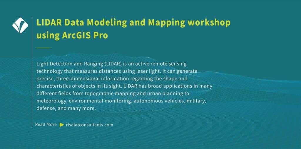
Light Detection and Ranging (LIDAR) is an active remote sensing technology that measures distances using laser light. It can generate precise, three-dimensional information regarding the shape and characteristics of objects in its sight. LIDAR has broad applications in many different fields from topographic mapping and urban planning to meteorology, environmental monitoring, autonomous vehicles, military, defense, and many more.
Free self-check: the digital readiness assessment gives how ready your institution is for digital services, data and AI, in about 10 minutes.
ArcGIS provides a comprehensive platform for working with LIDAR data modeling. This training programme has been developed to help ArcGIS professionals leverage LIDAR data to expand their geospatial analysis, mapping, and visualization capabilities. Delivered by Risalat Consultants International in Vilnius, Lithuania, it combines expert-led sessions, real cases and group work, so that participants can apply what they learn in their own institution.
The course is designed for those who want to demonstrate a thorough understanding of LIDAR technology and its applications in GIS, seamlessly navigate through the ArcGIS Pro interface, effectively manage spatial data, understand LIDAR point clouds and their attributes, and acquire practical, current skills in digital government, data and technology.
O programa reforça a capacidade institucional em:
- Introduction to light detection and ranging
- LIDAR data acquisition
- ArcGIS suite
- The interface of ArcGIS Pro
- Project setup and organization
- Adding and managing spatial data in ArcGIS Pro
- Sistemas de coordenadas e projeções
- Consultas espaciais simples
- Estratégia digital e planeamento da transformação
- Governação e qualidade dos dados
- Análise e visualização de dados
- Noções básicas de cibersegurança e gestão de riscos
Why this matters now
As organizações precisam cada vez mais de profissionais capazes de:
- Planear iniciativas digitais que resolvam problemas reais
- Gerir a qualidade, a proteção e a partilha de dados
- Analisar dados e apresentá-los com clareza
- Gerir riscos cibernéticos e tecnológicos
- Liderar pessoas na mudança digital
Sistemas sólidos de governo digital, dados e tecnologia ajudam as organizações a:
- Prestar serviços mais rápidos e acessíveis
- Fazer melhor uso dos dados nas decisões
- Proteger sistemas e dados pessoais
- Tirar partido dos investimentos em tecnologia
- Recolher
- Limpar
- Armazenar
- Analisar
- Decidir
Quem deve participar
Este programa destina-se a:
- Demonstrate a thorough understanding of LIDAR technology and its applications in GIS
- Seamlessly navigate through the ArcGIS Pro interface and effectively manage spatial data
- Understand LIDAR point clouds and their attributes
- Import and manage LIDAR data in ArcGIS Pro
- Realizar modelação de terreno com dados LIDAR
- Create compelling 3D visualizations and apply advanced 3D analysis tools
- Perform feature extraction and classification
- Integrar dados LIDAR com outros conjuntos de dados espaciais para análise avançada
- Gestores e técnicos de TIC
- Responsáveis pela transformação digital
- Analistas de dados e estatísticos
- Responsáveis pela segurança da informação
Assinale o que a sua equipa precisa de ser capaz de fazer.
Objetivos do programa
No final deste programa, os participantes serão capazes de:
- Explicar as principais tendências do governo digital e da utilização de dados
- Planear uma iniciativa digital ligada aos objetivos dos serviços
- Aplicar princípios de governação e qualidade dos dados
- Analisar e visualizar dados para os decisores
- Identificar e gerir riscos cibernéticos e tecnológicos
- Aplicar práticas responsáveis na utilização da IA e da automação
- Planear a aquisição e a gestão de tecnologia
- Liderar pessoas na mudança digital
- Preparar um plano de ação digital para a sua instituição
Training Structure & Contents
- Introduction to light detection and ranging
- LIDAR data acquisition
- ArcGIS suite
- The interface of ArcGIS Pro
- Project setup and organization
- Workshop: Introduction to light detection and ranging, LIDAR data acquisition: Applying It to Your Institution
- Adding and managing spatial data in ArcGIS Pro
- Sistemas de coordenadas e projeções
- Consultas espaciais simples
- Junções de atributos e espaciais
- LIDAR data structure
- LIDAR data attributes and classification
- Workshop: Adding and managing spatial data in ArcGIS Pro, Coordinate systems…: Applying It to Your Institution
- Common LIDAR data formats
- Importing LIDAR data in ArcGIS Pro
- Terrain modeling with LIDAR data
- Creating digital elevation models (DEMs)
- Creating digital surface models (DSMs)
- Case Study: Common LIDAR data formats, Importing LIDAR data in ArcGIS Pro in Practice
- 3D visualization of LIDAR data
- Criação de cenas em 3D
- Symbolizing LIDAR point clouds
- Viewshed analysis
- Ferramentas de medição e análise 3D
- Feature extraction and classification
- Workshop: 3D visualization of LIDAR data, Creating 3D scenes: Applying It to Your Institution
- Advanced LIDAR analysis
- Change detection with LIDAR
- Integration with other data sources
- Multi-sensor data fusion
- Best practices and data optimization
- Use of Python for automation in ArcGIS
- Capstone Exercise: LIDAR Data Modeling and Mapping Action Plan for Your Institution
Conteúdo completo, dia a dia
First Day | Introduction to light detection and ranging, LIDAR data acquisition
- Introduction to light detection and ranging
- LIDAR data acquisition
- ArcGIS suite
- The interface of ArcGIS Pro
- Project setup and organization
- Workshop: Introduction to light detection and ranging, LIDAR data acquisition: Applying It to Your Institution
Second Day | Adding and managing spatial data in ArcGIS Pro, Coordinate systems…
- Adding and managing spatial data in ArcGIS Pro
- Sistemas de coordenadas e projeções
- Consultas espaciais simples
- Junções de atributos e espaciais
- LIDAR data structure
- LIDAR data attributes and classification
- Workshop: Adding and managing spatial data in ArcGIS Pro, Coordinate systems…: Applying It to Your Institution
Third Day | Common LIDAR data formats, Importing LIDAR data in ArcGIS Pro
- Common LIDAR data formats
- Importing LIDAR data in ArcGIS Pro
- Terrain modeling with LIDAR data
- Creating digital elevation models (DEMs)
- Creating digital surface models (DSMs)
- Case Study: Common LIDAR data formats, Importing LIDAR data in ArcGIS Pro in Practice
Fourth Day | 3D visualization of LIDAR data, Creating 3D scenes
- 3D visualization of LIDAR data
- Criação de cenas em 3D
- Symbolizing LIDAR point clouds
- Viewshed analysis
- Ferramentas de medição e análise 3D
- Feature extraction and classification
- Workshop: 3D visualization of LIDAR data, Creating 3D scenes: Applying It to Your Institution
Fifth Day | Advanced LIDAR analysis, Change detection with LIDAR
- Advanced LIDAR analysis
- Change detection with LIDAR
- Integration with other data sources
- Multi-sensor data fusion
- Best practices and data optimization
- Use of Python for automation in ArcGIS
- Capstone Exercise: LIDAR Data Modeling and Mapping Action Plan for Your Institution
Metodologia de formação
Adult learning principles and practical focus have been embedded in the design of LIDAR Data Modeling and Mapping workshop using ArcGIS Pro. All sessions comprise practical components and hands-on exercises that help participants master LIDAR data modeling and mapping in ArcGIS Pro. Before the programme, a short pre-assessment helps the facilitators understand each participant’s role and priorities, so that examples and exercises can be adjusted to the group. Each day ends with a short reflection in which participants note what they will apply at work.
- Sessões conduzidas por especialistas sobre as práticas atuais
- Estudos de caso regionais e internacionais
- Trabalho de grupo e exercícios práticos
- Simulações e dramatizações, quando relevante
- Discussion of participants’ own challenges
- Aprendizagem entre pares de várias instituições e países
- Ferramentas e modelos práticos para levar para o trabalho
- Reflexão diária e planeamento de ações
Resultados esperados
- GIS technicians and analysts, particularly those willing to specialize in working with LIDAR data
- Urban planners and designers
- Environmental scientists work with LIDAR data modeling for various purposes e.g., habitat mapping, vegetation analysis, or environmental monitoring
- Forestry specialists using LIDAR for forest inventory, canopy analysis, and precision agriculture
- Transportation and infrastructure professionals
- Remote sensing specialists
- Municipal planners
- Planear iniciativas digitais ligadas aos objetivos dos serviços
£3.860 por participante · fatura e transferência bancária · grupos de 5 ou mais pessoas beneficiam de desconto
Cinco ou mais participantes da mesma organização: peça a tarifa de grupo no pedido de fatura.
Ten or more: an in-house version for your institution may cost less per person. Ask for an in-house quote.
As inscrições encerram em 37 dias (30 dez 2026)
Relevância regional e aplicação
Europe: European institutions apply digital government, data and technology within detailed regulatory frameworks and reform agendas. Participants from Europe can compare their practice with colleagues from other regions and test how established methods work under different conditions.
Africa: Across Africa, ministries, agencies and project teams working in digital government, data and technology increasingly operate alongside donor-financed programmes that expect clear systems and evidence. The programme helps participants adapt good practice to the institutions and resources they work with.
Middle East: In the Middle East, national development strategies and diversification plans place growing demands on digital government, data and technology. Participants explore how to build the capability these plans need inside public bodies and companies.
Asia: Institutions across Asia combine rapid growth with ambitious modernisation programmes. Participants from Asia can share their experience of scaling systems quickly and learn from approaches used elsewhere.
Pacific: Small island and Pacific states face particular constraints of size, distance and capacity. The programme highlights practical, proportionate approaches to digital government, data and technology that suit smaller institutions.
Holding the programme in Vilnius, Lithuania brings participants together away from their daily pressures, so they can compare how digital government, data and technology is handled in different settings. The same programme can also be delivered in-house for one institution, in its own country or online, with cases taken from its current work.
Perfil do país anfitrião
Programmes, Workshops, Exposures, Training Courses in Vilnius, Lithuania by Risalat Consultants International. Studying away from their own country gives participants time to focus, a fresh view of their own institution and the chance to build a network with colleagues from other countries.
Who Will Deliver This Programme
Each date is delivered by a team assigned from Risalat's expert network for this subject. For this programme we assign:
How we choose them: Experience in the region of the participants or comparable settings; Command of the financier rules that apply (World Bank, ADB, AfDB, EU, UN) where relevant; Delivery in English; other languages on request for in-house groups; No conflict of interest with participants' institutions.
Training courses in VilniusCursos de formação em Ciência de Dados e Modelação em Excel
Porquê Vílnius para este programa
Vilnius hosts central government ministries, national agencies, and European Union bodies such as the European Institute for Gender Equality. Visiting officials can examine public administration reforms and digital public services implemented across Lithuania. The city is easily accessible via regular direct flights connecting Vilnius Airport with major European transport hubs.
The LIDAR Data Modeling and Mapping Training using ArcGIS Pro programme in February 2027 brings together officials and professionals from across Europe, Africa, the Middle East and Asia. Sessions combine short inputs, case studies and group work on participants' own files, and the city's institutions can be added as a study visit on request.
Getting there: Vilnius International Airport (VNO).
Verifique se precisa de visto com o Verificador de Vistos gratuito e peça uma carta-convite depois de se inscrever.
Outros programas em Vílnius
Is there data, ai and analytics training for government officials in Vilnius in February 2027?
Can "LIDAR Data Modeling and Mapping Training using ArcGIS Pro" be delivered in-house for one organisation?
Que outros programas de dados, IA e análise realiza a Risalat?
Como se inscrevem e pagam as organizações?
For teams and institutions
Bring your team
Teams that learn together apply more at work. Tell us how many people and how you would like to take part: we reply with a group quote within two working days.
Watch: this programme in short
Mais cursos de formação na Lituânia · Todos os programas na Europa · Calendário de formação completo
Planear este programa num roteiro: porque importa, porque o aprovar, as datas a planear e a carreira que constrói.