حقائق رئيسية
- المواعيد
- 8–12 فبراير 2027 (5 أيام)
- المكان
- City Hotels Algirdas, Vilnius, Lithuania
- الرسوم لكل مشارك
- £3,860 (GBP)
- الدفع
- بالفاتورة والتحويل المصرفي
- إغلاق التسجيل
- 30 ديسمبر 2026
- الصيغة
- 5-day short course: a practical capacity-building programme for government, NGO and project teams in Vilnius
- الخيار المؤسسي
- نفّذه لفريقك، في المواعيد التي تناسبك
في هذه الصفحة 11 قسماً
برنامج تدريبي في نمذجة بيانات LIDAR ورسم الخرائط باستخدام ArcGIS Pro
نظرة عامة على البرنامج
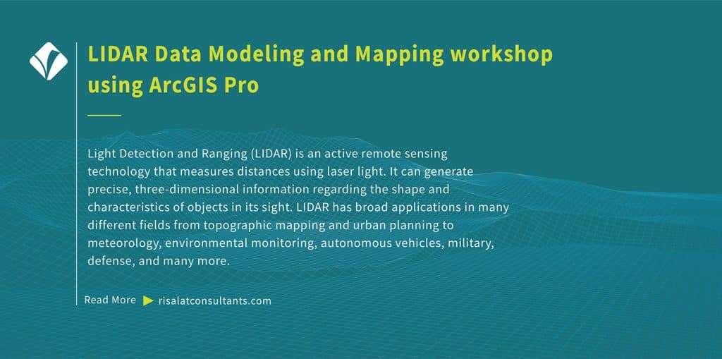
Light Detection and Ranging (LIDAR) is an active remote sensing technology that measures distances using laser light. It can generate precise, three-dimensional information regarding the shape and characteristics of objects in its sight. LIDAR has broad applications in many different fields from topographic mapping and urban planning to meteorology, environmental monitoring, autonomous vehicles, military, defense, and many more.
Free self-check: the digital readiness assessment gives how ready your institution is for digital services, data and AI, in about 10 minutes.
ArcGIS provides a comprehensive platform for working with LIDAR data modeling. This training programme has been developed to help ArcGIS professionals leverage LIDAR data to expand their geospatial analysis, mapping, and visualization capabilities. Delivered by Risalat Consultants International in Vilnius, Lithuania, it combines expert-led sessions, real cases and group work, so that participants can apply what they learn in their own institution.
The course is designed for those who want to demonstrate a thorough understanding of LIDAR technology and its applications in GIS, seamlessly navigate through the ArcGIS Pro interface, effectively manage spatial data, understand LIDAR point clouds and their attributes, and acquire practical, current skills in digital government, data and technology.
يعزز البرنامج القدرات المؤسسية في:
- Introduction to light detection and ranging
- LIDAR data acquisition
- ArcGIS suite
- The interface of ArcGIS Pro
- Project setup and organization
- Adding and managing spatial data in ArcGIS Pro
- أنظمة الإحداثيات والمساقط
- الاستعلامات المكانية البسيطة
- الاستراتيجية الرقمية وتخطيط التحول
- حوكمة البيانات وجودتها
- تحليل البيانات وتصويرها مرئياً
- أساسيات الأمن السيبراني وإدارة المخاطر
Why this matters now
تحتاج المؤسسات بشكل متزايد إلى مهنيين قادرين على:
- تخطيط مبادرات رقمية تحل مشكلات حقيقية
- إدارة جودة البيانات وحمايتها ومشاركتها
- تحليل البيانات وعرضها بوضوح
- إدارة المخاطر السيبرانية والتقنية
- قيادة الأفراد خلال التغيير الرقمي
تساعد الأنظمة القوية في الحكومة الرقمية والبيانات والتكنولوجيا المؤسسات على:
- تقديم خدمات أسرع وأيسر وصولاً
- تحسين استخدام البيانات في القرارات
- حماية الأنظمة والبيانات الشخصية
- تحقيق القيمة من الاستثمارات التقنية
- الجمع
- التنقية
- التخزين
- التحليل
- القرار
من ينبغي له الحضور
صُمم هذا البرنامج من أجل:
- Demonstrate a thorough understanding of LIDAR technology and its applications in GIS
- Seamlessly navigate through the ArcGIS Pro interface and effectively manage spatial data
- Understand LIDAR point clouds and their attributes
- Import and manage LIDAR data in ArcGIS Pro
- إجراء نمذجة التضاريس باستخدام بيانات الليدار
- Create compelling 3D visualizations and apply advanced 3D analysis tools
- Perform feature extraction and classification
- دمج بيانات LIDAR مع مجموعات البيانات المكانية الأخرى للتحليل المتقدم
- مديرو وموظفو تقنية المعلومات والاتصالات
- قادة التحول الرقمي
- محللو البيانات والإحصائيون
- موظفو أمن المعلومات
حدّد ما يحتاج فريقك إلى القدرة على إنجازه.
أهداف البرنامج
بنهاية هذا البرنامج سيتمكن المشاركون من:
- شرح الاتجاهات الرئيسية في الحكومة الرقمية واستخدام البيانات
- تخطيط مبادرة رقمية مرتبطة بأهداف الخدمات
- تطبيق مبادئ حوكمة البيانات وجودتها
- تحليل البيانات وتصويرها مرئياً لصناع القرار
- تحديد المخاطر السيبرانية والتقنية وإدارتها
- تطبيق ممارسات مسؤولة عند استخدام الذكاء الاصطناعي والأتمتة
- تخطيط شراء التكنولوجيا وإدارتها
- قيادة الأفراد خلال التغيير الرقمي
- إعداد خطة عمل رقمية لمؤسساتهم
Training Structure & Contents
- Introduction to light detection and ranging
- LIDAR data acquisition
- ArcGIS suite
- The interface of ArcGIS Pro
- Project setup and organization
- ورشة عمل: مقدمة في الكشف عن الضوء والمدى، الحصول على بيانات LIDAR: تطبيقها على مؤسستك
- Adding and managing spatial data in ArcGIS Pro
- أنظمة الإحداثيات والمساقط
- الاستعلامات المكانية البسيطة
- عمليات الدمج المكاني والخصائص
- LIDAR data structure
- LIDAR data attributes and classification
- Workshop: Adding and managing spatial data in ArcGIS Pro, Coordinate systems…: Applying It to Your Institution
- Common LIDAR data formats
- استيراد بيانات LIDAR في برنامج ArcGIS Pro
- نمذجة التضاريس باستخدام بيانات المسح بالليزر (LIDAR)
- Creating digital elevation models (DEMs)
- Creating digital surface models (DSMs)
- Case Study: Common LIDAR data formats, Importing LIDAR data in ArcGIS Pro in Practice
- 3D visualization of LIDAR data
- إنشاء مشهد ثلاثي الأبعاد
- Symbolizing LIDAR point clouds
- Viewshed analysis
- أدوات القياس والتحليل ثلاثية الأبعاد
- Feature extraction and classification
- Workshop: 3D visualization of LIDAR data, Creating 3D scenes: Applying It to Your Institution
- Advanced LIDAR analysis
- Change detection with LIDAR
- Integration with other data sources
- Multi-sensor data fusion
- أفضل الممارسات وتحسين البيانات
- Use of Python for automation in ArcGIS
- Capstone Exercise: LIDAR Data Modeling and Mapping Action Plan for Your Institution
المحتوى الكامل يوماً بيوم
اليوم الأول | مقدمة في الكشف عن الضوء والمدى، الحصول على بيانات الليدار
- Introduction to light detection and ranging
- LIDAR data acquisition
- ArcGIS suite
- The interface of ArcGIS Pro
- Project setup and organization
- ورشة عمل: مقدمة في الكشف عن الضوء والمدى، الحصول على بيانات LIDAR: تطبيقها على مؤسستك
Second Day | Adding and managing spatial data in ArcGIS Pro, Coordinate systems…
- Adding and managing spatial data in ArcGIS Pro
- أنظمة الإحداثيات والمساقط
- الاستعلامات المكانية البسيطة
- عمليات الدمج المكاني والخصائص
- LIDAR data structure
- LIDAR data attributes and classification
- Workshop: Adding and managing spatial data in ArcGIS Pro, Coordinate systems…: Applying It to Your Institution
Third Day | Common LIDAR data formats, Importing LIDAR data in ArcGIS Pro
- Common LIDAR data formats
- استيراد بيانات LIDAR في برنامج ArcGIS Pro
- نمذجة التضاريس باستخدام بيانات المسح بالليزر (LIDAR)
- Creating digital elevation models (DEMs)
- Creating digital surface models (DSMs)
- Case Study: Common LIDAR data formats, Importing LIDAR data in ArcGIS Pro in Practice
Fourth Day | 3D visualization of LIDAR data, Creating 3D scenes
- 3D visualization of LIDAR data
- إنشاء مشهد ثلاثي الأبعاد
- Symbolizing LIDAR point clouds
- Viewshed analysis
- أدوات القياس والتحليل ثلاثية الأبعاد
- Feature extraction and classification
- Workshop: 3D visualization of LIDAR data, Creating 3D scenes: Applying It to Your Institution
Fifth Day | Advanced LIDAR analysis, Change detection with LIDAR
- Advanced LIDAR analysis
- Change detection with LIDAR
- Integration with other data sources
- Multi-sensor data fusion
- أفضل الممارسات وتحسين البيانات
- Use of Python for automation in ArcGIS
- Capstone Exercise: LIDAR Data Modeling and Mapping Action Plan for Your Institution
منهجية التدريب
Adult learning principles and practical focus have been embedded in the design of LIDAR Data Modeling and Mapping workshop using ArcGIS Pro. All sessions comprise practical components and hands-on exercises that help participants master LIDAR data modeling and mapping in ArcGIS Pro. Before the programme, a short pre-assessment helps the facilitators understand each participant’s role and priorities, so that examples and exercises can be adjusted to the group. Each day ends with a short reflection in which participants note what they will apply at work.
- جلسات يقودها خبراء حول الممارسات الحالية
- دراسات حالة إقليمية ودولية
- عمل جماعي وتمارين عملية
- محاكاة ولعب أدوار حسب الحاجة
- Discussion of participants’ own challenges
- التعلم من الأقران عبر المؤسسات والدول
- أدوات ونماذج عملية تعود بها إلى العمل
- تأمل يومي وتخطيط للعمل
النتائج المتوقعة
- GIS technicians and analysts, particularly those willing to specialize in working with LIDAR data
- Urban planners and designers
- Environmental scientists work with LIDAR data modeling for various purposes e.g., habitat mapping, vegetation analysis, or environmental monitoring
- Forestry specialists using LIDAR for forest inventory, canopy analysis, and precision agriculture
- Transportation and infrastructure professionals
- Remote sensing specialists
- المخططون البلديون
- تخطيط مبادرات رقمية مرتبطة بأهداف الخدمات
£3,860 لكل مشارك · فاتورة وتحويل مصرفي · تحصل المجموعات المكونة من 5 مشاركين أو أكثر على خصم
خمسة مشاركين أو أكثر من مؤسسة واحدة: اطلبوا سعر المجموعة عند طلب الفاتورة.
Ten or more: an in-house version for your institution may cost less per person. Ask for an in-house quote.
Registration closes in 38 days (30 Dec 2026)
الأهمية الإقليمية والتطبيق
Europe: European institutions apply digital government, data and technology within detailed regulatory frameworks and reform agendas. Participants from Europe can compare their practice with colleagues from other regions and test how established methods work under different conditions.
Africa: Across Africa, ministries, agencies and project teams working in digital government, data and technology increasingly operate alongside donor-financed programmes that expect clear systems and evidence. The programme helps participants adapt good practice to the institutions and resources they work with.
Middle East: In the Middle East, national development strategies and diversification plans place growing demands on digital government, data and technology. Participants explore how to build the capability these plans need inside public bodies and companies.
Asia: Institutions across Asia combine rapid growth with ambitious modernisation programmes. Participants from Asia can share their experience of scaling systems quickly and learn from approaches used elsewhere.
Pacific: Small island and Pacific states face particular constraints of size, distance and capacity. The programme highlights practical, proportionate approaches to digital government, data and technology that suit smaller institutions.
Holding the programme in Vilnius, Lithuania brings participants together away from their daily pressures, so they can compare how digital government, data and technology is handled in different settings. The same programme can also be delivered in-house for one institution, in its own country or online, with cases taken from its current work.
نبذة عن البلد المضيف
Programmes, Workshops, Exposures, Training Courses in Vilnius, Lithuania by Risalat Consultants International. Studying away from their own country gives participants time to focus, a fresh view of their own institution and the chance to build a network with colleagues from other countries.
Who Will Deliver This Programme
Each date is delivered by a team assigned from Risalat's expert network for this subject. For this programme we assign:
How we choose them: Experience in the region of the participants or comparable settings; Command of the financier rules that apply (World Bank, ADB, AfDB, EU, UN) where relevant; Delivery in English; other languages on request for in-house groups; No conflict of interest with participants' institutions.
Training courses in Vilniusدورات تدريب علوم البيانات ونمذجة Excel
لماذا فيلنيوس لهذا البرنامج
Vilnius hosts central government ministries, national agencies, and European Union bodies such as the European Institute for Gender Equality. Visiting officials can examine public administration reforms and digital public services implemented across Lithuania. The city is easily accessible via regular direct flights connecting Vilnius Airport with major European transport hubs.
يجمع برنامج التدريب على نمذجة ورسم خرائط بيانات الليدار باستخدام ArcGIS Pro في فبراير 2027 بين المسؤولين والمختصين من جميع أنحاء إفريقيا وآسيا والشرق الأوسط وأوروبا. تجمع الجلسات بين المدخلات القصيرة ودراسات الحالة والعمل الجماعي على ملفات المشاركين الخاصة، ويمكن إضافة مؤسسات المدينة زيارةً ميدانية دراسية بناءً على الطلب.
Getting there: Vilnius International Airport (VNO).
تحقق مما إذا كنت بحاجة إلى تأشيرة عبر أداة التحقق من التأشيرة المجانية، واطلب خطاب دعوة بعد إتمام تسجيلك.
برامج أخرى في فيلنيوس
Is there data, ai and analytics training for government officials in Vilnius in February 2027?
Can "LIDAR Data Modeling and Mapping Training using ArcGIS Pro" be delivered in-house for one organisation?
ما البرامج الأخرى التي تقدّمها Risalat في مجال البيانات والذكاء الاصطناعي والتحليلات؟
كيف تسجّل المؤسسات وتسدّد الرسوم؟
للفرق والمؤسسات
Bring your team
Teams that learn together apply more at work. Tell us how many people and how you would like to take part: we reply with a group quote within two working days.
Watch: this programme in short
المزيد من الدورات التدريبية في ليتوانيا · جميع البرامج في أوروبا · تقويم التدريب الكامل
تخطيط هذا البرنامج في خارطة طريق: لماذا هو مهم، ولماذا يجب الموافقة عليه، والتواريخ المراد التخطيط لها، والمسار المهني الذي يبنيه.