关键信息
- 日期
- 2027年2月8–12日(5天)
- 地点
- City Hotels Algirdas, Vilnius, Lithuania
- 每位学员费用
- £3,860(英镑)
- 付款
- 通过发票和银行转账付款
- 报名截止
- 2026年12月30日
- 形式
- 5-day short course: a practical capacity-building programme for government, NGO and project teams in Vilnius
- 内训选项
- 按您的日期,为您的团队专场举办
本页内容11个部分
使用ArcGIS Pro进行激光雷达(LIDAR)数据建模与制图培训
培训项目概述
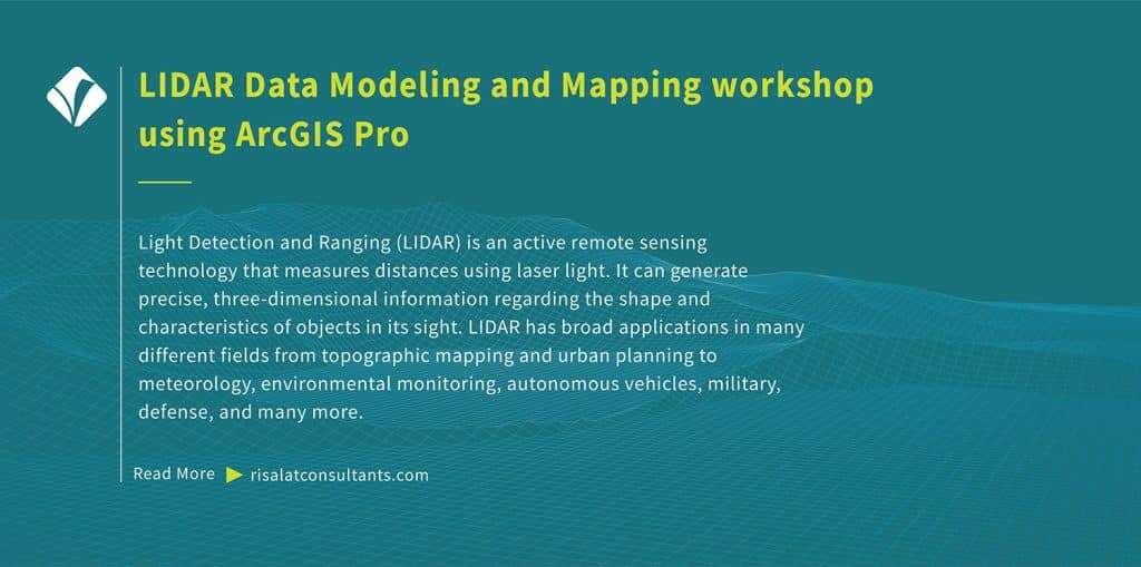
Light Detection and Ranging (LIDAR) is an active remote sensing technology that measures distances using laser light. It can generate precise, three-dimensional information regarding the shape and characteristics of objects in its sight. LIDAR has broad applications in many different fields from topographic mapping and urban planning to meteorology, environmental monitoring, autonomous vehicles, military, defense, and many more.
Free self-check: the digital readiness assessment gives how ready your institution is for digital services, data and AI, in about 10 minutes.
ArcGIS provides a comprehensive platform for working with LIDAR data modeling. This training programme has been developed to help ArcGIS professionals leverage LIDAR data to expand their geospatial analysis, mapping, and visualization capabilities. Delivered by Risalat Consultants International in Vilnius, Lithuania, it combines expert-led sessions, real cases and group work, so that participants can apply what they learn in their own institution.
The course is designed for those who want to demonstrate a thorough understanding of LIDAR technology and its applications in GIS, seamlessly navigate through the ArcGIS Pro interface, effectively manage spatial data, understand LIDAR point clouds and their attributes, and acquire practical, current skills in digital government, data and technology.
本培训项目可在以下方面加强机构能力:
- Introduction to light detection and ranging
- LIDAR data acquisition
- ArcGIS suite
- The interface of ArcGIS Pro
- Project setup and organization
- Adding and managing spatial data in ArcGIS Pro
- 坐标系统与投影
- 简单空间查询
- 数字战略与转型规划
- 数据治理与数据质量
- 数据分析与可视化
- 网络安全基础与风险管理
Why this matters now
各机构日益需要具备以下能力的专业人员:
- 规划切实解决问题的数字化举措
- 管理数据质量、保护与共享
- 分析数据并清晰呈现
- 管理网络与技术风险
- 带领员工完成数字化变革
健全的数字政府、数据与技术体系有助于机构:
- 提供更快捷、更便利的服务
- 在决策中更好地利用数据
- 保护系统和个人数据
- 从技术投资中获取价值
- 收集
- 清洗
- 存储
- 分析
- 决策
哪些人员应参加
本培训项目适合:
- Demonstrate a thorough understanding of LIDAR technology and its applications in GIS
- Seamlessly navigate through the ArcGIS Pro interface and effectively manage spatial data
- Understand LIDAR point clouds and their attributes
- Import and manage LIDAR data in ArcGIS Pro
- 使用LIDAR数据执行地形建模
- Create compelling 3D visualizations and apply advanced 3D analysis tools
- Perform feature extraction and classification
- 将激光雷达(LIDAR)数据与其他空间数据集整合以进行高级分析
- 信息通信技术经理与官员
- 数字化转型负责人
- 数据分析师与统计人员
- 信息安全官员
勾选您的团队需要具备的能力。
培训项目目标
完成本培训项目后,学员将能够:
- 阐述数字政府与数据应用的主要趋势
- 规划与服务目标挂钩的数字化举措
- 运用数据治理和质量原则
- 为决策者分析和可视化数据
- 识别和管理网络与技术风险
- 在使用人工智能和自动化时践行负责任的做法
- 规划技术的采购与管理
- 带领员工完成数字化变革
- 为本单位制定数字化行动计划
Training Structure & Contents
- Introduction to light detection and ranging
- LIDAR data acquisition
- ArcGIS suite
- The interface of ArcGIS Pro
- Project setup and organization
- Workshop: Introduction to light detection and ranging, LIDAR data acquisition: Applying It to Your Institution
- Adding and managing spatial data in ArcGIS Pro
- 坐标系统与投影
- 简单空间查询
- 属性与空间连接
- LIDAR data structure
- LIDAR data attributes and classification
- Workshop: Adding and managing spatial data in ArcGIS Pro, Coordinate systems…: Applying It to Your Institution
- Common LIDAR data formats
- Importing LIDAR data in ArcGIS Pro
- Terrain modeling with LIDAR data
- Creating digital elevation models (DEMs)
- Creating digital surface models (DSMs)
- Case Study: Common LIDAR data formats, Importing LIDAR data in ArcGIS Pro in Practice
- 3D visualization of LIDAR data
- 创建3D场景
- Symbolizing LIDAR point clouds
- Viewshed analysis
- 三维测量和分析工具
- 特征提取与分类
- Workshop: 3D visualization of LIDAR data, Creating 3D scenes: Applying It to Your Institution
- Advanced LIDAR analysis
- Change detection with LIDAR
- Integration with other data sources
- Multi-sensor data fusion
- 最佳实践与数据优化
- Use of Python for automation in ArcGIS
- Capstone Exercise: LIDAR Data Modeling and Mapping Action Plan for Your Institution
完整的每日课程内容
First Day | Introduction to light detection and ranging, LIDAR data acquisition
- Introduction to light detection and ranging
- LIDAR data acquisition
- ArcGIS suite
- The interface of ArcGIS Pro
- Project setup and organization
- Workshop: Introduction to light detection and ranging, LIDAR data acquisition: Applying It to Your Institution
Second Day | Adding and managing spatial data in ArcGIS Pro, Coordinate systems…
- Adding and managing spatial data in ArcGIS Pro
- 坐标系统与投影
- 简单空间查询
- 属性与空间连接
- LIDAR data structure
- LIDAR data attributes and classification
- Workshop: Adding and managing spatial data in ArcGIS Pro, Coordinate systems…: Applying It to Your Institution
Third Day | Common LIDAR data formats, Importing LIDAR data in ArcGIS Pro
- Common LIDAR data formats
- Importing LIDAR data in ArcGIS Pro
- Terrain modeling with LIDAR data
- Creating digital elevation models (DEMs)
- Creating digital surface models (DSMs)
- Case Study: Common LIDAR data formats, Importing LIDAR data in ArcGIS Pro in Practice
Fourth Day | 3D visualization of LIDAR data, Creating 3D scenes
- 3D visualization of LIDAR data
- 创建3D场景
- Symbolizing LIDAR point clouds
- Viewshed analysis
- 三维测量和分析工具
- 特征提取与分类
- Workshop: 3D visualization of LIDAR data, Creating 3D scenes: Applying It to Your Institution
Fifth Day | Advanced LIDAR analysis, Change detection with LIDAR
- Advanced LIDAR analysis
- Change detection with LIDAR
- Integration with other data sources
- Multi-sensor data fusion
- 最佳实践与数据优化
- Use of Python for automation in ArcGIS
- Capstone Exercise: LIDAR Data Modeling and Mapping Action Plan for Your Institution
培训方法
Adult learning principles and practical focus have been embedded in the design of LIDAR Data Modeling and Mapping workshop using ArcGIS Pro. All sessions comprise practical components and hands-on exercises that help participants master LIDAR data modeling and mapping in ArcGIS Pro. Before the programme, a short pre-assessment helps the facilitators understand each participant’s role and priorities, so that examples and exercises can be adjusted to the group. Each day ends with a short reflection in which participants note what they will apply at work.
- 专家主讲当前实践
- 区域及国际案例研究
- 小组作业与实践练习
- 视情况安排模拟演练与角色扮演
- Discussion of participants’ own challenges
- 跨机构、跨国家的同伴学习
- 可带回工作岗位的实用工具与模板
- 每日反思与行动规划
预期成果
- GIS technicians and analysts, particularly those willing to specialize in working with LIDAR data
- Urban planners and designers
- Environmental scientists work with LIDAR data modeling for various purposes e.g., habitat mapping, vegetation analysis, or environmental monitoring
- Forestry specialists using LIDAR for forest inventory, canopy analysis, and precision agriculture
- Transportation and infrastructure professionals
- Remote sensing specialists
- Municipal planners
- 规划与服务目标挂钩的数字化举措
每位学员£3,860 · 发票与银行转账 · 5人及以上团体可享折扣
同一机构五人及以上:请在申请发票时索取团体价。
Ten or more: an in-house version for your institution may cost less per person. Ask for an in-house quote.
注册截止时间为 37天后(2026年12月30日)
区域相关性与应用
Europe: European institutions apply digital government, data and technology within detailed regulatory frameworks and reform agendas. Participants from Europe can compare their practice with colleagues from other regions and test how established methods work under different conditions.
Africa: Across Africa, ministries, agencies and project teams working in digital government, data and technology increasingly operate alongside donor-financed programmes that expect clear systems and evidence. The programme helps participants adapt good practice to the institutions and resources they work with.
Middle East: In the Middle East, national development strategies and diversification plans place growing demands on digital government, data and technology. Participants explore how to build the capability these plans need inside public bodies and companies.
Asia: Institutions across Asia combine rapid growth with ambitious modernisation programmes. Participants from Asia can share their experience of scaling systems quickly and learn from approaches used elsewhere.
Pacific: Small island and Pacific states face particular constraints of size, distance and capacity. The programme highlights practical, proportionate approaches to digital government, data and technology that suit smaller institutions.
Holding the programme in Vilnius, Lithuania brings participants together away from their daily pressures, so they can compare how digital government, data and technology is handled in different settings. The same programme can also be delivered in-house for one institution, in its own country or online, with cases taken from its current work.
东道国概况
Programmes, Workshops, Exposures, Training Courses in Vilnius, Lithuania by Risalat Consultants International. Studying away from their own country gives participants time to focus, a fresh view of their own institution and the chance to build a network with colleagues from other countries.
Who Will Deliver This Programme
Each date is delivered by a team assigned from Risalat's expert network for this subject. For this programme we assign:
How we choose them: Experience in the region of the participants or comparable settings; Command of the financier rules that apply (World Bank, ADB, AfDB, EU, UN) where relevant; Delivery in English; other languages on request for in-house groups; No conflict of interest with participants' institutions.
Training courses in Vilnius数据科学与Excel建模培训课程
为何选择在维尔纽斯举办本培训项目
Vilnius hosts central government ministries, national agencies, and European Union bodies such as the European Institute for Gender Equality. Visiting officials can examine public administration reforms and digital public services implemented across Lithuania. The city is easily accessible via regular direct flights connecting Vilnius Airport with major European transport hubs.
2027 年 2 月举办的“使用 ArcGIS Pro 的 LIDAR 数据建模与测绘培训”项目汇聚了来自欧洲、非洲、中东和亚洲的官员和专业人士。课程结合了简短讲授、案例研究以及针对参与者自身文件的分组讨论,经请求可将该市的机构安排为学习考察点。
Getting there: Vilnius International Airport (VNO).
使用免费的签证查询工具确认您是否需要签证,完成报名后即可申请邀请函。
维尔纽斯的其他培训项目
- UN E-Government Survey UN DESA
- 经济合作与发展组织(OECD) OECD
Is there data, ai and analytics training for government officials in Vilnius in February 2027?
Can "LIDAR Data Modeling and Mapping Training using ArcGIS Pro" be delivered in-house for one organisation?
Risalat还开设哪些数据、人工智能与分析类培训项目?
机构如何报名和付款?
For teams and institutions
Bring your team
Teams that learn together apply more at work. Tell us how many people and how you would like to take part: we reply with a group quote within two working days.
Watch: this programme in short
在路线图中规划此项目:为什么重要、为什么要批准它、要计划的日期以及它所构建的职业生涯。