Ключевые факты
- Даты
- 8–12 февр. 2027 (5 дней)
- Где
- City Hotels Algirdas, Vilnius, Lithuania
- Стоимость на одного участника
- £3 860 (GBP)
- Оплата
- По счету банковским переводом
- Регистрация закрывается
- 30 дек. 2026
- Формат
- 5-day short course: a practical capacity-building programme for government, NGO and project teams in Vilnius
- Корпоративный формат
- Проведите ее для своей команды в удобные вам даты
На этой странице 11 разделов
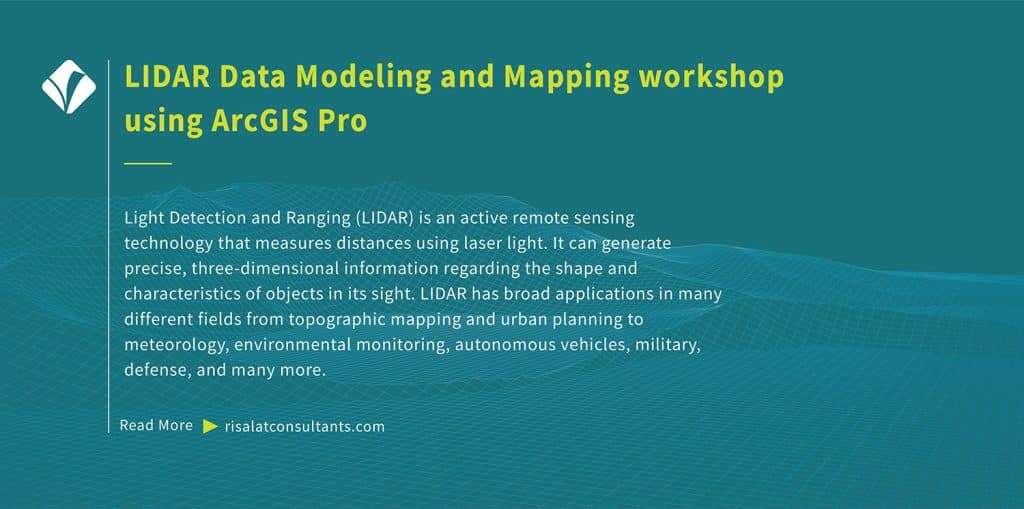
Обучение моделированию и картографированию данных LIDAR в ArcGIS Pro
Обзор программы
Light Detection and Ranging (LIDAR) is an active remote sensing technology that measures distances using laser light. It can generate precise, three-dimensional information regarding the shape and characteristics of objects in its sight. LIDAR has broad applications in many different fields from topographic mapping and urban planning to meteorology, environmental monitoring, autonomous vehicles, military, defense, and many more.
Free self-check: the digital readiness assessment gives how ready your institution is for digital services, data and AI, in about 10 minutes.
ArcGIS provides a comprehensive platform for working with LIDAR data modeling. This training programme has been developed to help ArcGIS professionals leverage LIDAR data to expand their geospatial analysis, mapping, and visualization capabilities. Delivered by Risalat Consultants International in Vilnius, Lithuania, it combines expert-led sessions, real cases and group work, so that participants can apply what they learn in their own institution.
The course is designed for those who want to demonstrate a thorough understanding of LIDAR technology and its applications in GIS, seamlessly navigate through the ArcGIS Pro interface, effectively manage spatial data, understand LIDAR point clouds and their attributes, and acquire practical, current skills in digital government, data and technology.
Программа укрепляет институциональный потенциал в следующих областях:
- Introduction to light detection and ranging
- LIDAR data acquisition
- ArcGIS suite
- The interface of ArcGIS Pro
- Project setup and organization
- Adding and managing spatial data in ArcGIS Pro
- Системы координат и проекции
- Простые пространственные запросы
- Цифровая стратегия и планирование трансформации
- Управление данными и их качество
- Анализ и визуализация данных
- Основы кибербезопасности и управление рисками
Why this matters now
Организациям все больше нужны специалисты, способные:
- Планировать цифровые инициативы, решающие реальные проблемы
- Управлять качеством, защитой и обменом данных
- Анализировать данные и наглядно их представлять
- Управлять киберрисками и технологическими рисками
- Вести людей через цифровые изменения
Сильные системы цифрового государства, данных и технологий помогают организациям:
- Предоставлять услуги быстрее и доступнее
- Эффективнее использовать данные при принятии решений
- Защищать системы и персональные данные
- Извлекать пользу из инвестиций в технологии
- Сбор
- Очистка
- Хранение
- Анализ
- Решение
Кому стоит участвовать
Программа предназначена для:
- Demonstrate a thorough understanding of LIDAR technology and its applications in GIS
- Seamlessly navigate through the ArcGIS Pro interface and effectively manage spatial data
- Understand LIDAR point clouds and their attributes
- Import and manage LIDAR data in ArcGIS Pro
- Выполнение моделирования рельефа с использованием данных LIDAR
- Create compelling 3D visualizations and apply advanced 3D analysis tools
- Perform feature extraction and classification
- Интеграция данных LIDAR с другими пространственными наборами данных для расширенного анализа
- Руководители и специалисты в сфере ИКТ
- Руководители цифровой трансформации
- Аналитики данных и статистики
- Специалисты по информационной безопасности
Отметьте, что должна уметь ваша команда.
Цели программы
По завершении программы участники смогут:
- Объяснять основные тенденции в цифровом государстве и использовании данных
- Спланировать цифровую инициативу, увязанную с целями услуг
- Применять принципы управления данными и обеспечения их качества
- Анализировать и визуализировать данные для лиц, принимающих решения
- Выявлять киберриски и технологические риски и управлять ими
- Применять ответственную практику при использовании ИИ и автоматизации
- Планировать закупку технологий и управление ими
- Вести людей через цифровые изменения
- Подготовить план цифровых действий для своей организации
Training Structure & Contents
- Introduction to light detection and ranging
- LIDAR data acquisition
- ArcGIS suite
- The interface of ArcGIS Pro
- Project setup and organization
- Семинар: Введение в лазерное сканирование и определение дальности, сбор данных LIDAR: применение в вашем учреждении
- Adding and managing spatial data in ArcGIS Pro
- Системы координат и проекции
- Простые пространственные запросы
- Атрибутивное и пространственное объединение
- LIDAR data structure
- LIDAR data attributes and classification
- Workshop: Adding and managing spatial data in ArcGIS Pro, Coordinate systems…: Applying It to Your Institution
- Common LIDAR data formats
- Importing LIDAR data in ArcGIS Pro
- Моделирование рельефа с использованием данных LIDAR
- Creating digital elevation models (DEMs)
- Creating digital surface models (DSMs)
- Case Study: Common LIDAR data formats, Importing LIDAR data in ArcGIS Pro in Practice
- 3D visualization of LIDAR data
- Создание 3D-сцен
- Symbolizing LIDAR point clouds
- Viewshed analysis
- Инструменты 3D-измерений и анализа
- Извлечение и классификация признаков
- Workshop: 3D visualization of LIDAR data, Creating 3D scenes: Applying It to Your Institution
- Advanced LIDAR analysis
- Change detection with LIDAR
- Integration with other data sources
- Multi-sensor data fusion
- Лучшие практики и оптимизация данных
- Use of Python for automation in ArcGIS
- Capstone Exercise: LIDAR Data Modeling and Mapping Action Plan for Your Institution
Полное содержание по дням
Первый день | Введение в лазерное сканирование и дальнометрию (LIDAR), сбор данных LIDAR
- Introduction to light detection and ranging
- LIDAR data acquisition
- ArcGIS suite
- The interface of ArcGIS Pro
- Project setup and organization
- Семинар: Введение в лазерное сканирование и определение дальности, сбор данных LIDAR: применение в вашем учреждении
Second Day | Adding and managing spatial data in ArcGIS Pro, Coordinate systems…
- Adding and managing spatial data in ArcGIS Pro
- Системы координат и проекции
- Простые пространственные запросы
- Атрибутивное и пространственное объединение
- LIDAR data structure
- LIDAR data attributes and classification
- Workshop: Adding and managing spatial data in ArcGIS Pro, Coordinate systems…: Applying It to Your Institution
Third Day | Common LIDAR data formats, Importing LIDAR data in ArcGIS Pro
- Common LIDAR data formats
- Importing LIDAR data in ArcGIS Pro
- Моделирование рельефа с использованием данных LIDAR
- Creating digital elevation models (DEMs)
- Creating digital surface models (DSMs)
- Case Study: Common LIDAR data formats, Importing LIDAR data in ArcGIS Pro in Practice
Fourth Day | 3D visualization of LIDAR data, Creating 3D scenes
- 3D visualization of LIDAR data
- Создание 3D-сцен
- Symbolizing LIDAR point clouds
- Viewshed analysis
- Инструменты 3D-измерений и анализа
- Извлечение и классификация признаков
- Workshop: 3D visualization of LIDAR data, Creating 3D scenes: Applying It to Your Institution
Fifth Day | Advanced LIDAR analysis, Change detection with LIDAR
- Advanced LIDAR analysis
- Change detection with LIDAR
- Integration with other data sources
- Multi-sensor data fusion
- Лучшие практики и оптимизация данных
- Use of Python for automation in ArcGIS
- Capstone Exercise: LIDAR Data Modeling and Mapping Action Plan for Your Institution
Методология обучения
Adult learning principles and practical focus have been embedded in the design of LIDAR Data Modeling and Mapping workshop using ArcGIS Pro. All sessions comprise practical components and hands-on exercises that help participants master LIDAR data modeling and mapping in ArcGIS Pro. Before the programme, a short pre-assessment helps the facilitators understand each participant’s role and priorities, so that examples and exercises can be adjusted to the group. Each day ends with a short reflection in which participants note what they will apply at work.
- Занятия под руководством экспертов по актуальной практике
- Региональные и международные кейсы
- Групповая работа и практические упражнения
- Симуляции и ролевые игры, где это уместно
- Discussion of participants’ own challenges
- Обмен опытом между организациями и странами
- Практические инструменты и шаблоны для работы
- Ежедневная рефлексия и планирование действий
Ожидаемые результаты
- GIS technicians and analysts, particularly those willing to specialize in working with LIDAR data
- Urban planners and designers
- Environmental scientists work with LIDAR data modeling for various purposes e.g., habitat mapping, vegetation analysis, or environmental monitoring
- Forestry specialists using LIDAR for forest inventory, canopy analysis, and precision agriculture
- Transportation and infrastructure professionals
- Remote sensing specialists
- Муниципальные планировщики
- Планировать цифровые инициативы, увязанные с целями услуг
£3 860 за участника · счет и банковский перевод · группам от 5 человек предоставляется скидка
Пять и более участников от одной организации: укажите групповой тариф в запросе счета.
Ten or more: an in-house version for your institution may cost less per person. Ask for an in-house quote.
Регистрация закрывается через 38 дней (30 дек. 2026 г.)
Региональная актуальность и применение
Europe: European institutions apply digital government, data and technology within detailed regulatory frameworks and reform agendas. Participants from Europe can compare their practice with colleagues from other regions and test how established methods work under different conditions.
Africa: Across Africa, ministries, agencies and project teams working in digital government, data and technology increasingly operate alongside donor-financed programmes that expect clear systems and evidence. The programme helps participants adapt good practice to the institutions and resources they work with.
Middle East: In the Middle East, national development strategies and diversification plans place growing demands on digital government, data and technology. Participants explore how to build the capability these plans need inside public bodies and companies.
Asia: Institutions across Asia combine rapid growth with ambitious modernisation programmes. Participants from Asia can share their experience of scaling systems quickly and learn from approaches used elsewhere.
Pacific: Small island and Pacific states face particular constraints of size, distance and capacity. The programme highlights practical, proportionate approaches to digital government, data and technology that suit smaller institutions.
Holding the programme in Vilnius, Lithuania brings participants together away from their daily pressures, so they can compare how digital government, data and technology is handled in different settings. The same programme can also be delivered in-house for one institution, in its own country or online, with cases taken from its current work.
Профиль принимающей страны
Programmes, Workshops, Exposures, Training Courses in Vilnius, Lithuania by Risalat Consultants International. Studying away from their own country gives participants time to focus, a fresh view of their own institution and the chance to build a network with colleagues from other countries.
Who Will Deliver This Programme
Each date is delivered by a team assigned from Risalat's expert network for this subject. For this programme we assign:
How we choose them: Experience in the region of the participants or comparable settings; Command of the financier rules that apply (World Bank, ADB, AfDB, EU, UN) where relevant; Delivery in English; other languages on request for in-house groups; No conflict of interest with participants' institutions.
Training courses in VilniusУчебные курсы по науке о данных и моделированию в Excel
Почему эта программа проходит в Вильнюсе
Vilnius hosts central government ministries, national agencies, and European Union bodies such as the European Institute for Gender Equality. Visiting officials can examine public administration reforms and digital public services implemented across Lithuania. The city is easily accessible via regular direct flights connecting Vilnius Airport with major European transport hubs.
Программа «Моделирование данных LIDAR и обучение картированию с использованием ArcGIS Pro» в феврале 2027 года объединяет должностных лиц и профессионалов из Европы, Африки, Ближнего Востока и Азии. Занятия сочетают в себе краткие вводные материалы, тематические исследования и групповую работу над собственными файлами участников, а учреждения города могут быть добавлены в качестве учебного визита по запросу.
Getting there: Vilnius International Airport (VNO).
Узнайте, нужна ли вам виза, с помощью бесплатного сервиса «Проверка визы» и запросите приглашение после регистрации.
Другие программы в Вильнюсе
Is there data, ai and analytics training for government officials in Vilnius in February 2027?
Can "LIDAR Data Modeling and Mapping Training using ArcGIS Pro" be delivered in-house for one organisation?
Какие еще программы по данным, ИИ и аналитике проводит Risalat?
Как организации регистрируются и оплачивают участие?
Для команд и организаций
Bring your team
Teams that learn together apply more at work. Tell us how many people and how you would like to take part: we reply with a group quote within two working days.
Watch: this programme in short
Другие учебные курсы в Литве · Все программы в Европе · Полный календарь обучения
Запланировать эту программу в дорожной карте: почему это важно, зачем это утверждать, даты планирования и карьера, которую это создает.