Points clés
- Dates
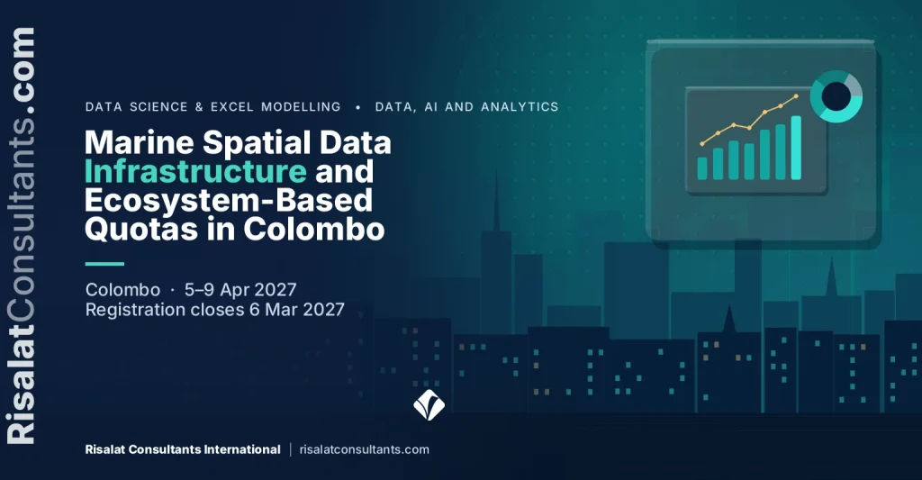
- 5–9 avr. 2027 (5 jours)
- Lieu
- Colombo, Sri Lanka
- Frais par participant
- 3 550 £ (GBP)
- Paiement
- Sur facture et par virement bancaire
- Clôture des inscriptions
- 6 Mar 2027
- Certificat
- Certificat de participation
- Option intra
- Organisez-le pour votre équipe, à vos dates
Sur cette page 15 sections
Présentation du programme
Coastal and island administrations require robust spatial intelligence and ecologically balanced governance frameworks to manage fisheries sustainably. This five-day course equips technical specialists and policy professionals with the principles of Marine Spatial Data Infrastructure (MSDI) and ecosystem-based quota management. Participants review technical architectures for marine spatial data collection, interoperability, and marine habitat classification, developing foundational capacities to guide resource interventions across shared exclusive economic zones.
The curriculum addresses the intersection of spatial planning, stock assessment, and harvest control regulations. Learners evaluate spatial data layers for offshore habitat mapping, migratory stock modelling, and marine protected zone demarcation. Through technical demonstrations and practical workflows, participants analyse regional marine datasets to support science-based policy decisions. Sessions incorporate standards established by the International Hydrographic Organization and guidelines from the Food and Agriculture Organization.
Delivered in Colombo, this course supports delegates seeking to convert complex spatial and biological data into enforceable fisheries governance instruments. Participants formulate harvest control rules and marine resource management plans aligned with regional agreements and national policy objectives. By connecting data infrastructure with regulatory mechanisms, the programme strengthens institutional capacity to monitor shared stocks, balance commercial exploitation, and protect vulnerable marine ecosystems effectively.
Marine jurisdictions across the Indian Ocean face increasing pressure from overexploitation, climate-induced habitat shifts, and competing maritime uses. Island and coastal nations must modernise their spatial intelligence systems and regulatory protocols to meet institutional requirements and regional governance milestones. This programme addresses the analytical and resource governance deliverables associated with coastal transformation programmes such as the TransFORM SWIOFish5 project, where establishing operational spatial data nodes and setting science-based harvest limits are critical for securing marine biodiversity, food security, and regional resource integrity.
Delivered by Risalat Consultants International in Colombo, Sri Lanka, it combines expert-led sessions, real cases and group work, so that participants can apply what they learn in their own institution.
The Programme Strengthens Institutional Capability
- Core components of Marine Spatial Data Infrastructure: data, technology, standards, and governance
- International Hydrographic Organization S-100 universal data model and OGC marine interoperability
- Spatial metadata cataloguing, geonodes, and clearinghouse design for public marine datasets
- Data ingestion pipelines: bathymetry, remote sensing sea surface parameters, and oceanographic observations
- Practical laboratory: configuring marine spatial metadata profiles to standard schemas
- Classification systems for offshore habitats, benthic zones, and essential fish habitats
- Processing vessel monitoring system (VMS) and automatic identification system (AIS) spatial data
- Spatial overlay techniques for identifying ecological and biological significant areas (EBSAs)
- Stratégie numérique et planification de la transformation
- Gouvernance et qualité des données
- Analyse et visualisation des données
- Notions de base en cybersécurité et gestion des risques
It is designed for marine resource researchers and biometricians, fisheries GIS analysts and spatial data officers, marine fisheries policy advisors and legal drafting officers and others who want practical, current skills in digital government, data and technology.
The Growing Importance of Marine Spatial Data Infrastructure and Ecosystem-Based Quotas in Colombo
- Core components of Marine Spatial Data Infrastructure: data, technology, standards, and governance
- International Hydrographic Organization S-100 universal data model and OGC marine interoperability
- Spatial metadata cataloguing, geonodes, and clearinghouse design for public marine datasets
- Data ingestion pipelines: bathymetry, remote sensing sea surface parameters, and oceanographic observations
- Practical laboratory: configuring marine spatial metadata profiles to standard schemas
- Classification systems for offshore habitats, benthic zones, and essential fish habitats
- Processing vessel monitoring system (VMS) and automatic identification system (AIS) spatial data
- Spatial overlay techniques for identifying ecological and biological significant areas (EBSAs)
- Demarcation criteria for no-take marine reserves and seasonal fisheries closures
- Practical exercise: delineating critical habitat boundary coordinates and buffer areas
- Principles of spatial stock distribution: straddling stocks and highly migratory pelagic species
- Integrating fisheries survey data with environmental covariates in spatial modeling workflows
- Mapping fishing effort distribution against catch-per-unit-effort (CPUE) surfaces
- Assessing bycatch hotspots and risk exposure for vulnerable marine megafauna
- Analytical workflow: generating spatial density estimations for commercial target species
- Transitioning from single-species maximum sustainable yield to ecosystem-based fisheries management
- Mechanics of Harvest Control Rules (HCR): biological reference points and target thresholds
- Designing dynamic spatial quotas responsive to sea temperature anomalies and recruitment shifts
- Allocation frameworks: artisanal fleet equity, offshore industrial fleets, and regional allocations
- Scenario testing: establishing harvest limits under differing stock replenishment projections
- Aligning management plans with Indian Ocean Tuna Commission (IOTC) and FAO Code of Conduct mandates
- Drafting enforceable operational regulations from marine spatial data infrastructure insights
- Cross-boundary data exchange agreements and regional compliance reporting frameworks
- Institutional implementation roadmaps for fisheries authorities and environmental ministries
- Participant group presentations: integrated spatial zoning and quota management plans
Les services numériques, les données et les nouvelles technologies transforment le fonctionnement des institutions et le service rendu aux citoyens. Bien utilisés, ils rendent les services plus rapides, moins coûteux et plus transparents ; mal utilisés, ils gaspillent de l'argent et exposent les données à des risques.
Les institutions ont besoin de personnes capables de planifier le changement numérique, de gérer les données de manière responsable, de protéger les systèmes et d'utiliser les données probantes dans leurs décisions. Ces compétences sont désormais attendues dans toutes les fonctions, et pas seulement dans l'informatique.
Les organisations ont de plus en plus besoin de professionnels capables de :
- Planifier des initiatives numériques qui résolvent de vrais problèmes
- Gérer la qualité, la protection et le partage des données
- Analyser les données et les présenter clairement
- Gérer les risques cyber et technologiques
- Accompagner les équipes dans le changement numérique
Des systèmes solides d'administration numérique, de données et de technologies aident les organisations à :
- Fournir des services plus rapides et plus accessibles
- Mieux utiliser les données dans les décisions
- Protéger les systèmes et les données personnelles
- Tirer parti des investissements technologiques
This Marine Spatial Data Infrastructure and Ecosystem-Based Quotas in Colombo programme brings these elements together in a practical format, so that participants understand not only what good practice looks like but also how to introduce it in their own setting, with the people and resources they have.
Who Should Attend This Marine Spatial Data Infrastructure and Ecosystem-Based Quotas in Colombo Training?
Ce programme s'adresse à :
- Marine resource researchers and biometricians
- Fisheries GIS analysts and spatial data officers
- Marine fisheries policy advisors and legal drafting officers
- Marine spatial planning technical working group members
- Monitoring, Control, and Surveillance (MCS) operations specialists
- Ecosystem conservation managers focused on marine protected areas
- Technical specialists from regional fisheries management bodies
- Project delivery unit personnel managing donor-funded marine investments
- Responsables et chargés des TIC
- Responsables de la transformation numérique
- Analystes de données et statisticiens
- Responsables de la sécurité de l'information
Le programme convient aussi bien aux professionnels expérimentés qu’à ceux qui prennent de nouvelles responsabilités. Les groupes réunissant plusieurs institutions et pays sont encouragés, car les participants apprennent beaucoup de l’expérience des autres.
Cochez ce que votre équipe doit être capable de faire.
Marine Spatial Data Infrastructure and Ecosystem-Based Quotas in Colombo Training Objectives
Upon successful completion of this Marine Spatial Data Infrastructure and Ecosystem-Based Quotas in Colombo Training, participants will be able to:
- Evaluate spatial data layers for offshore habitat mapping, bathymetric modelling, and marine zone demarcation
- Apply Open Geospatial Consortium and International Hydrographic Organization standards to build interoperable marine spatial data infrastructure
- Analyse migratory fish stock distributions and seasonal aggregations using spatial analytical tools and catch datasets
- Formulate ecosystem-based harvest control rules that incorporate multi-species interactions and environmental parameters
- Design marine spatial zoning plans that integrate designated marine protected areas with managed commercial fishing sectors
- Synthesise scientific survey findings into clear fisheries management plans aligned with international conventions
- Assess institutional governance structures to improve multi-agency marine data sharing and inter-governmental compliance
- Expliquer les grandes tendances de l'administration numérique et de l'utilisation des données
- Planifier une initiative numérique liée aux objectifs de service
- Appliquer les principes de gouvernance et de qualité des données
Chaque objectif est mis en pratique pendant le programme à travers des exercices, des études de cas ou des travaux de groupe, afin que les participants repartent capables de le faire, et pas seulement de le décrire.
Contenu et structure du programme
Le programme se déroule sur 5 jours. Chaque journée associe apports d'experts, travail pratique et un atelier ou une étude de cas de clôture :
- First Day: Day 1: Marine Spatial Data Infrastructure Architecture and Hydrographic Standards
- Second Day: Day 2: Offshore Habitat Mapping and Marine Protected Zone Demarcation
- Third Day: Day 3: Spatial Stock Assessment and Migratory Species Modelling
- Fourth Day: Day 4: Ecosystem-Based Fisheries Quotas and Harvest Control Rules
- Fifth Day: Day 5: Resource Management Planning and Regional Policy Harmonisation
Contenu détaillé jour par jour
First Day | Day 1: Marine Spatial Data Infrastructure Architecture and Hydrographic Standards
- Core components of Marine Spatial Data Infrastructure: data, technology, standards, and governance
- International Hydrographic Organization S-100 universal data model and OGC marine interoperability
- Spatial metadata cataloguing, geonodes, and clearinghouse design for public marine datasets
- Data ingestion pipelines: bathymetry, remote sensing sea surface parameters, and oceanographic observations
- Practical laboratory: configuring marine spatial metadata profiles to standard schemas
Workshop: Day 1: Marine Spatial Data Infrastructure Architecture and Hydrographic Standards: Applying It to Your Institution
En petits groupes, les participants appliquent les méthodes du jour à des exemples tirés de leurs institutions et conviennent d'étapes concrètes pour la suite.
Second Day | Day 2: Offshore Habitat Mapping and Marine Protected Zone Demarcation
- Classification systems for offshore habitats, benthic zones, and essential fish habitats
- Processing vessel monitoring system (VMS) and automatic identification system (AIS) spatial data
- Spatial overlay techniques for identifying ecological and biological significant areas (EBSAs)
- Demarcation criteria for no-take marine reserves and seasonal fisheries closures
- Practical exercise: delineating critical habitat boundary coordinates and buffer areas
Workshop: Day 2: Offshore Habitat Mapping and Marine Protected Zone Demarcation: Applying It to Your Institution
En petits groupes, les participants appliquent les méthodes du jour à des exemples tirés de leurs institutions et conviennent d'étapes concrètes pour la suite.
Third Day | Day 3: Spatial Stock Assessment and Migratory Species Modelling
- Principles of spatial stock distribution: straddling stocks and highly migratory pelagic species
- Integrating fisheries survey data with environmental covariates in spatial modeling workflows
- Mapping fishing effort distribution against catch-per-unit-effort (CPUE) surfaces
- Assessing bycatch hotspots and risk exposure for vulnerable marine megafauna
- Analytical workflow: generating spatial density estimations for commercial target species
Case Study: Day 3: Spatial Stock Assessment and Migratory Species Modelling in Practice
Les participants analysent un cas réaliste, comparent les choix effectués aux bonnes pratiques et en tirent des enseignements applicables à leur propre contexte.
Fourth Day | Day 4: Ecosystem-Based Fisheries Quotas and Harvest Control Rules
- Transitioning from single-species maximum sustainable yield to ecosystem-based fisheries management
- Mechanics of Harvest Control Rules (HCR): biological reference points and target thresholds
- Designing dynamic spatial quotas responsive to sea temperature anomalies and recruitment shifts
- Allocation frameworks: artisanal fleet equity, offshore industrial fleets, and regional allocations
- Scenario testing: establishing harvest limits under differing stock replenishment projections
Workshop: Day 4: Ecosystem-Based Fisheries Quotas and Harvest Control Rules: Applying It to Your Institution
En petits groupes, les participants appliquent les méthodes du jour à des exemples tirés de leurs institutions et conviennent d'étapes concrètes pour la suite.
Fifth Day | Day 5: Resource Management Planning and Regional Policy Harmonisation
- Aligning management plans with Indian Ocean Tuna Commission (IOTC) and FAO Code of Conduct mandates
- Drafting enforceable operational regulations from marine spatial data infrastructure insights
- Cross-boundary data exchange agreements and regional compliance reporting frameworks
- Institutional implementation roadmaps for fisheries authorities and environmental ministries
- Participant group presentations: integrated spatial zoning and quota management plans
Capstone Exercise: Marine Spatial Data Infrastructure and Ecosystem-Based Quotas in Colombo Action Plan for Your Institution
Les participants synthétisent la semaine dans un plan d'action pour leur institution, avec des priorités, des responsables et des premières étapes, puis le présentent à leurs pairs et aux animateurs pour recueillir leurs retours.
Marine Spatial Data Infrastructure and Ecosystem-Based Quotas in Colombo Training Methodology
The training employs a practitioner-focused methodology combining technical presentations, spatial laboratory sessions, and regulatory drafting exercises. Participants work with open-source geographic information systems and marine analytical datasets to simulate real-world spatial planning challenges. Learning is structured around case-based scenarios relevant to oceanic island and coastal settings, promoting technical debate and structured peer review. Daily debriefs consolidate analytical insights into concrete operational guidelines suitable for national policy implementation.
Le programme associe :
- Sessions animées par des experts sur les pratiques actuelles
- Études de cas régionales et internationales
- Travaux de groupe et exercices pratiques
- Simulations et jeux de rôle le cas échéant
- Discussion des défis rencontrés par les participants dans l'exercice de leurs fonctions
- Apprentissage entre pairs, d'institutions et de pays différents
- Des outils et modèles pratiques à réutiliser au travail
- Réflexion quotidienne et plan d'action
Avant le programme, une courte pré-évaluation aide les animateurs à comprendre le rôle et les priorités de chaque participant, afin d’adapter les exemples et les exercices au groupe. Chaque journée se termine par une brève réflexion au cours de laquelle les participants notent ce qu’ils appliqueront dans leur travail.
Résultats attendus
Upon completion of this Marine Spatial Data Infrastructure and Ecosystem-Based Quotas in Colombo Training, participants will be able to:
- Establish functional marine spatial data architecture adhering to recognised international metadata standards
- Map sensitive offshore benthic habitats and pelagic critical areas to support spatial zoning policies
- Model migratory stock movements to inform spatial fisheries management decisions and closed seasons
- Calculate ecosystem-based catch limits and harvest control reference points for commercial marine species
- Draft integrated marine resource management plans that comply with regional fisheries arrangements
- Formulate institutional data-sharing protocols to streamline inter-agency maritime surveillance and reporting
- Planifier des initiatives numériques liées aux objectifs de service
- Appliquer les principes de gouvernance et de qualité des données
Les participants repartent avec un plan d'action personnel et des outils pratiques utilisables dans leur institution dès la première semaine de retour. Les institutions qui envoient plusieurs participants peuvent s'appuyer sur le programme pour convenir de méthodes et de modèles communs entre équipes, ce qui facilite la pérennité des améliorations.
3 550 £ par participant · facture et virement bancaire · réduction pour les groupes de 5 personnes ou plus
Cinq personnes ou plus d'une même organisation : demandez le tarif de groupe lors de votre demande de facture.
À partir de dix participants, une version intra pour votre institution peut revenir moins cher par personne. Demander un devis intra.
Registration closes in 114 days (6 Mar 2027)
Institutional Application of Marine Spatial Data Infrastructure and Ecosystem-Based Quotas in Colombo Training
Ce programme aide les organisations à renforcer :
- Stratégie numérique
- Gouvernance des données
- Décisions fondées sur les données
- Cybersécurité
- Gestion des technologies
Les participants repartent avec des outils pratiques pour améliorer :
- Inventaires des données
- Tableaux de bord
- Registres des risques
- Achats de technologies
- Plans de changement
Le programme est conçu pour que l'apprentissage passe de la salle de formation à l'institution. Les participants travaillent, dans la mesure du possible, sur leurs propres processus et documents, et repartent avec un plan d'action que leurs responsables peuvent examiner et soutenir.
Pertinence régionale & mise en application
Europe
Les institutions européennes pratiquent l'administration numérique, la gestion des données et des technologies dans le cadre de réglementations détaillées et de programmes de réforme. Les participants venus d'Europe peuvent comparer leurs pratiques avec celles de collègues d'autres régions et vérifier comment des méthodes éprouvées fonctionnent dans d'autres conditions.
Afrique
En Afrique, les ministères, agences et équipes de projet œuvrant dans l'administration numérique, les données et les technologies travaillent de plus en plus aux côtés de programmes financés par les bailleurs qui exigent des systèmes clairs et des données probantes. Le programme aide les participants à adapter les bonnes pratiques aux institutions et aux ressources avec lesquelles ils travaillent.
Moyen-Orient
Au Moyen-Orient, les stratégies nationales de développement et les plans de diversification sollicitent de plus en plus l'administration numérique, les données et les technologies. Les participants examinent comment bâtir, au sein des organismes publics et des entreprises, les capacités dont ces plans ont besoin.
Asie
Les institutions asiatiques conjuguent croissance rapide et programmes de modernisation ambitieux. Les participants venus d'Asie peuvent partager leur expérience du déploiement rapide de systèmes à grande échelle et découvrir les approches adoptées ailleurs.
Pacifique
Les petits États insulaires et du Pacifique font face à des contraintes particulières de taille, de distance et de capacités. Le programme met en avant des approches pratiques et proportionnées de l'administration numérique, des données et des technologies, adaptées aux institutions de petite taille.
Holding the programme in Colombo, Sri Lanka brings participants together away from their daily pressures, so they can compare how digital government, data and technology is handled in different settings. The same programme can also be delivered in-house for one institution, in its own country or online, with cases taken from its current work.
- Collecter
- Nettoyer
- Stocker
- Analyser
- Décider
Profil du pays d'accueil – Sri Lanka
Programmes, ateliers, immersions et formations à Colombo, Sri Lanka, par Risalat Consultants International
Se former hors de son pays permet aux participants de se concentrer, de porter un regard neuf sur leur propre institution et de constituer un réseau avec des collègues d'autres pays.
Marine Spatial Data Infrastructure and Ecosystem-Based Quotas in Colombo Training Deliverables
Les participants sont accompagnés avant, pendant et après le programme, afin que la préparation, l'apprentissage et le suivi forment une expérience continue.
Avant le programme
- Pré-évaluation des participants
- Marine Spatial Data Infrastructure and Ecosystem-Based Quotas in Colombo Readiness Assessment
- Marine Spatial Data Infrastructure and Ecosystem-Based Quotas in Colombo Resource Pack
- Lectures préparatoires
- Aide et conseils gratuits pour le visa
Pendant le programme
- Accueil à l'aéroport & assistance à l'arrivée
- Hébergement avec petit-déjeuner
- Dîner de bienvenue et de réseautage
- Kit de formation Risalat (sac, gourde, mug, t-shirt, casquette, protège-passeport, stylos, carnet, magnet & porte-clés)
- Comprehensive Marine Spatial Data Infrastructure and Ecosystem-Based Quotas in Colombo Training Manual
- Liste de contrôle de la maturité numérique
- Modèle d'inventaire des données
- Modèle de planification de tableau de bord
- Registre des risques technologiques
- Ateliers pratiques & simulations
- Discussions de groupe & apprentissage entre pairs
- Déjeuner et pauses-café quotidiens
- Accès complet aux installations du lieu de formation
- Mini tablette avec supports pédagogiques numériques
- Visite de terrain (le cas échéant)
- Visite récréative de la ville
Après le programme
- Certificat de participation
- Distinction Risalat de participation au programme
- Documents de référence après la formation
- Autoévaluation de la gouvernance des données
- Liste de contrôle d'examen des projets numériques
- Accompagnement après la formation & conseils de suivi
- Rapport du programme
Les institutions peuvent aussi demander une version intra sur mesure de ce programme, dispensée dans leurs locaux ou en ligne. Demander une proposition.
Common Challenges in Marine Spatial Data Infrastructure and Ecosystem-Based Quotas in Colombo, And How This Training Helps
Comment les institutions peuvent-elles planifier des initiatives numériques qui résolvent de vrais problèmes ?
The programme addresses this directly on the first day (Day 1: Marine Spatial Data Infrastructure Architecture and Hydrographic Standards), where participants practise the methods involved and adapt them to their own institution, then build it into their action plan.
Comment les institutions peuvent-elles gérer la qualité, la protection et le partage des données ?
The programme addresses this directly on the second day (Day 2: Offshore Habitat Mapping and Marine Protected Zone Demarcation), where participants practise the methods involved and adapt them to their own institution, then build it into their action plan.
Comment les institutions peuvent-elles analyser les données et les présenter clairement ?
The programme addresses this directly on the third day (Day 3: Spatial Stock Assessment and Migratory Species Modelling), where participants practise the methods involved and adapt them to their own institution, then build it into their action plan.
Comment les institutions peuvent-elles gérer les risques cyber et technologiques ?
The programme addresses this directly on the fourth day (Day 4: Ecosystem-Based Fisheries Quotas and Harvest Control Rules), where participants practise the methods involved and adapt them to their own institution, then build it into their action plan.
Comment les institutions peuvent-elles accompagner les équipes dans le changement numérique ?
The programme addresses this directly on the fifth day (Day 5: Resource Management Planning and Regional Policy Harmonisation), where participants practise the methods involved and adapt them to their own institution, then build it into their action plan.
Questions fréquentes
When and where does the Marine Spatial Data Infrastructure and Ecosystem-Based Quotas in Colombo programme take place?
It runs from 5 Apr 2027 to 9 Apr 2027, in Colombo, Sri Lanka. The registration deadline is shown at the top of this page.
Qui devrait participer ?
The programme is designed for marine resource researchers and biometricians, fisheries GIS analysts and spatial data officers, marine fisheries policy advisors and legal drafting officers, marine spatial planning technical working group members, and others who want practical skills in digital government, data and technology.
Recevrai-je un certificat ?
Oui. Les participants qui terminent le programme reçoivent un certificat de participation délivré par Risalat Consultants International.
Ce programme peut-il être dispensé pour notre seule institution ?
Oui. Nous pouvons proposer une version intra sur mesure dans vos locaux, dans une autre ville ou en ligne, construite autour de vos propres cas. Utilisez la demande de proposition sur cette page.
Faut-il une expérience préalable en administration numérique, données et technologies ?
Aucune formation spécialisée n'est requise au-delà d'une expérience dans une fonction similaire. Une courte pré-évaluation aide les animateurs à adapter les sessions au groupe.
Who Will Deliver This Programme
Each date is delivered by a team assigned from Risalat's expert network for this subject. For this programme we assign:
How we choose them: Experience in the region of the participants or comparable settings; Command of the financier rules that apply (World Bank, ADB, AfDB, EU, UN) where relevant; Delivery in English; other languages on request for in-house groups; No conflict of interest with participants' institutions.
Names and short CVs of the assigned experts are shared with registered participants and sponsoring organisations before the programme, on request. Are you an expert in this subject? Join our expert network.
Training courses in ColomboClimate Change & Environment training courses
Pourquoi Colombo pour ce programme
Colombo is the commercial capital of Sri Lanka and hosts major national institutions, including the Central Bank of Sri Lanka and the Port of Colombo. Visiting delegations can observe maritime logistics, financial administration and urban governance within a compact area. Bandaranaike International Airport provides direct flight connections across South Asia, Southeast Asia and the Middle East.
The Marine Spatial Data Infrastructure and Ecosystem-Based Quotas in Colombo programme in April 2027 brings together officials and professionals from across the Asia region and beyond. Sessions combine short inputs, case studies and group work on participants' own files, and the city's institutions can be added as a study visit on request.
Getting there: Bandaranaike International Airport (CMB).
Vérifiez si vous avez besoin d'un visa avec le vérificateur de visa gratuit, et demandez une lettre d'invitation une fois inscrit.
Le même thème dans d'autres villes
Autres programmes à Colombo
- Atoll School Clusters & Secondary Distance Pedagogy Management in Colombo
- Marine Spatial Planning & Pelagic Fisheries Stock Auditing in Colombo
- Atoll School Digital Pedagogy, STEM Labs and Remote Learning Operations in Colombo
- Multi-Hazard Cyclone Shelter Design and Community Refuge Management in Colombo
- Social Registry Operations, Biometric Verification and Grievance Redress in Colombo
- OCDE (Organisation de coopération et de développement économiques) OCDE
- Programme des Nations Unies pour le développement PNUD
- Open Contracting Partnership Open Contracting Partnership
For teams and institutions
Bring your team
Teams that learn together apply more at work. Tell us how many people and how you would like to take part: we reply with a group quote within two working days.
Other dates and cities for this subject: Infrastructure, Roads and Transport Projects training courses (161 upcoming dates).
Plus de formations au Sri Lanka · Tous les programmes en Asie · Calendrier complet des formations
Plan this programme in a roadmap: why it matters, why to approve it, the dates to plan and the career it builds.