Key facts
- Dates
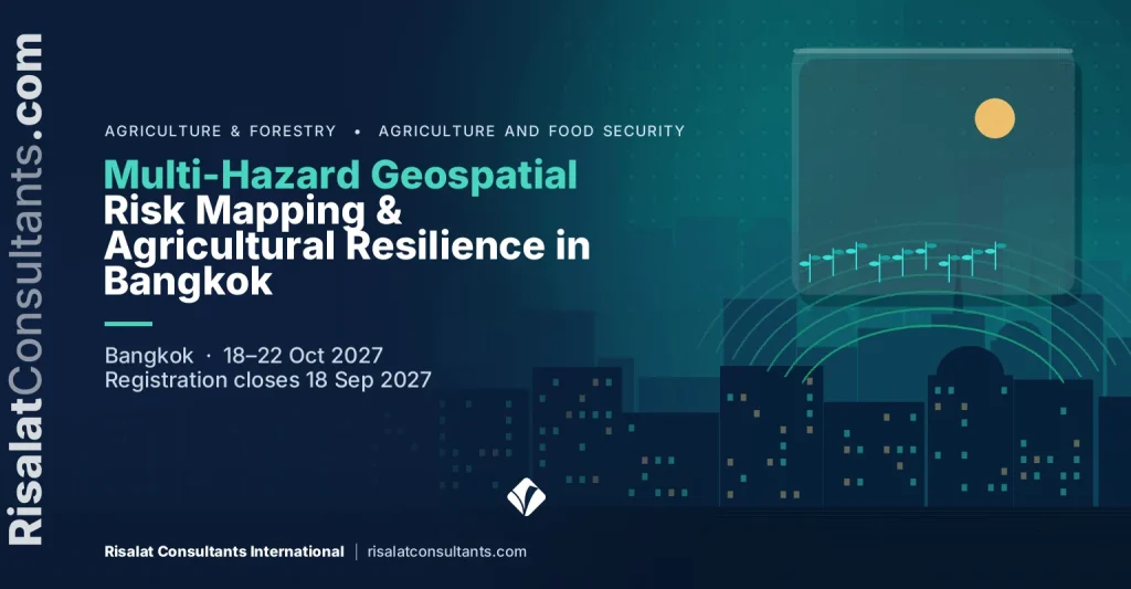
- 18–22 Oct 2027 (5 days)
- Where
- Bangkok, Thailand
- Fee per participant
- £2,250 (GBP)
- Payment
- By invoice and bank transfer
- Registration closes
- 18 Sep 2027
- Certificate
- Certificate of completion
- In-house option
- Run it for your team, on your dates
On this page 12 sections
Programme Overview
Government agencies and development programmes operate under increasing exposure to compounding natural hazards. This five-day executive training course in Bangkok provides technical specialists and planning officers with applied capabilities in multi-hazard geospatial risk mapping and rural resilience planning. Delivered through practical computer laboratory sessions, participants examine how satellite Earth observation, digital elevation data, and open-source spatial platforms integrate to identify vulnerable agricultural landscapes, community assets, and critical rural production corridors.
The curriculum addresses the physical processes and spatial data requirements of major hazard domains, focusing on landslide susceptibility, fluvial flooding, and agricultural vulnerability. Participants gain systematic competencies in acquisition, pre-processing, and multi-criteria spatial analysis using platforms such as QGIS and Google Earth Engine. The technical content equips institutions to transition from static spatial inventories to dynamic, multi-tier risk models that directly feed into national spatial data infrastructures and disaster prevention frameworks.
Beyond geospatial analytical processing, the course establishes operational mechanisms to bridge technical analysis with institutional decision-making. Participants formulate practical hazard communication protocols and early warning linkages covering: agricultural extension networks, sub-national planning administrations, and vulnerable farming communities. Through rigorous real-world scenario analysis, attendees build structured frameworks that ensure geospatial risk analytics inform rural public investment programmes, infrastructure retrofitting, and local emergency management plans effectively.
Public institutions and project implementation units face urgent demands to protect rural livelihoods against escalating hydro-meteorological shocks and complex terrain instability. This programme directly aligns with the operational requirements of national risk analytics initiatives, including technical workflows associated with the Strengthening Risk Information for Disaster Resilience in Bhutan project. Developing robust, cross-sectoral geospatial capacities ensures that state agencies and multilateral investment operations under World Bank, ADB, and UN portfolios can standardise baseline hazard data, satisfy appraisal standards, and protect agricultural economies through verifiable risk mitigation.
Delivered by Risalat Consultants International in Bangkok, Thailand, it combines expert-led sessions, real cases and group work, so that participants can apply what they learn in their own institution.
The Programme Strengthens Institutional Capability
- Review of international disaster risk frameworks: Sendai Framework monitoring and ISO 31010 standards for risk assessment
- Open spatial data sources: Copernicus Sentinel, NASA Landsat, and global digital elevation models (DEMs)
- Pre-processing spatial data in QGIS: Coordinate reference systems, reprojection, clipping, and terrain surface extraction
- Agricultural asset exposure mapping: Developing spatial layers for crop types, livestock assets, and rural infrastructure
- Hands-on lab: Building a structured, multi-tier geospatial risk data catalogue for public sector institutions
- Physical mechanics and environmental triggers of slope failures in steep terrain
- Extracting morphometric terrain parameters: Slope, aspect, curvature, and topographic wetness index (TWI)
- Compiling historical landslide inventories using satellite optical archives and participatory spatial methods
- Climate and environmental risk assessment
- Adaptation and mitigation planning
- Sector strategies for energy, water and land
- Project design for climate and environmental goals
It is designed for disaster risk management officers and emergency planners, spatial data specialists, GIS analysts, and cartographers, agricultural planning officers and rural development specialists and others who want practical, current skills in climate, environment and natural resources.
- Funds
- Entity
- Project
- Results
- MRV
The Growing Importance of Multi-Hazard Geospatial Risk Mapping & Agricultural Resilience in Bangkok
Climate change, environmental pressure and resource management now shape national plans, budgets and investment decisions. Financiers increasingly expect climate and environmental considerations to be built into projects from the start.
Institutions that can plan for climate risks, manage natural resources well and prepare sound proposals are better placed to protect services and to access the funding available for this work.
Organisations increasingly require professionals capable of:
- Assess climate and environmental risks to their services and assets
- Design projects that meet climate and environmental goals
- Prepare proposals that financiers can approve
- Measure and report results credibly
- Work with communities and partners across sectors
Strong climate, environment and natural resources systems help organisations:
- Protect services and infrastructure from climate risks
- Access climate and environmental finance
- Meet national and international commitments
- Use natural resources sustainably
This Multi-Hazard Geospatial Risk Mapping & Agricultural Resilience in Bangkok programme brings these elements together in a practical format, so that participants understand not only what good practice looks like but also how to introduce it in their own setting, with the people and resources they have.
Who Should Attend This Multi-Hazard Geospatial Risk Mapping & Agricultural Resilience in Bangkok Training?
This programme is designed for:
- Disaster risk management officers and emergency planners
- Spatial data specialists, GIS analysts, and cartographers
- Agricultural planning officers and rural development specialists
- Irrigation and water resources engineers in public agencies
- Project Implementation Unit (PIU) monitoring and evaluation staff
- Land use planners and natural resource management officers
- Technical specialists from national hydro-meteorological services
- Climate change adaptation practitioners in donor-funded programmes
- Local government engineers responsible for rural infrastructure
- Climate change and environment officers
- Energy, water and agriculture sector staff
- Planning and policy officers
The programme suits experienced professionals as well as those moving into new responsibilities. Groups that mix institutions and countries are encouraged, because participants learn a great deal from each other’s experience.
Tick what your team needs to be able to do.
Multi-Hazard Geospatial Risk Mapping & Agricultural Resilience in Bangkok Training Objectives
Upon successful completion of this Multi-Hazard Geospatial Risk Mapping & Agricultural Resilience in Bangkok Training, participants will be able to:
- Apply open-source GIS and remote sensing platforms to acquire, process, and analyse multi-spectral satellite imagery for terrain hazard assessment
- Model landslide susceptibility using geotechnical factors, digital elevation models, and spatial multi-criteria evaluation methodologies
- Delineate flood hazard extents and surface inundation zones through terrain analysis, hydrologic thresholds, and historical observation data
- Evaluate crop and agricultural vulnerability using satellite-derived vegetation indices, phenological stages, and asset exposure mapping
- Integrate hazard, exposure, and vulnerability layers into composite multi-hazard risk indices following international risk assessment guidelines
- Formulate operational risk communication protocols for agricultural extension networks and local rural farming administrations
- Develop actionable spatial integration plans to embed multi-hazard spatial analytics into sub-national public investment pipelines
- Explain the main climate and environmental challenges for their sector
- Assess climate and environmental risks to services and assets
- Plan adaptation and mitigation measures
Each objective is practised during the programme through exercises, cases or group work, so that participants leave able to do it, not only to describe it.
Programme Contents and Structure
- Earth Observation, Spatial Data Infrastructures, and Baseline Hazard Mapping & Agricultural Resilience
- Review of international disaster risk frameworks: Sendai Framework monitoring and ISO 31010 standards for risk assessment
- Open spatial data sources: Copernicus Sentinel, NASA Landsat, and global digital elevation models (DEMs)
- Pre-processing spatial data in QGIS: Coordinate reference systems, reprojection, clipping, and terrain surface extraction
- Agricultural asset exposure mapping: Developing spatial layers for crop types, livestock assets, and rural infrastructure
- Hands-on lab: Building a structured, multi-tier geospatial risk data catalogue for public sector institutions
- Physical mechanics and environmental triggers of slope failures in steep terrain
- Extracting morphometric terrain parameters: Slope, aspect, curvature, and topographic wetness index (TWI)
- Compiling historical landslide inventories using satellite optical archives and participatory spatial methods
- Analytical Hierarchy Process (AHP) and weight assignment for geology, land cover, and drainage proximity
- Hands-on lab: Generating an operational landslide susceptibility raster index and classifying critical hazard tiers
- Principles of catchment hydrology, fluvial flooding, and surface water runoff in agricultural basins
- Radar remote sensing fundamentals: Using Sentinel-1 Synthetic Aperture Radar (SAR) for flood extent extraction
- Automated water thresholding and inundation mapping using cloud-based geospatial workflows
- Overlaying inundation polygons with spatial agricultural cadastre data to calculate exposed crop acreage
- Hands-on lab: Calibrating historical flood extents and producing flood return-level exposure maps for district planning
- Agricultural vulnerability assessment: Biophysical factors, seasonal sensitivity, and socio-economic adaptive capacity
- Time-series vegetation analytics using NDVI, EVI, and the Vegetation Condition Index (VCI) for moisture stress detection
- Mapping vulnerable production zones across varied agro-ecological corridors and irrigation command areas
- Developing multi-hazard agricultural vulnerability matrices combining drought, flood, and slope failure risks
- Hands-on lab: Calculating a composite agricultural risk metric at the sub-district level using spatial overlay analysis
- Standardising spatial hazard data sharing across ministries: Interoperability and Open Geospatial Consortium (OGC) standards
- Designing actionable hazard communication bulletins for rural agricultural extension officers and farming collectives
- Establishing trigger mechanisms and standard operating procedures (SOPs) linking spatial models to early action
- Presenting multi-hazard spatial outputs to ministerial decision-makers and multilateral project task teams
- Participant capstone exercise: Presentation and peer review of integrated multi-hazard mapping plans for target basins
Full day-by-day contents
The programme runs over 5 days. Each day combines expert input, practical work and a closing workshop or case study:
- First Day: Earth Observation, Spatial Data Infrastructures, and Baseline Hazard Mapping
- Second Day: Slope Instability and Landslide Susceptibility Modelling
- Third Day: Hydrological Hazard Mapping and Agricultural Flood Exposure
- Fourth Day: Crop Vulnerability Modelling and Drought Monitoring
- Fifth Day: Operational Protocols, Communication Systems, and Policy Integration
Full day-by-day contents
First Day | Earth Observation, Spatial Data Infrastructures, and Baseline Hazard Mapping & Agricultural Resilience
- Review of international disaster risk frameworks: Sendai Framework monitoring and ISO 31010 standards for risk assessment
- Open spatial data sources: Copernicus Sentinel, NASA Landsat, and global digital elevation models (DEMs)
- Pre-processing spatial data in QGIS: Coordinate reference systems, reprojection, clipping, and terrain surface extraction
- Agricultural asset exposure mapping: Developing spatial layers for crop types, livestock assets, and rural infrastructure
- Hands-on lab: Building a structured, multi-tier geospatial risk data catalogue for public sector institutions
Workshop: Earth Observation, Spatial Data Infrastructures, and Baseline Hazard Mapping: Applying It to Your Institution
Working in small groups, participants apply the day's methods to examples from their own institutions and agree practical next steps.
Second Day | Slope Instability and Landslide Susceptibility Modelling
- Physical mechanics and environmental triggers of slope failures in steep terrain
- Extracting morphometric terrain parameters: Slope, aspect, curvature, and topographic wetness index (TWI)
- Compiling historical landslide inventories using satellite optical archives and participatory spatial methods
- Analytical Hierarchy Process (AHP) and weight assignment for geology, land cover, and drainage proximity
- Hands-on lab: Generating an operational landslide susceptibility raster index and classifying critical hazard tiers
Workshop: Slope Instability and Landslide Susceptibility Modelling: Applying It to Your Institution
Working in small groups, participants apply the day's methods to examples from their own institutions and agree practical next steps.
Third Day | Hydrological Hazard Mapping and Agricultural Flood Exposure
- Principles of catchment hydrology, fluvial flooding, and surface water runoff in agricultural basins
- Radar remote sensing fundamentals: Using Sentinel-1 Synthetic Aperture Radar (SAR) for flood extent extraction
- Automated water thresholding and inundation mapping using cloud-based geospatial workflows
- Overlaying inundation polygons with spatial agricultural cadastre data to calculate exposed crop acreage
- Hands-on lab: Calibrating historical flood extents and producing flood return-level exposure maps for district planning
Case Study: Hydrological Hazard Mapping and Agricultural Flood Exposure in Practice
Participants analyse a realistic case, compare the choices made with good practice and draw lessons they can use in their own setting.
Fourth Day | Crop Vulnerability Modelling and Drought Monitoring
- Agricultural vulnerability assessment: Biophysical factors, seasonal sensitivity, and socio-economic adaptive capacity
- Time-series vegetation analytics using NDVI, EVI, and the Vegetation Condition Index (VCI) for moisture stress detection
- Mapping vulnerable production zones across varied agro-ecological corridors and irrigation command areas
- Developing multi-hazard agricultural vulnerability matrices combining drought, flood, and slope failure risks
- Hands-on lab: Calculating a composite agricultural risk metric at the sub-district level using spatial overlay analysis
Workshop: Crop Vulnerability Modelling and Drought Monitoring: Applying It to Your Institution
Working in small groups, participants apply the day's methods to examples from their own institutions and agree practical next steps.
Fifth Day | Operational Protocols, Communication Systems, and Policy Integration
- Standardising spatial hazard data sharing across ministries: Interoperability and Open Geospatial Consortium (OGC) standards
- Designing actionable hazard communication bulletins for rural agricultural extension officers and farming collectives
- Establishing trigger mechanisms and standard operating procedures (SOPs) linking spatial models to early action
- Presenting multi-hazard spatial outputs to ministerial decision-makers and multilateral project task teams
- Participant capstone exercise: Presentation and peer review of integrated multi-hazard mapping plans for target basins
Capstone Exercise: Multi-Hazard Geospatial Risk Mapping & Agricultural Resilience in Bangkok Action Plan for Your Institution
Participants bring the week together in an action plan for their own institution, with priorities, owners and first steps, and present it for feedback from peers and facilitators.
Multi-Hazard Geospatial Risk Mapping & Agricultural Resilience in Bangkok Training Methodology
The training is delivered entirely in a modern computer laboratory in Bangkok, utilising interactive lectures, hands-on spatial analytical exercises, and peer-to-peer technical reviews. Participants work through realistic scenarios using real-world datasets from mountainous and flood-prone agricultural regions. Each participant constructs active spatial models in open-source software packages, ensuring practical competencies can be directly transferred to institutional workflows and donor-financed project implementation environments upon return to their duty stations.
The programme combines:
- Expert-led sessions on current practice
- Regional and international case studies
- Group work and practical exercises
- Simulations and role plays where relevant
- Discussion of participants' own challenges
- Peer learning across institutions and countries
- Practical tools and templates to take back to work
- Daily reflection and action planning
Before the programme, a short pre-assessment helps the facilitators understand each participant’s role and priorities, so that examples and exercises can be adjusted to the group. Each day ends with a short reflection in which participants note what they will apply at work.
- Collect
- Clean
- Store
- Analyse
- Decide
Expected Outcomes
Upon completion of this Multi-Hazard Geospatial Risk Mapping & Agricultural Resilience in Bangkok Training, participants will be able to:
- Proficiency in extracting, calibrating, and processing satellite Earth observation data for operational public sector hazard monitoring
- Validated spatial models for slope instability and landslide susceptibility using multi-criteria geospatial evaluation techniques
- Operational flood inundation and exposure mapping workflows calibrated using synthetic aperture radar imagery
- Standardised crop vulnerability assessment procedures integrating satellite vegetation indices and local agricultural baselines
- Structured operational protocols for transmitting spatial risk intelligence to sub-national extension services and farming communities
- Technical roadmaps for integrating spatial hazard data into national disaster databases and donor project planning pipelines
- Assess climate and environmental risks
- Plan adaptation and mitigation measures
Participants leave with a personal action plan and practical tools they can use in their institution from the first week back. Institutions that send several participants can use the programme to agree shared methods and templates across teams, which makes improvements easier to sustain.
£2,250 per participant · invoice and bank transfer · groups of 5 or more receive a discount
Five or more from one organisation: ask for the group rate on the invoice request.
Ten or more: an in-house version for your institution may cost less per person. Ask for an in-house quote.
Registration closes in 315 days (18 Sep 2027)
Institutional Application of Multi-Hazard Geospatial Risk Mapping & Agricultural Resilience in Bangkok Training
This programme supports organisations in strengthening:
- Climate and environmental planning
- Project design
- Access to finance
- Results measurement
- Stakeholder involvement
Participants return with practical tools to improve:
- Risk assessments
- Concept notes
- Results frameworks
- Monitoring systems
- Partnership arrangements
The programme is built so that learning moves from the classroom into the institution. Participants work on their own processes and documents where possible, and leave with an action plan that their managers can review and support.
Regional Relevance & Application
Europe
European institutions apply climate, environment and natural resources within detailed regulatory frameworks and reform agendas. Participants from Europe can compare their practice with colleagues from other regions and test how established methods work under different conditions.
Africa
Across Africa, ministries, agencies and project teams working in climate, environment and natural resources increasingly operate alongside donor-financed programmes that expect clear systems and evidence. The programme helps participants adapt good practice to the institutions and resources they work with.
Middle East
In the Middle East, national development strategies and diversification plans place growing demands on climate, environment and natural resources. Participants explore how to build the capability these plans need inside public bodies and companies.
Asia
Institutions across Asia combine rapid growth with ambitious modernisation programmes. Participants from Asia can share their experience of scaling systems quickly and learn from approaches used elsewhere.
Pacific
Small island and Pacific states face particular constraints of size, distance and capacity. The programme highlights practical, proportionate approaches to climate, environment and natural resources that suit smaller institutions.
Holding the programme in Bangkok, Thailand brings participants together away from their daily pressures, so they can compare how climate, environment and natural resources is handled in different settings. The same programme can also be delivered in-house for one institution, in its own country or online, with cases taken from its current work.
Host Country Profile – Thailand
Explore expert-led training in Bangkok. Join Risalat’s professional courses to enhance your skills in leadership, finance, governance, and development.
Studying away from their own country gives participants time to focus, a fresh view of their own institution and the chance to build a network with colleagues from other countries.
Multi-Hazard Geospatial Risk Mapping & Agricultural Resilience in Bangkok Training Deliverables
Participants receive support before, during and after the programme, so that preparation, learning and follow-up form one continuous experience.
Before the Programme
- Participant Pre-Assessment
- Multi-Hazard Geospatial Risk Mapping & Agricultural Resilience in Bangkok Readiness Assessment
- Multi-Hazard Geospatial Risk Mapping & Agricultural Resilience in Bangkok Resource Pack
- Preparatory Reading Materials
- Complimentary Visa Support & Advisory
During the Programme
- Airport Pickup & Welcome Assistance
- Accommodation with Breakfast
- Welcome Networking Dinner
- Risalat Training Kit (Bag, Bottle, Mug, T-Shirt, Cap, Passport Cover, Pens, Notebook, Magnet & Keychain)
- Comprehensive Multi-Hazard Geospatial Risk Mapping & Agricultural Resilience in Bangkok Training Manual
- Climate Risk Screening Checklist
- Options Appraisal Template
- Concept Note Template
- Results Measurement Template
- Practical Workshops & Simulations
- Group Discussions & Peer Learning
- Daily Lunch and Refreshments
- Full Access to Training Venue Facilities
- Mini Pad / Tablet with Digital Learning Materials
- Field Visit (where applicable)
- Entertaining City Tour
After the Programme
- Certificate of Completion
- Risalat Programme Participation Recognition Award
- Post-Training Reference Materials
- Funding Readiness Checklist
- Monitoring and Reporting Template
- Post-Training Support & Follow-Up Guidance
- Programme Report
Institutions can also request a tailored in-house version of this programme, delivered at their premises or online. Request a proposal.
Common Challenges in Multi-Hazard Geospatial Risk Mapping & Agricultural Resilience in Bangkok, And How This Training Helps
How can institutions assess climate and environmental risks to their services and assets?
The programme addresses this directly on the first day (Earth Observation, Spatial Data Infrastructures, and Baseline Hazard Mapping), where participants practise the methods involved and adapt them to their own institution, then build it into their action plan.
How can institutions design projects that meet climate and environmental goals?
The programme addresses this directly on the second day (Slope Instability and Landslide Susceptibility Modelling), where participants practise the methods involved and adapt them to their own institution, then build it into their action plan.
How can institutions prepare proposals that financiers can approve?
The programme addresses this directly on the third day (Hydrological Hazard Mapping and Agricultural Flood Exposure), where participants practise the methods involved and adapt them to their own institution, then build it into their action plan.
How can institutions measure and report results credibly?
The programme addresses this directly on the fourth day (Crop Vulnerability Modelling and Drought Monitoring), where participants practise the methods involved and adapt them to their own institution, then build it into their action plan.
How can institutions work with communities and partners across sectors?
The programme addresses this directly on the fifth day (Operational Protocols, Communication Systems, and Policy Integration), where participants practise the methods involved and adapt them to their own institution, then build it into their action plan.
Frequently Asked Questions
When and where does the Multi-Hazard Geospatial Risk Mapping & Agricultural Resilience in Bangkok programme take place?
It runs from 18 Oct 2027 to 22 Oct 2027, in Bangkok, Thailand. The registration deadline is shown at the top of this page.
Who should attend?
The programme is designed for disaster risk management officers and emergency planners, spatial data specialists, GIS analysts, and cartographers, agricultural planning officers and rural development specialists, irrigation and water resources engineers in public agencies, and others who want practical skills in climate, environment and natural resources.
Will I receive a certificate?
Yes. Participants who complete the programme receive a Certificate of Completion from Risalat Consultants International.
Can this programme be delivered for our institution only?
Yes. We can deliver a tailored in-house version at your premises, in another city or online, built around your own cases. Use the proposal request on this page.
Do I need prior experience in climate, environment and natural resources?
No specialist background is required beyond experience in a related role. A short pre-assessment helps the facilitators adapt the sessions to the group.
Training courses in BangkokAgriculture & Forestry training courses
Why Bangkok for this programme
Bangkok hosts UN regional offices and is a central, good-value hub for South and South-East Asia.
The Multi-Hazard Geospatial Risk Mapping & Agricultural Resilience in Bangkok programme in October 2027 brings together officials and professionals from across the Asia region and beyond. Sessions combine short inputs, case studies and group work on participants' own files, and the city's institutions can be added as a study visit on request.
Getting there: Suvarnabhumi (BKK).
Check whether you need a visa with the free Visa Checker, and ask for an invitation letter once you are registered.
Other programmes in Bangkok
- High-Voltage Transmission Network Planning and Solar Grid Integration in Bangkok
- Pandemic Preparedness, Laboratory Systems and Emergency Health Logistics in Bangkok
- Cross-Border Trade Facilitation and Transit Corridor Operations in Bangkok
- Livestock Value Chain Commercialisation and Dairy Productivity in Bangkok
- Universal Health Coverage and Health Equity Fund Administration in Bangkok
More training courses in Thailand · All programmes in Asia · Full training calendar