Points clés
- Dates
- 15–19 févr. 2027 (5 jours)
- Lieu
- Hawthorn Suites by Wyndham Abu Dhabi, Abu Dhabi, United Arab Emirates
- Frais par participant
- 2 700 £ (GBP)
- Paiement
- Sur facture et par virement bancaire
- Clôture des inscriptions
- 6 janv. 2027
- Format
- 5-day short course: a practical capacity-building programme for government, NGO and project teams in Abu Dhabi
- Certificat
- Certificat de participation
- Option intra
- Organisez-le pour votre équipe, à vos dates
Sur cette page 16 sections
Présentation du programme
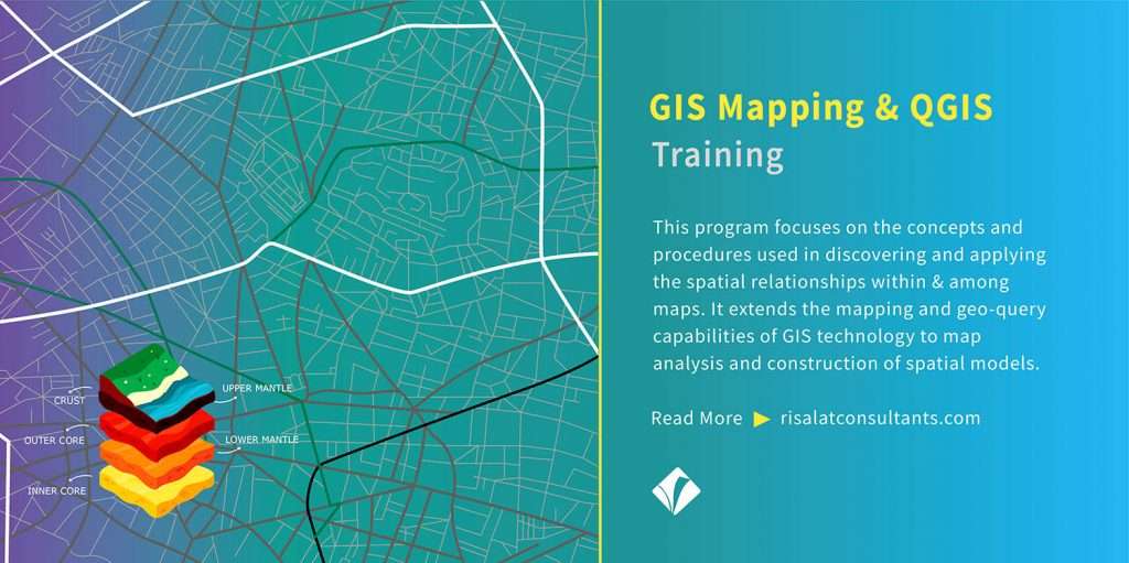
This practical gis mapping and qgis programme in Abu Dhabi is designed for professionals who must turn established technical guidance into reliable institutional practice. Participants examine the decisions, evidence, controls and working relationships that determine whether improvements endure beyond an individual course.
Free self-check: the digital readiness assessment gives how ready your institution is for digital services, data and AI, in about 10 minutes.
The learning journey covers spatial data models and coordinate systems, qgis interface and project organisation and data sourcing and licensing. Each topic is treated as an operational responsibility, not simply a theoretical concept.
Current primary guidance informs the programme, including QGIS Official Training Manual. Participants learn to identify which requirements apply to their organisation and how to document the reasoning behind their decisions.
The programme is hosted in Abu Dhabi, UAE. Case studies are adapted to the participant group; no external institutional visit, accreditation, funding allocation or regulatory endorsement is implied unless separately agreed and verified.
The Programme Strengthens Institutional Capability
- Spatial data models and coordinate systems
- QGIS interface and project organisation
- Data sourcing and licensing
- Couches vectorielles et tables attributaires
- Data cleaning and geometry validation
- Georeferencing and raster basics
- Spatial joins and overlay analysis
- Buffering and proximity analysis
- Terrain and environmental layers
- Cartographic design and print layouts
- Métadonnées et flux de travail reproductibles
- GIS outputs for institutional decisions
- Appliquer une règle de décision documentée à la cartographie SIG et à qgis
- Review evidence and data limitations for gis mapping and qgis
- Define accountable owners and approval points for gis mapping and qgis
- Record practical risks and corrective actions for gis mapping and qgis
The emphasis is on practical templates, defensible decisions and an implementation plan that can be reviewed by a line manager.
The Growing Importance of GIS Mapping and QGIS
Institutions are expected to show how their gis mapping and qgis arrangements work in practice. Written policies alone cannot demonstrate sound decisions, quality assurance or follow-up when responsibilities are fragmented.
Official guidance provides a useful reference point: QGIS Official Training Manual. The programme converts that guidance into questions, checks and evidence that a team can use in its own operating environment.
A structured approach makes it easier to distinguish a genuine control weakness from a documentation gap, set priorities and communicate progress without relying on unsupported performance claims.
Les organisations ont de plus en plus besoin de professionnels capables de :
- Spatial data models and coordinate systems
- QGIS interface and project organisation
- Data sourcing and licensing
- Couches vectorielles et tables attributaires
- Data cleaning and geometry validation
- Georeferencing and raster basics
- Spatial joins and overlay analysis
- Buffering and proximity analysis
- Terrain and environmental layers
- Cartographic design and print layouts
- Appliquer une règle de décision documentée à la performance institutionnelle
Strong gis mapping and qgis systems help organisations:
- Clarify decision rights and accountability
- Réduire les erreurs évitables et le travail redondant
- Use evidence consistently across teams
- Identify implementation risks earlier
- Make records easier to review
- Improve coordination between functions
- Prioritise limited staff time
- Support defensible reporting to leadership
- Track corrective actions to completion
The course focuses on improvements that can be implemented with realistic resources and assigned owners.
Who Should Attend This GIS Mapping and QGIS Training?
Ce programme s'adresse à :
- GIS analysts
- Planificateurs municipaux
- Responsables de l'environnement
- Infrastructure asset managers
- Survey technicians
- Disaster risk analysts
- Utilities data officers
- Analystes de la santé publique
- Land administration staff
- Project monitoring officers
- Chercheurs
- Spatial data managers
Mixed teams are welcome where technical, operational and management perspectives need to be aligned. Participants should be able to discuss a current institutional process or case.
Cochez ce que votre équipe doit être capable de faire.
GIS Mapping and QGIS Training Objectives
Upon successful completion of this GIS Mapping and QGIS Training, participants will be able to:
- Explain the relevant official framework and its scope
- Diagnose a current institutional capability gap
- Select fit-for-purpose methods and controls
- Prepare a traceable evidence and decision record
- Design an achievable improvement plan
- Set indicators and reporting responsibilities
- Présenter clairement les conclusions à la haute direction
- Spatial data models and coordinate systems
- QGIS interface and project organisation
- Data sourcing and licensing
- Couches vectorielles et tables attributaires
- Data cleaning and geometry validation
Each objective is tested through an exercise, peer review or practical output during the programme.
1. What should an institution do before changing its gis mapping and qgis procedures?
The official reference material on gis mapping and qgis must be interpreted in its applicable context: https://docs.qgis.org/testing/en/docs/training_manual/
2. Which output best supports implementation after training?
Un plan de mise en œuvre documenté aide à traduire les principes du manuel de formation officiel de QGIS en pratique opérationnelle.
3. When may a training provider claim that an external organisation endorses a course?
Publishing an official guideline does not by itself confer endorsement or accreditation.
Contenu et structure du programme
- Spatial data models and coordinate systems
- QGIS interface and project organisation
- Data sourcing and licensing
- Couches vectorielles et tables attributaires
- Data cleaning and geometry validation
- Georeferencing and raster basics
- Apply a documented decision rule to gis fundamentals and qgis workflow
- Data sourcing and licensing
- Couches vectorielles et tables attributaires
- Data cleaning and geometry validation
- Georeferencing and raster basics
- Spatial joins and overlay analysis
- Buffering and proximity analysis
- Apply a documented decision rule to data preparation and map design
- Data cleaning and geometry validation
- Georeferencing and raster basics
- Spatial joins and overlay analysis
- Buffering and proximity analysis
- Terrain and environmental layers
- Cartographic design and print layouts
- Apply a documented decision rule to spatial analysis and geoprocessing
- Spatial joins and overlay analysis
- Buffering and proximity analysis
- Terrain and environmental layers
- Cartographic design and print layouts
- Métadonnées et flux de travail reproductibles
- GIS outputs for institutional decisions
- Apply a documented decision rule to raster workflows and quality assurance
- Terrain and environmental layers
- Cartographic design and print layouts
- Métadonnées et flux de travail reproductibles
- GIS outputs for institutional decisions
- Spatial data models and coordinate systems
- QGIS interface and project organisation
- Apply a documented decision rule to applied gis project and map portfolio
Contenu détaillé jour par jour
The five-day learning pathway moves from fundamentals to applied decisions, review and implementation.
- Day 1: GIS fundamentals and QGIS workflow
- Day 2: Data preparation and map design
- Day 3: Spatial analysis and geoprocessing
- Day 4: Raster workflows and quality assurance
- Day 5: Applied GIS project and map portfolio
Contenu détaillé jour par jour
Premier jour | Fondamentaux des SIG et flux de travail QGIS
- Spatial data models and coordinate systems
- QGIS interface and project organisation
- Data sourcing and licensing
- Couches vectorielles et tables attributaires
- Data cleaning and geometry validation
- Georeferencing and raster basics
- Apply a documented decision rule to gis fundamentals and qgis workflow
- Review evidence and data limitations for gis fundamentals and qgis workflow
- Define accountable owners and approval points for gis fundamentals and qgis workflow
Workshop: GIS fundamentals and QGIS workflow in practice
Working with a realistic gis mapping and qgis scenario, participants review the available records, identify the decisions that require justification and produce a practical output. The group tests assumptions, records risks and receives structured peer feedback. The result is a reusable template and a clear next step for the participant’s organisation.
Second Day | Data preparation and map design
- Data sourcing and licensing
- Couches vectorielles et tables attributaires
- Data cleaning and geometry validation
- Georeferencing and raster basics
- Spatial joins and overlay analysis
- Buffering and proximity analysis
- Apply a documented decision rule to data preparation and map design
- Review evidence and data limitations for data preparation and map design
- Define accountable owners and approval points for data preparation and map design
Case Study: Data preparation and map design in practice
Working with a realistic gis mapping and qgis scenario, participants review the available records, identify the decisions that require justification and produce a practical output. The group tests assumptions, records risks and receives structured peer feedback. The result is a reusable template and a clear next step for the participant’s organisation.
Troisième jour | Analyse spatiale et géotraitements
- Data cleaning and geometry validation
- Georeferencing and raster basics
- Spatial joins and overlay analysis
- Buffering and proximity analysis
- Terrain and environmental layers
- Cartographic design and print layouts
- Apply a documented decision rule to spatial analysis and geoprocessing
- Review evidence and data limitations for spatial analysis and geoprocessing
- Définir les propriétaires responsables et les points d'approbation pour l'analyse spatiale et le géotraitement
Workshop: Spatial analysis and geoprocessing in practice
Working with a realistic gis mapping and qgis scenario, participants review the available records, identify the decisions that require justification and produce a practical output. The group tests assumptions, records risks and receives structured peer feedback. The result is a reusable template and a clear next step for the participant’s organisation.
Fourth Day | Raster workflows and quality assurance
- Spatial joins and overlay analysis
- Buffering and proximity analysis
- Terrain and environmental layers
- Cartographic design and print layouts
- Métadonnées et flux de travail reproductibles
- GIS outputs for institutional decisions
- Apply a documented decision rule to raster workflows and quality assurance
- Examiner les données probantes et les limites des données pour les flux de travail matriciels et l'assurance qualité
- Define accountable owners and approval points for raster workflows and quality assurance
Case Study: Raster workflows and quality assurance in practice
Working with a realistic gis mapping and qgis scenario, participants review the available records, identify the decisions that require justification and produce a practical output. The group tests assumptions, records risks and receives structured peer feedback. The result is a reusable template and a clear next step for the participant’s organisation.
Fifth Day | Applied GIS project and map portfolio
- Terrain and environmental layers
- Cartographic design and print layouts
- Métadonnées et flux de travail reproductibles
- GIS outputs for institutional decisions
- Spatial data models and coordinate systems
- QGIS interface and project organisation
- Apply a documented decision rule to applied gis project and map portfolio
- Review evidence and data limitations for applied gis project and map portfolio
- Define accountable owners and approval points for applied gis project and map portfolio
Capstone Exercise: Applied GIS project and map portfolio in practice
Working with a realistic gis mapping and qgis scenario, participants review the available records, identify the decisions that require justification and produce a practical output. The group tests assumptions, records risks and receives structured peer feedback. The result is a reusable template and a clear next step for the participant’s organisation.
GIS Mapping and QGIS Training Methodology
Facilitated instruction is paired with guided analysis, realistic case files, group exercises and short individual reflections. Participants are encouraged to bring non-confidential examples and adapt the templates to their own procedures.
Le programme associe :
- Courts exposés d'experts
- Official framework interpretation
- Guided document review
- Practical worksheets
- Role-specific simulations
- Group problem-solving
- Case comparisons
- Peer feedback
- Facilitator demonstrations
- Decision logs
- Réflexions quotidiennes sur l'apprentissage
- Final action planning
Exercises emphasise evidence quality, transparent assumptions and the limits of what a particular source or case can establish.
- Collecter
- Nettoyer
- Stocker
- Analyser
- Décider
Résultats attendus
Upon completion of this GIS Mapping and QGIS Training, participants will be able to:
- Explain the governing principles relevant to their role
- Identify the most material process weaknesses
- Use a documented checklist to assess current practice
- Prepare a decision and evidence log
- Select appropriate operational indicators
- Communicate findings to non-specialists
- Identify roles and resource needs
- Draft a phased improvement roadmap
- Plan a review of progress and unresolved risks
Participants leave with a draft improvement plan and practical working materials, rather than an unsupported claim of organisational certification.
2 700 £ par participant · facture et virement bancaire · réduction pour les groupes de 5 personnes ou plus
Cinq personnes ou plus d'une même organisation : demandez le tarif de groupe lors de votre demande de facture.
Dix personnes ou plus : une version interne pour votre institution peut coûter moins cher par personne. Demander un devis interne.
Registration closes in 45 days (6 Jan 2027)
Institutional Application of GIS Mapping and QGIS Training
Ce programme aide les organisations à renforcer :
- Spatial data models and coordinate systems
- QGIS interface and project organisation
- Data sourcing and licensing
- Couches vectorielles et tables attributaires
- Data cleaning and geometry validation
- Georeferencing and raster basics
- Spatial joins and overlay analysis
- Buffering and proximity analysis
- Terrain and environmental layers
- Cartographic design and print layouts
- Apply a documented decision rule to institutional accountability
Les participants repartent avec des outils pratiques pour améliorer :
- Process mapping and responsibility allocation
- Evidence and document review
- Risk and issue registers
- Quality checklists
- Management briefings
- Action plans with owners
- Performance indicators
- Peer review and escalation
- Post-training learning transfer
Teams can use the outputs in internal planning, supervision and professional development without assuming that a specific donor has allocated funds for this course.
Pertinence régionale & mise en application
Asie
For organisations working in Asia, gis mapping and qgis capabilities can support cross-border professional learning, service delivery and institutional reporting. The exercises are adaptable to local requirements; participants must verify the standards and laws that govern their own institution.
Europe
For organisations working in Europe, gis mapping and qgis capabilities can support regulatory interpretation, documentation and accountable management. The exercises are adaptable to local requirements; participants must verify the standards and laws that govern their own institution.
Afrique
For organisations working in Africa, gis mapping and qgis capabilities can support capacity-building, programme implementation and resource prioritisation. The exercises are adaptable to local requirements; participants must verify the standards and laws that govern their own institution.
Moyen-Orient
For organisations working in Middle East, gis mapping and qgis capabilities can support institutional modernisation and performance management. The exercises are adaptable to local requirements; participants must verify the standards and laws that govern their own institution.
Regional examples are illustrative learning contexts, not claims that any particular project has commissioned or financed this programme.
Profil du pays d'accueil – EAU
Abu Dhabi provides an international setting for structured professional learning, peer exchange and reflection away from routine office demands. The programme retains the original advertised destination.
Le contenu de la formation utilise du matériel de référence international officiel et des études de cas de participants. Aucune affirmation n'est faite selon laquelle une institution d'Abou Dhabi a approuvé le cours ou a accepté de recevoir une visite d'étude.
Travel documentation, visa eligibility, local entry rules and accommodation arrangements should be checked individually before booking. The programme team can provide administrative guidance but cannot guarantee admission or a visa.
GIS Mapping and QGIS Training Deliverables
The following learning and participation services form the standard Risalat programme package, subject to the participant agreement and final logistical confirmation.
Avant le programme
- Pré-évaluation des participants
- GIS Mapping and QGIS Readiness Assessment
- GIS Mapping and QGIS Resource Pack
- Lectures préparatoires
- Aide et conseils gratuits pour le visa
Pendant le programme
- Accueil à l'aéroport & assistance à l'arrivée
- Accommodation with breakfast: 6 nights, check-in Sunday 14 February 2027, check-out Saturday 20 February 2027 (one night before and one night after the programme)
- Dîner de bienvenue et de réseautage
- Kit de formation Risalat (sac, gourde, mug, t-shirt, casquette, protège-passeport, stylos, carnet, magnet & porte-clés)
- Comprehensive GIS Mapping and QGIS Training Manual
- Assessment checklist
- Decision log template
- Registre des risques et des mesures
- Evidence review worksheet
- Management briefing template
- Ateliers pratiques & simulations
- Discussions de groupe & apprentissage entre pairs
- Déjeuner et pauses-café quotidiens
- Accès complet aux installations du lieu de formation
- Mini tablette avec supports pédagogiques numériques
- Field Visit (where applicable, subject to confirmation)
- Visite récréative de la ville
Après le programme
- Certificat de participation
- Distinction Risalat de participation au programme
- Documents de référence après la formation
- Feuille de route pour l'amélioration personnelle
- Institutional action tracker
- Post-training reflection checklist
- Accompagnement après la formation & conseils de suivi
- Rapport du programme
Institutions may request a tailored in-house version through the Risalat proposal request form.
Common Challenges in GIS Mapping and QGIS, And How This Training Helps
How can our team identify the most urgent capability gaps?
Day 1 addresses this challenge through a guided exercise on gis fundamentals and qgis workflow. Participants use a checklist, discuss competing choices and document an action that can be tested in their own institution.
How can we interpret official guidance consistently?
Le jour 2 aborde ce défi à travers un exercice guidé sur la préparation des données et la conception de cartes. Les participants utilisent une liste de contrôle, discutent des choix concurrents et documentent une action qui peut être testée dans leur propre institution.
How can we improve decisions without adding unnecessary bureaucracy?
Day 3 addresses this challenge through a guided exercise on spatial analysis and geoprocessing. Participants use a checklist, discuss competing choices and document an action that can be tested in their own institution.
How can we demonstrate that evidence is reliable?
Day 4 addresses this challenge through a guided exercise on raster workflows and quality assurance. Participants use a checklist, discuss competing choices and document an action that can be tested in their own institution.
How can we involve technical and management colleagues effectively?
Day 5 addresses this challenge through a guided exercise on applied gis project and map portfolio. Participants use a checklist, discuss competing choices and document an action that can be tested in their own institution.
How can we turn training into an institutional action plan?
Day 5 addresses this challenge through a guided exercise on applied gis project and map portfolio. Participants use a checklist, discuss competing choices and document an action that can be tested in their own institution.
How can we monitor improvements after participants return?
Day 5 addresses this challenge through a guided exercise on applied gis project and map portfolio. Participants use a checklist, discuss competing choices and document an action that can be tested in their own institution.
Explore further professional development options through Risalat programme categories and use the training needs assessment to prioritise team learning requirements.
Questions fréquentes
Who is this programme intended for?
It is intended for professionals responsible for gis mapping and qgis decisions, supervision or reporting.
Is previous experience required?
Professional familiarity is useful. A pre-assessment helps tailor the level of practical exercises.
Are institutional visits guaranteed?
No. Any external visit depends on host approval, access and logistics and is confirmed separately.
Qu'est-ce que les participants rapporteront dans leur travail ?
Templates, case notes, a documented action plan and post-training reference materials.
Le programme peut-il être dispensé en intra ?
Yes. Risalat can adapt the content to an institutional team and its operational priorities.
Who Will Deliver This Programme
Each date is delivered by a team assigned from Risalat's expert network for this subject. For this programme we assign:
How we choose them: Experience in the region of the participants or comparable settings; Command of the financier rules that apply (World Bank, ADB, AfDB, EU, UN) where relevant; Delivery in English; other languages on request for in-house groups; No conflict of interest with participants' institutions.
Training courses in Abu DhabiData Science & Excel Modelling training courses
Pourquoi Abou Dhabi pour ce programme
Abou Dhabi est une capitale sereine dotée d'institutions publiques solides, un atout pour les programmes sur la performance publique et l'énergie.
The GIS Mapping and QGIS Training in Abu Dhabi programme in February 2027 brings together officials and professionals from across the Middle East region and beyond. Sessions combine short inputs, case studies and group work on participants' own files, and the city's institutions can be added as a study visit on request.
Accès : aéroport international Zayed (AUH).
Vérifiez si vous avez besoin d'un visa avec le vérificateur de visa gratuit, et demandez une lettre d'invitation une fois inscrit.
Le même thème dans d'autres villes
- Digital Land Registration, Cadastre Systems and Tenure Security in Kigali (Kigali)
- Multi-Hazard Geospatial Risk Mapping & Agricultural Resilience in Bangkok (Bangkok)
- Formation aux SIG & à la télédétection pour la gestion des risques de catastrophe à Vientiane (Vientiane)
- Formation avancée en cartographie SIG, QGIS et Grass GIS (Patras)
Autres programmes à Abou Dhabi
Pour les équipes et les institutions
Bring your team
Teams that learn together apply more at work. Tell us how many people and how you would like to take part: we reply with a group quote within two working days.
Watch: this programme in short

More training courses in the United Arab Emirates · Tous les programmes au Moyen-Orient · Calendrier complet des formations
Plan this programme in a roadmap: why it matters, why to approve it, the dates to plan and the career it builds.